

A few days ago, all the talk was about record warmth for Christmas. Now? We might not reach the 50s...what gives?
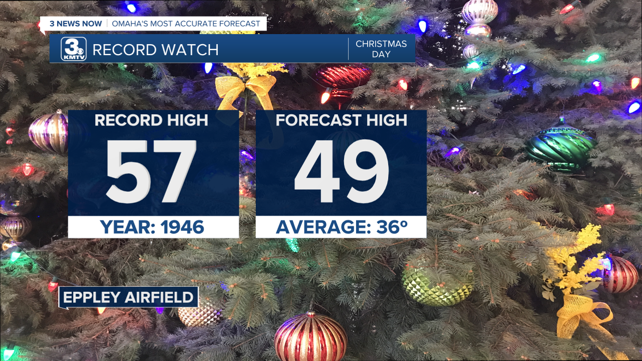
First of all, the record on Christmas Day is beatable! It's 57 degrees, the coolest record high in all of December. We hit it twice, in 1936 & 1946. So that's not the issue. The issue is that our forecast has changed by 15 degrees over the last few days. How does that even happen?
The weather is complex, and any slight change in one storm system can have ripple effects on future storms. This is the butterfly effect. The butterfly effect is when small-scale events in the short term create huge ramifications in the long term. For example, if a butterfly flaps its wings in South America, it creates a tiny air current that alters the environment around it. That air current then affects other air currents around it, and could lead to a hurricane developing on the other side of the planet in a few weeks.
So, how does the Butterfly Effect impact our Christmas weather?
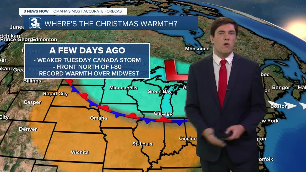
It comes from a storm system sliding southeast across Canada/New England Tuesday night. Computer models showed that this low-pressure system was very weak a few days ago. A weak system would struggle to send a cold front into our area, and it would remain north of I-80. This meant record warmth was all but certain over much of the Midwest, including Omaha.
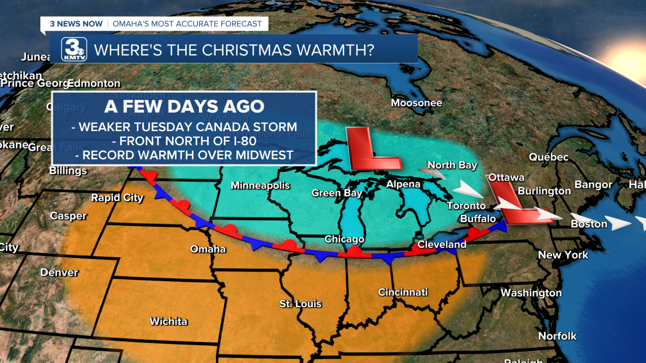
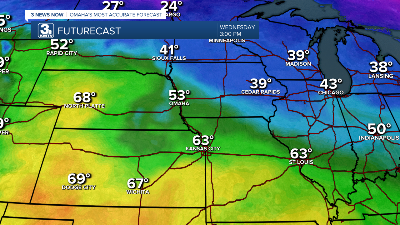
But that changed. The Canadian system tonight is now expected to be stronger (though still quite weak) than originally thought, which would be able to send the front farther south to I-70 in Missouri. This means more of the Midwest will experience clouds & cooler temps, and the record warmth is farther south.

This cold front will aid in developing low clouds, fog, and drizzle across eastern NE and IA beginning Tuesday night. The clouds will significantly stunt any warm-up we may see.
The warm air is not far off; western Nebraska will be unaffected by the front, and North Platte could see highs in the 60s! Same with parts of Kansas & Missouri. It would take a Christmas miracle for Omaha to have record highs this year.