

3 THINGS TO KNOW
- Record highs possible again today
- Windy with Red Flag Warning
- A few isolated rain and snow showers possible this week
FORECAST
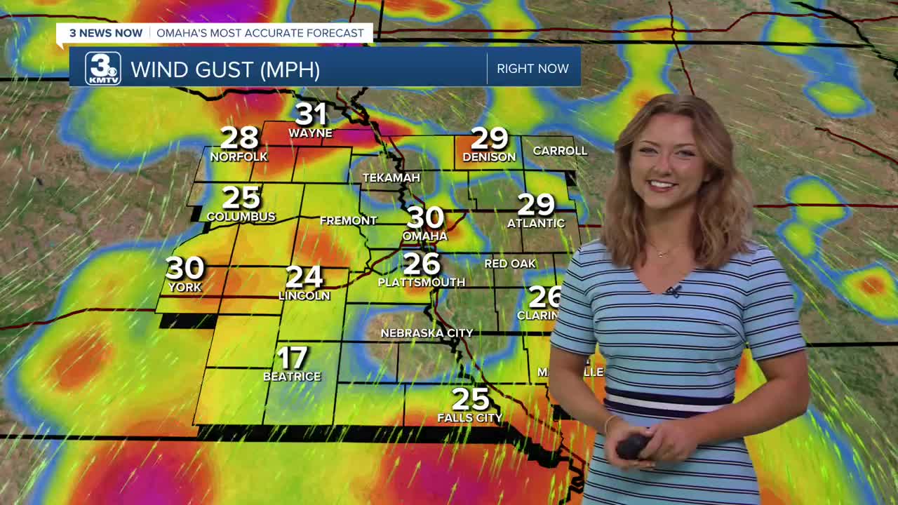
Your Tuesday afternoon looks strangely similar to a nice spring day, with highs in the mid 70s! However, those winds are something to take note of, with some gusts reaching upwards of 40 mph.
Due to high winds and dry air less than 25% relative humidity, hold off on burning anything outdoors. The ingredients are there, and a Red Flag Warning has been issued for areas in central and near eastern Nebraska.
Heading into Tuesday evening, a cold front could pop up a few isolated thunderstorms, but a lot of us will stay dry. The best place to see this rain will be east of Omaha.
It will be a little cooler out on Wednesday, but still very mild for February, and we could be up near some record highs again, depending on how much cool air moves into the region. It will be mostly sunny and breezy with highs in the mid 60s. The record is 70.
We start to get into chances for rain on Thursday. As even cooler air moves into the region, some snow could try and mix in with the rain north of Omaha. It stays breezy with highs in the mid 40s Thursday, dropping in the upper 30s on Friday.
This weekend should be mostly dry, but it will be cooler and closer to average with highs near 40. The average high by February 20th is around 41 degrees.
TUESDAY
Mostly Sunny
Warm & Windy
High: 75
Wind: S 25-35
TUESDAY NIGHT
Partly Cloudy
Warm
Low: 43
Wind: S 7-15
WEDNESDAY
Mostly Sunny
Pleasant
High: 65
Wind: SW 15-20
Share your weather pictures with KMTV:
- Email to News@3newsnow.com
- 3 News Now Facebook page
- Use the hashtag #3NewsNow on Instagram or X (formerly Twitter)
