

3 THINGS TO KNOW
- Windy Saturday with isolated snow showers
- Warmer weather returns next week
- Rain and snow chances end of next week
FORECAST:
This is weekend will be a chilly one, and closer to normal for January.
Saturday will be mostly cloudy and breezy with highs in the mid-30s. Isolated snow showers, similar to a heavy rain downpour, may be possible during the day which could lower visibility. Snow accumulations are not expected.
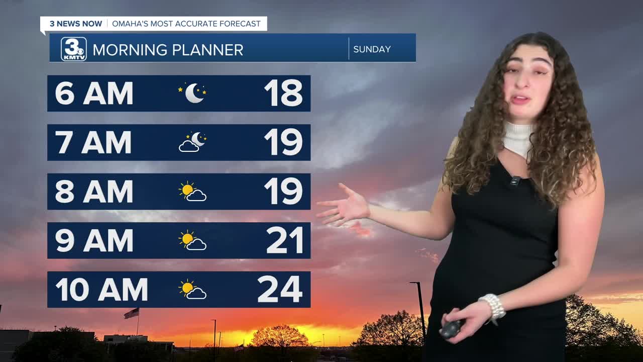
Skies will clear up Saturday night and we'll be in the 10s by Sunday morning. We're back into some sunshine on Sunday with highs in the mid-30s.
Next week starts mild again, in the low 50s for Monday and near 60 degrees by Tuesday. Tuesday's record high is 63.
There are small chances for rain and snow mid-week, from Wednesday through Friday as things cool off closer to January normals again.
SATURDAY
Mostly Cloudy
Breezy
Snow Flurries
High: 35
Wind: N 15-25
SUNDAY
Mostly Cloudy
Cold
High: 39
Wind: NW 5-15
Share your weather pictures with KMTV:
- Email to News@3newsnow.com
- 3 News Now Facebook page
- Use the hashtag #3NewsNow on Instagram or X (formerly Twitter)
