

3 THINGS TO KNOW
- Wintry mix on Sunday, minor snow possible
- Several chances at rain next week
- Starting off cold, then getting warmer
FORECAST
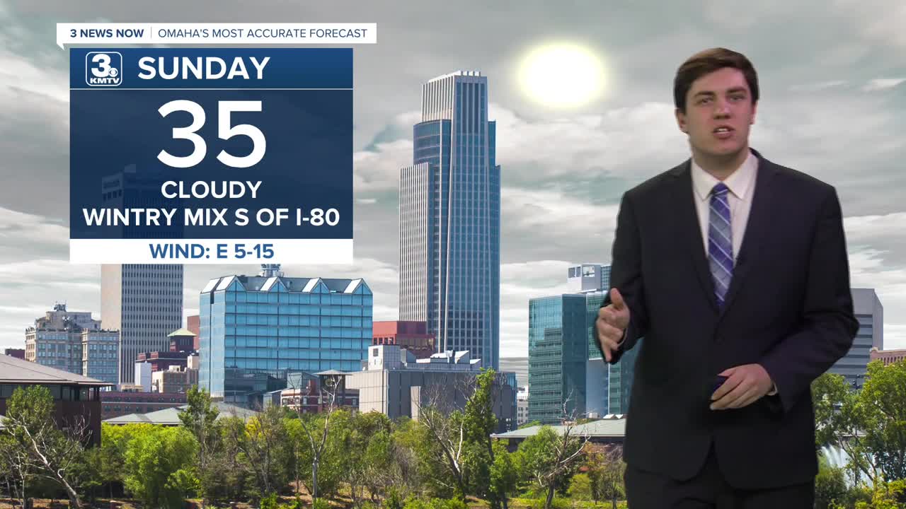
We stay cloudy & cold (mid-30s) on Sunday. By early afternoon, light snow will move in for neighborhoods south of I-80. This will continue into the evening before moving away overnight. Some could see snow totals as high as 1-2", but most will stay under 1". For Omaha and points north, a few flakes may fly, but no accumulation is expected.
Most of Monday will be dry, barring a bit of drizzle south of I-80 on Monday morning. It stays cloudy with highs in the low 40s.
Our next storm system moves in Monday night, bringing some rain chances for Tuesday morning. While anyone could see some rain, the best chance will be south of I-80. Highs on Tuesday are a bit warmer, in the upper 40s.
The front will be over Kansas and Missouri on Wednesday and Thursday, but it may be close enough for some rain south of I-80. For Omaha, it's looking more probable that Wednesday and Thursday stay dry. However, it does mean that we get warmer with 50s on Wednesday and some 60s on Thursday.
A bigger storm system is possible late Thursday into Friday, which may bring a better chance of rain for everyone, though it's still a bit far out, so things can change. Highs will be in the upper 50s.
We dry out into the weekend with temperatures in the 50s.
SUNDAY
Mostly Cloudy
Wintry Mix South
High: 35
Wind: E 10-15
SUNDAY NIGHT
Mostly Cloudy
Patchy AM Fog
Low: 28
Wind: NE 5-15
MONDAY
Cloudy
Small AM Rain Chance
High: 42
Wind: SE 5-15
TUESDAY
Cloudy
Scattered AM Rain
High: 48
Wind: NE 5-15
Share your weather pictures with KMTV:
- Email to News@3newsnow.com
- 3 News Now Facebook page
- Use the hashtag #3NewsNow on Instagram or X (formerly Twitter)
