

Today will be mostly cloudy and cooler thanks to the cold front that brought our latest round of storms overnight. Northwest of Omaha, highs will be in the 70s. Omaha will likely be in the low 80s, and mid 80s are possible down towards northwest Missouri. While cooler today, it will still be humid. A few storms are possible this evening and tonight, mainly south of Omaha.
The humidity will fall overnight, allowing us to cool off more than normal. We will wake up to upper 50s and low 60s Thursday morning.
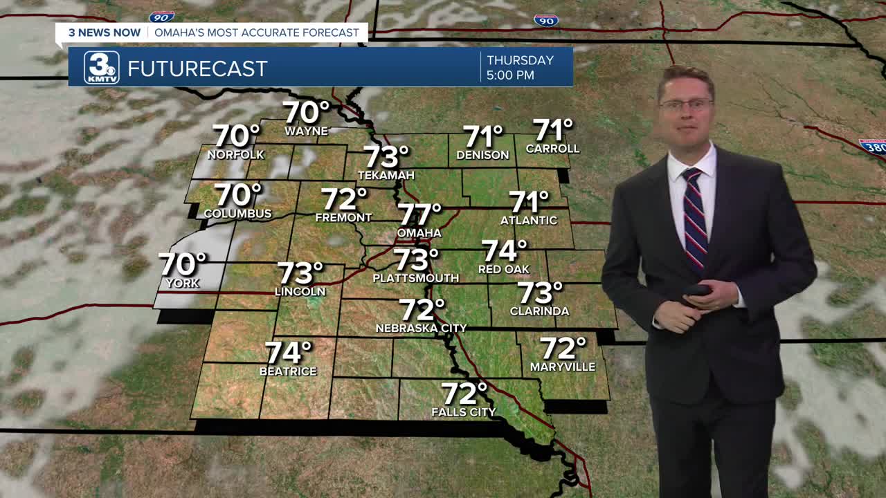
Thursday afternoon will be comfortable thanks to the lower humidity and highs only in the upper 70s! We'll see a mix of sun and clouds. While most of our neighborhoods stay dry, a couple spotty and light showers can't be ruled out in the region.
The humidity climbs higher again Friday, and we start to warm back up. It will be mostly cloudy with low 80s in the afternoon. Another round of scattered storms will pop up in the second half of the day, but it's still unclear how widespread these will be.
Hit and miss storms will still be around Saturday, but there will be plenty of dry time mixed in. It will be mostly cloudy and warmer with upper 80s.
Continue to have a backup indoor plan ready for your outdoor plans Sunday, because there will continue to be some hit and miss storms around. It stays mostly cloudy with mid 80s.
More of us stay dry Monday, but some leftover rain could still be around. With drier weather, we start to heat up again. Highs will be in the low 90s.
Tuesday brings more sunshine and more heat with mid 90s.
WEDNESDAY
Mostly Cloudy
Muggy
High: 81
WEDNESDAY NIGHT
Mostly Cloudy
Spotty Storms South
Low: 60
THURSDAY
Partly Cloudy
Lower Humidity
High: 77
FRIDAY
Mostly Cloudy
Storms Possible
High: 83
Share your weather pictures with KMTV:
- Email to News@3newsnow.com
- 3 News Now Facebook page
- Use the hashtag #3NewsNow on Instagram or X (formerly Twitter)
