

The high humidity from the weekend continues into the workweek, and temperatures continue to climb. This will cause a dangerous combination of heat and humidity the next few days. Take it easy and stay hydrated. Check on your older friends, neighbors, and family members to make sure they are staying cool and safe.
Monday brings a mix of sun and clouds as we heat up into the low 90s. The humidity will make it feel like 106 in Omaha. The only hope for heat relief today will be a few spotty storms that pop up this afternoon, which could come with strong wind and some hail. The best chance for the storms will be south of Omaha. If the storms move too slowly, they could also kick off some short-lived flash flooding. A majority of us will stay dry and a little breezy.
A few spotty showers will continue overnight as we cool off into the mid 70s for Tuesday morning.
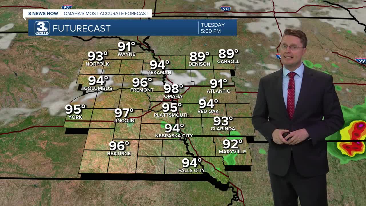
Tuesday will be even hotter with upper 90s. This will push the heat index just shy of 110 in Omaha. It will be mostly sunny and a little breezy at times. While an isolated shower or storm could pop up, a large majority of us will stay dry.
Wednesday will also be a little breezy with upper 90s, but thanks to a small drop in the humidity, the heat index should be closer to 105.
We'll keep our fingers crossed for a cold front to make it to us on Thursday. If it can make it here, showers and storms will be likely with highs down into the upper 80s.
There could be a few leftover showers and storms around Friday, but a lot of us will be dry with upper 80s.
We start to heat back up over the weekend. Saturday will be partly cloudy with low 90s, followed by mid 90s Sunday with a lot of sunshine.
MONDAY
Partly Cloudy
Spotty Storms
Breezy
High: 93
MONDAY NIGHT
Partly Cloudy
Spotty Storms
Low: 75
TUESDAY
Mostly Sunny
Isolated Rain
Breezy
High: 98
WEDNESDAY
Mostly Sunny
Breezy
High: 98
Share your weather pictures with KMTV:
- Email to News@3newsnow.com
- 3 News Now Facebook page
- Use the hashtag #3NewsNow on Instagram or X (formerly Twitter)
