

The last of the rain should fade away as it drifts southeast of Omaha in the first half of the afternoon. By late afternoon, even the wetter areas will start to see more sunshine. This will get us a little warmer with upper 70s.
While the wildfire smoke is still with us, it will be thinner for at least a couple days, making for better air quality.
Overnight, we will cool off into the mid 60s for Tuesday morning.
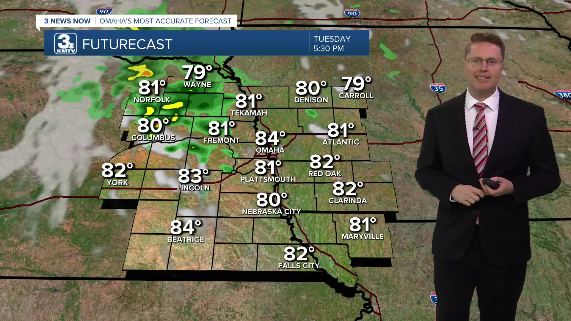
Tuesday will be partly cloudy with a little more heat and a little more humidity. Highs will be in the mid 80s. By late afternoon, spotty showers and storms will start to move into eastern Nebraska from the west. Scattered storms will likely hit more neighborhoods Tuesday night. A few leftover spotty showers could survive into Wednesday morning.
Wednesday afternoon will be dry for most of us. It will be breezy, warmer, and humid with upper 80s. A few more scattered showers and storms will move through eastern Nebraska and western Iowa Wednesday night and into Thursday morning.
We heat up into the low 90s Thursday. It will be breezy with mostly sunny skies and plenty of humidity.
Friday will be mostly sunny and breezy with low 90s.
Showers and storms are more likely Saturday as our next cold front arrives. Depending on the exact timing of things, we could still make it into the upper 80s.
Sunday will be in the mid 80s with a little more sunshine.
MONDAY
Clearing Skies
Rainy Areas
High: 77
MONDAY NIGHT
Mostly Clear
Nice
Low: 64
TUESDAY
Partly Cloudy
Scattered P.M. Storms
High: 84
WEDNESDAY
Partly Cloudy
Spotty Rain/Storms
Breezy
High: 87
Share your weather pictures with KMTV:
- Email to News@3newsnow.com
- 3 News Now Facebook page
- Use the hashtag #3NewsNow on Instagram or X (formerly Twitter)
