

After picking up 1.5 inches of rain at Eppley Airfield in Omaha this morning, the afternoon will be dry, and we'll see more sunshine mix in with the clouds later in the day. It will be breezy at times, humid, and warmer with upper 80s.
A few hit and miss storms could pop up overnight, but a lot of our neighborhoods will stay dry. We'll drop into the low 70s for Thursday morning. If there's any leftover rain for the drive into work, it would be in Iowa.
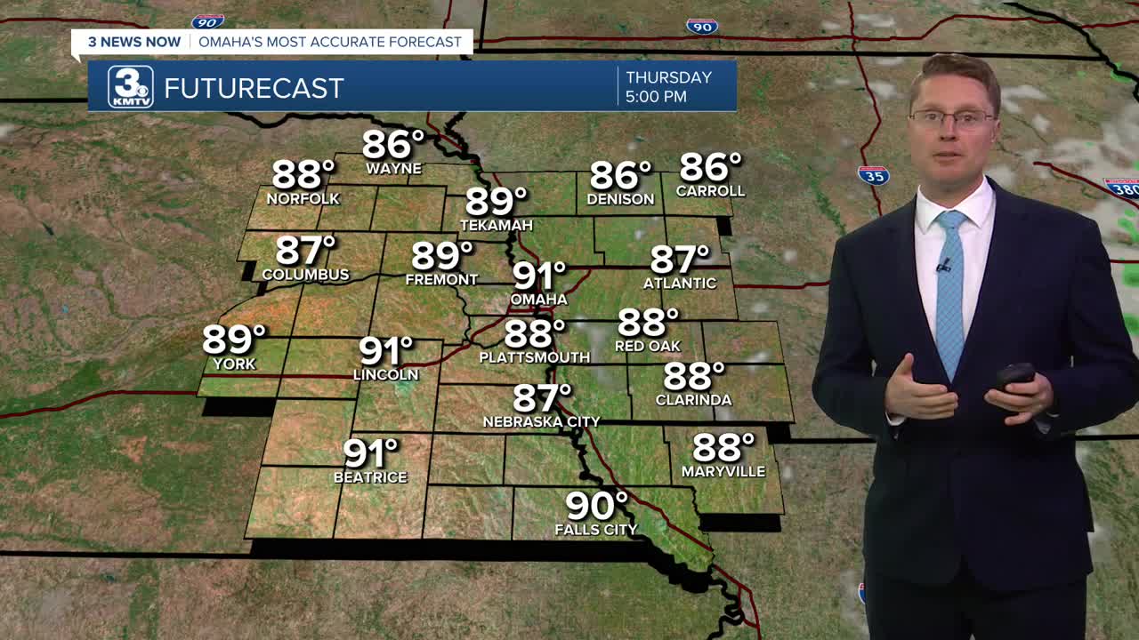
Thursday will be mostly sunny and breezy. Highs will be in the low 90s, but the high humidity will make it feel like we're just over 100 degrees late in the day.
We stay hot, humid, mostly sunny, and breezy Friday with mid 90s. Late Friday night, a few strong storms could pass through areas north of Omaha. A couple of those pockets of rain could survive into early Saturday morning.
Saturday will be partly cloudy with low 90s. While any part of the day could bring a quick shower, the better chance of getting hit by a scattered storm will be late Saturday night into early Sunday morning.
There's a good chance you'll stay dry Sunday afternoon, and thanks to a weak cold front, we'll drop into the mid 80s. Another round of scattered storms is possible Sunday night.
Monday will be mostly cloudy with low 80s.
The sunshine returns Tuesday with mid 80s.
WEDNESDAY
Partly Cloudy
Breezy
High: 87
WEDNESDAY NIGHT
Partly Cloudy
Isolated Rain
Low: 72
THURSDAY
Mostly Sunny
Breezy
High: 91
FRIDAY
Mostly Sunny
Breezy
Night Storms North
High: 95
Share your weather pictures with KMTV:
- Email to News@3newsnow.com
- 3 News Now Facebook page
- Use the hashtag #3NewsNow on Instagram or X (formerly Twitter)
