

For the middle of July, today's weather looks amazing! The humidity will be low, and temperatures will only climb into the mid 70s! We'll see a nice mix of sun and clouds throughout the day. Enjoy it, because it won't stay like this very long!!
Overnight, more clouds will move in, and they'll squeeze out a few hit and miss showers heading into Friday morning.
The humidity rapidly climbs Friday, and we'll start to warm up with highs in the mid 80s. It will be partly cloudy with some hit and miss storms across eastern Nebraska and western Iowa becoming more likely late in the day.
Hit and miss storms will continue across the region both Saturday and Sunday. Even if you get hit by a storm, there will still be plenty of dry time for your outdoor plans. Both afternoons will be in the upper 80s for neighborhoods that stay dry.
There won't be as many spotty storms around Monday, keeping more of us dry. We also continue to heat up with low 90s.
Temperatures continue to climb with mid 90s and plenty of humidity Tuesday and Wednesday. A couple isolated storms will be around both days, but a majority of the area will be dry.
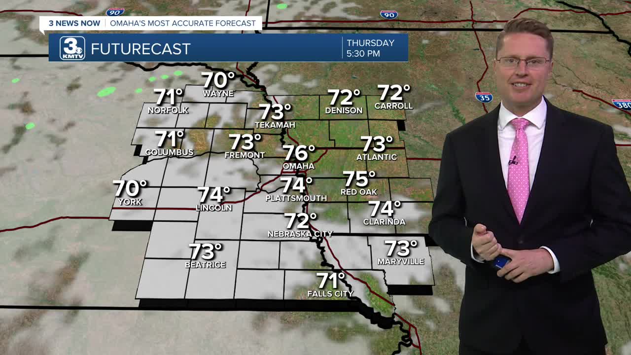
THURSDAY
Partly Cloudy
Lower Humidity
High: 76
THURSDAY NIGHT
Mostly Cloudy
Nice
Low: 65
FRIDAY
Partly Cloudy
Spotty Rain/Storms
High: 84
SATURDAY
Partly Cloudy
Spotty Storms
High: 88
Share your weather pictures with KMTV:
- Email to News@3newsnow.com
- 3 News Now Facebook page
- Use the hashtag #3NewsNow on Instagram or X (formerly Twitter)
