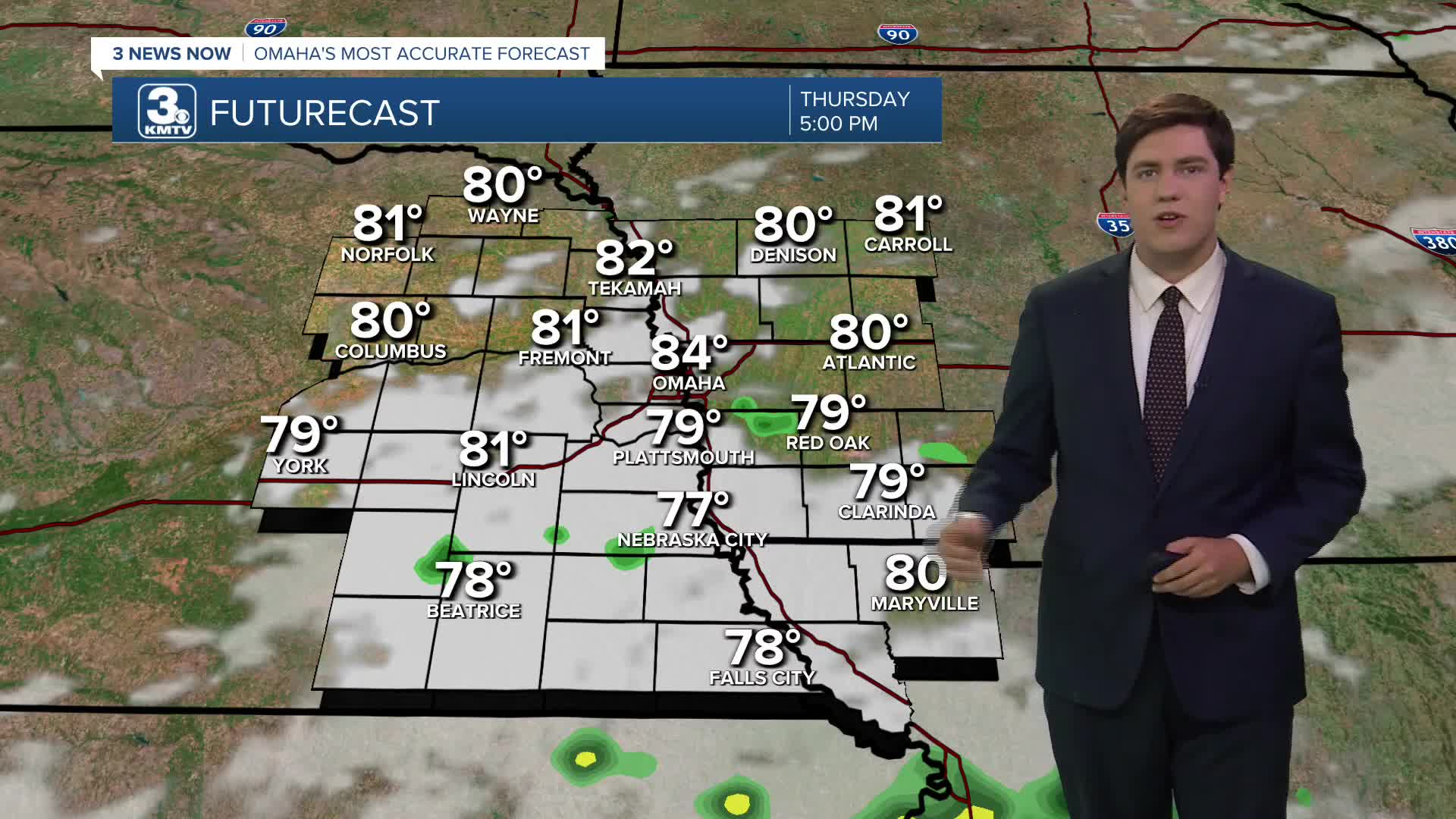


Thanks to the cold front that brought us the rain overnight, it won't be as hot today. We will be mostly cloudy with highs in the mid 80s. Sadly, the cold front did not push away the humidity. As we go through the afternoon, a few spotty showers and storms will pop up, likely only south of I-80. Any rain would end this evening.
Overnight, we cool off to about 70 degrees to start Friday with mostly cloudy skies.
We stay mostly cloudy Friday afternoon with highs only in the low 80s. A few spotty showers and storms will pop up again by late afternoon and continue into Friday night. While most of these will stay south of Omaha, there's a better chance for a couple of them to clip areas along the I-80 corridor late in the
day.
We start to warm back up Saturday with upper 80s and a little more sunshine. An isolated shower or storm could pop up, but most of our neighborhoods will be dry.
Sunday looks hot and humid! We will push into the mid 90s with mostly sunny skies.
The mid 90s continue Monday with a lot of sunshine.
Tuesday will be in the low 90s with a few more clouds. With a cold front in the region, a few spotty showers and storms could pop up, but many of us stay dry.
There's a better chance for some showers and storms on Wednesday, which will drop us into the mid 80s.
THURSDAY
Mostly Cloudy
Spotty Rain South
High: 84
THURSDAY NIGHT
Mostly Cloudy
Muggy
Low: 70
FRIDAY
Mostly Cloudy
Spotty Rain/Storms
High: 81
SATURDAY
Partly Cloudy
Isolated Rain
High: 89
Share your weather pictures with KMTV:
- Email to News@3newsnow.com
- 3 News Now Facebook page
- Use the hashtag #3NewsNow on Instagram or X (formerly Twitter)
