

3 THINGS TO KNOW
- Mostly light rain, some snow chances this evening
- Getting very warm Thursday and Friday
- More chances at snow late weekend
FORECAST
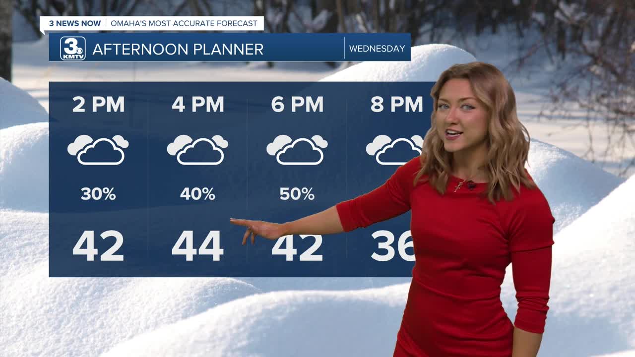
The middle of the week is marked with a little bit colder temps compared to yesterday, with highs only tapping out about the mid 40s. Rain chances start near the afternoon and last until later this evening.
From Omaha and points east, this rain and snow mix could lead some slushy roads and up to an inch of snow. If you are south or west of Omaha, this is likely just rain for you.
Roads may become a little sick during the evening commute, due to the slush. By Thursday morning, temps drop into the upper 20s and lower 30s, bringing the potential for some thin ice where rain has fallen. Be aware of this for your morning commute!
By Thursday, we are warming out from the cold again and with sunshine, reaching highs in the mid 50s.
Friday will be the warmest day out of this stretch, and looking like a great day with sunshine and highs in the mid 60s, with lighter winds.
By the weekend, it gets cold again...A cold front will move through Omaha late Friday night, and we drop to near 40 on Saturday, and the low 30s on Sunday. There is a chance for additional snow Sunday and into Monday of next week, and some small accumulations may be possible.
WEDNESDAY
Cloudy
Rain & Snow after 12pm
High: 44
Wind: SE 10-15
WEDNESDAY NIGHT
Cloudy
Patchy Fog
Low: 27
Wind: NW 5-10
THURSDAY
Sunny
Pleasant
High: 58
Wind: W 10-15
Share your weather pictures with KMTV:
- Email to News@3newsnow.com
- 3 News Now Facebook page
- Use the hashtag #3NewsNow on Instagram or X (formerly Twitter)
