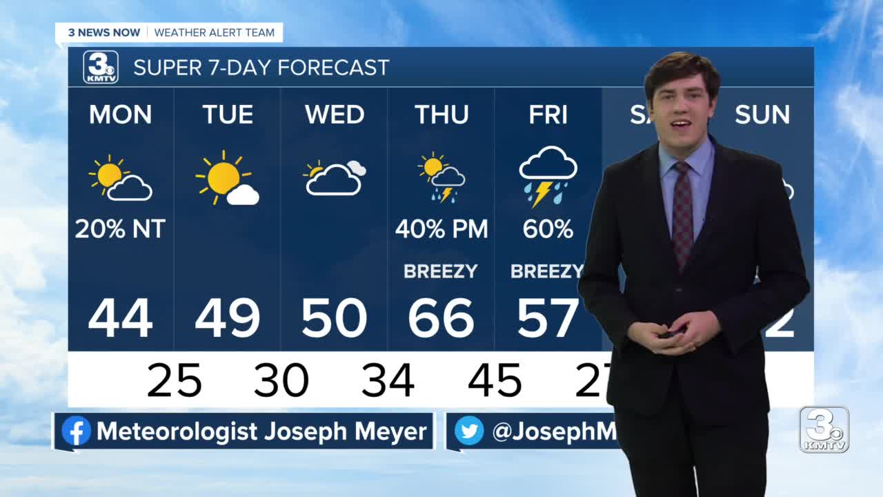


The start of the workweek is cool and below average. Monday stays in the mid 40s with increasing clouds throughout the day. The overnight hours into Tuesday brings a small rain/snow chance.
Tuesday brings more sunshine and a little warm-up of temperatures. We'll be able to reach the upper 40s with help of more sunshine.
The clouds come back in full force Wednesday and this brings another rain chance in the late hours. Highs in the upper 40s to near 50.
Thursday and Friday both bring chances of rain and breezy conditions. It will be nice and warm on Thursday! We reach into the middle 60s, despite dodging rain showers in the evening.
Beginning Thursday night into Friday scattered showers and thunderstorms are possible. The severe threat looks low at this time. Highs will be cooler on Friday with 50s in the morning, dropping into the afternoon. The day could end with some snow for northeast Nebraska. The precipitation ends Saturday morning.
The start of the weekend stays cool in the low 50s, but it brings the sunshine back for us.
MONDAY
Partly Cloudy
Small P.M. Rain Chances
High: 44
MONDAY NIGHT
Partly Cloudy
Small Rain/Snow Chance South
Low: 25
TUESDAY
Mostly Sunny
Below Average
High: 49
WEDNESDAY
Mostly Cloudy
Below Average
High: 50
Share your weather pictures with KMTV:
- Email to News@3newsnow.com
- 3 News Now Facebook page
- Use the hashtag #3NewsNow on Instagram or Twitter
Download the free Storm Shield app for ANY type of phoneReceive severe weather watches and warnings for your location as you track the storms on radar. Great for use at the office, at home, and while traveling.
