

We stay mostly sunny the rest of the day as we push into the low 90s in eastern Nebraska. The humidity will make it feel like the mid to upper 90s by the end of the afternoon. Western Iowa will be a little less hot with upper 80s.
Overnight, we will cool off into the upper 60s for Tuesday morning.
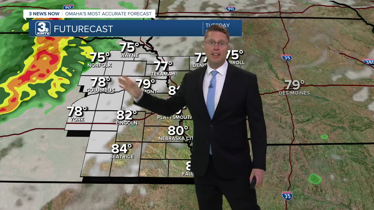
Tuesday afternoon will be a repeat of Monday with plenty of sunshine, low 90s, and a little extra humidity.
Late Tuesday night, around 10 or 11, storms will move in from the northwest. Depending on how well they hold their strength, there's a small threat for damaging wind and a couple pockets of hail. If the storms hold together for Omaha, they likely won't arrive until midnight or later. The storms should weaken as they push farther southeast overnight. The farther southeast of Omaha you live, the better chance of staying dry.
Wednesday will bring some hit and miss rain during the day, keeping us mostly cloudy. Highs will be in the upper 80s. Another round of storms looks a little more likely Wednesday night, again with a small threat for a couple severe storms.
There could be some leftover rain around into Thursday morning, but the afternoon looks drier. It will also be our coolest day of the week with highs falling just shy of 80 degrees.
Most of Friday looks dry with a mix of sun and clouds and low 80s. Hit and miss storms will move in heading into the night.
For now, we'll keep smaller chances for rain in the weekend forecast, but a number of neighborhoods will be dry. Saturday will be in the mid 80s, followed by upper 80s on Sunday.
MONDAY
Mostly Sunny
Muggy
High: 92
MONDAY NIGHT
Mostly Clear
Warm
Low: 68
TUESDAY
Mostly Sunny
Humid
Night Storms
High: 92
WEDNESDAY
Mostly Cloudy
Scattered Storms
High: 88
Share your weather pictures with KMTV:
- Email to News@3newsnow.com
- 3 News Now Facebook page
- Use the hashtag #3NewsNow on Instagram or X (formerly Twitter)
