

The humidity will continue to climb this afternoon as we warm up into the mid 80s in Omaha. Skies will be mostly cloudy, but we'll try to get some extra sunshine out to end Friday. An isolated shower can't be ruled out during the day, but nearly everyone will be dry through early tonight. Late tonight and overnight, a few scattered storms are possible. A couple of the strongest storms could come with some hail or strong wind. A tornado is not likely, but not impossible. Many spots will just stay dry.
Any leftover rain from the overnight storms should end by late Saturday morning. The day starts with low 70s and a lot of clouds, but we'll see more sunshine Saturday afternoon. We continue to heat up with upper 80s. The humidity will make it feel like the mid to upper 90s.
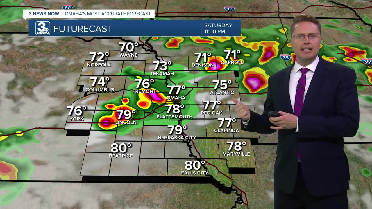
Late Saturday night and into early Sunday morning, another round of scattered storms will pop up. Like recent storms, they will come with a small chance for hail and strong wind. About 1/3 of eastern Nebraska and western Iowa should see the rain. Some of the scattered rain could continue into Sunday morning.
Sunday will be mostly cloudy and humid with upper 80s. A couple spotty storms are possible in the second half of the day, but they won't be common.
Storms will be a little harder to come by in the first half of next week with most of us being dry Monday. We keep heating up with highs in the low 90s. The humidity will still be very high, which could push the heat index over 105.
Most of us will continue to stay dry Tuesday and Wednesday with mid 90s, keeping the heat index well over 100 in the afternoons.
A cold front will try to move in Thursday. If it can get to us, storms would be more likely, but we likely still heat up into the 90s.
FRIDAY
Mostly Cloudy
Isolated Rain
High: 84
FRIDAY NIGHT
Partly Cloudy
Scattered Storms
Low: 71
SATURDAY
Partly Cloudy
Storms Early and Late
High: 88
SUNDAY
Mostly Cloudy
Spotty Storms
High: 88
Share your weather pictures with KMTV:
- Email to News@3newsnow.com
- 3 News Now Facebook page
- Use the hashtag #3NewsNow on Instagram or X (formerly Twitter)
