

3 THINGS TO KNOW
- Near record highs Wednesday
- Scattered rain all day Thursday
- Chance at light snow Friday evening
FORECAST:
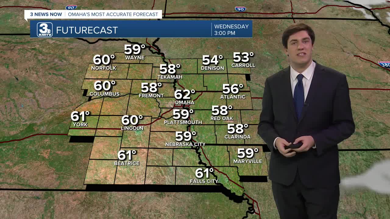
Today is the warmest day of the week (technically of the year), with highs in the 50s and 60s! The average high is 34 degrees. The January 7 record high for Omaha is 65, set in 2003. Omaha will likely fall short of its record, though Lincoln may be a little closer to its record of 65, also set in 2003.
Clouds return before the start of Thursday, leading to a cloudy day in the low 40s. Rain moves into the region by late morning and is expected to persist through the afternoon. Almost everyone will see rain at some point, but the heaviest rain will be along and south of I-80. Some spots could see as much as 1/2-1" of rain.
There may be a few snowflakes mixing in with the rain Thursday night as colder air moves in, but it is likely also met with drier arriving air, meaning any window of accumulation will be short.
We will experience dry conditions for most of Friday before a second wave of precipitation moves through on Friday evening. With the colder air in place, this looks to be light snow. Friday is trending drier as the storm system is looking weaker & farther south, so most of us will be dry, with neighbors south of Omaha/I-80 having the best chance to see it. Snow amounts will be light where it does fall, likely staying under 1".
Some lingering flurries or snow showers persist on Saturday as the colder air rushes in, highs will be in the mid-30s and lows into the 10s.
Another warmup begins next week with highs in the 40s and 50s on Monday.
WEDNESDAY
Mostly Sunny
Warm
High: 62
Wind: SW 5-15
WEDNESDAY NIGHT
Increasing Clouds
Chilly
Low: 36
Wind: SW 5-10
THURSDAY
Cloudy
Rainy
High: 43
Wind: SW 5-10
FRIDAY
Mostly Cloudy
Some PM Snow
High: 38
Wind: SW 5-10
Share your weather pictures with KMTV:
- Email to News@3newsnow.com
- 3 News Now Facebook page
- Use the hashtag #3NewsNow on Instagram or X (formerly Twitter)
