


Five years ago today, eastern Nebraska was rocked by a significant severe weather event on June 16, 2017. Large hail the size of golf balls, winds in excess of 100 mph, and several tornadoes moved through on that Friday afternoon. Today, we look back on that significant severe weather event. The atmospheric set-up, the storms, and the aftermath.
THE SET-UP

It was a Friday, temperatures began in the middle 70s as many woke up. The following day was the beginning of the College World Series, with thousands coming from out of town to watch. Temperatures would reach the low 90s, it was a humid afternoon. For many who have lived in Nebraska all their lives, they knew what a hot humid afternoon in June might portend, thunderstorms.
A cold front was moving into eastern Nebraska, which would clash with the warm humid air in front of it. This clash of air masses creates volatility in the atmosphere, and thunderstorms can grow as the warm air is thrusted upward due to the cooler air. Some of these storms were very tall, reaching over 50,000 feet.
Something was occuring in the atmosphere that would turn these storms from the ordinary summer thundershowers to severe rotating storms, wind shear. At the surface, the winds were out of the southeast for most of the day. As one goes higher in the atmosphere, those winds turned to the west, and eventually to the northwest. This turning of the winds allows for thunderstorms to rotate, eventually producing tornadic thunderstorms.
4-7PM: STORMS DEVELOP NORTH
By 4pm, the environment was ripe for severe weather. Thunderstorms quickly developed over northeastern Nebraska and moved southeast. These storms contained hail to the size of golf balls, damaging winds in excess of 70-80mph, and a few tornadoes.

Three tornadoes touched down northwest of the Omaha metro. The first was an EF-1 in southern Wayne County east of Hoskins, which was embedded in damaging winds upwards of 90mph across the county.

A second tornado touched down east of Madison, this tornado was rated an EF-0. Winds west of Norfolk were up to 74mph as the storms continued to the south.

A third tornado touched down east of Hooper in Dodge County, causing widespread power poles to be snapped. Damage within Hooper itself down to Fremont was due to 80-100 mph winds. Northwest of Fremont a storm chaser reported a 110 mph wind gust, with significant damage within Fremont.

7-8PM: STORMS IN THE METRO
As the storms moved southeast into the Omaha metro, they developed into a cluster of storms with extreme winds. Wind gusts ranged from 90-120 mph across western Douglas County into Sarpy and Cass Counties. At the National Weather Service office in Valley, an 87 mph wind gust was recorded.

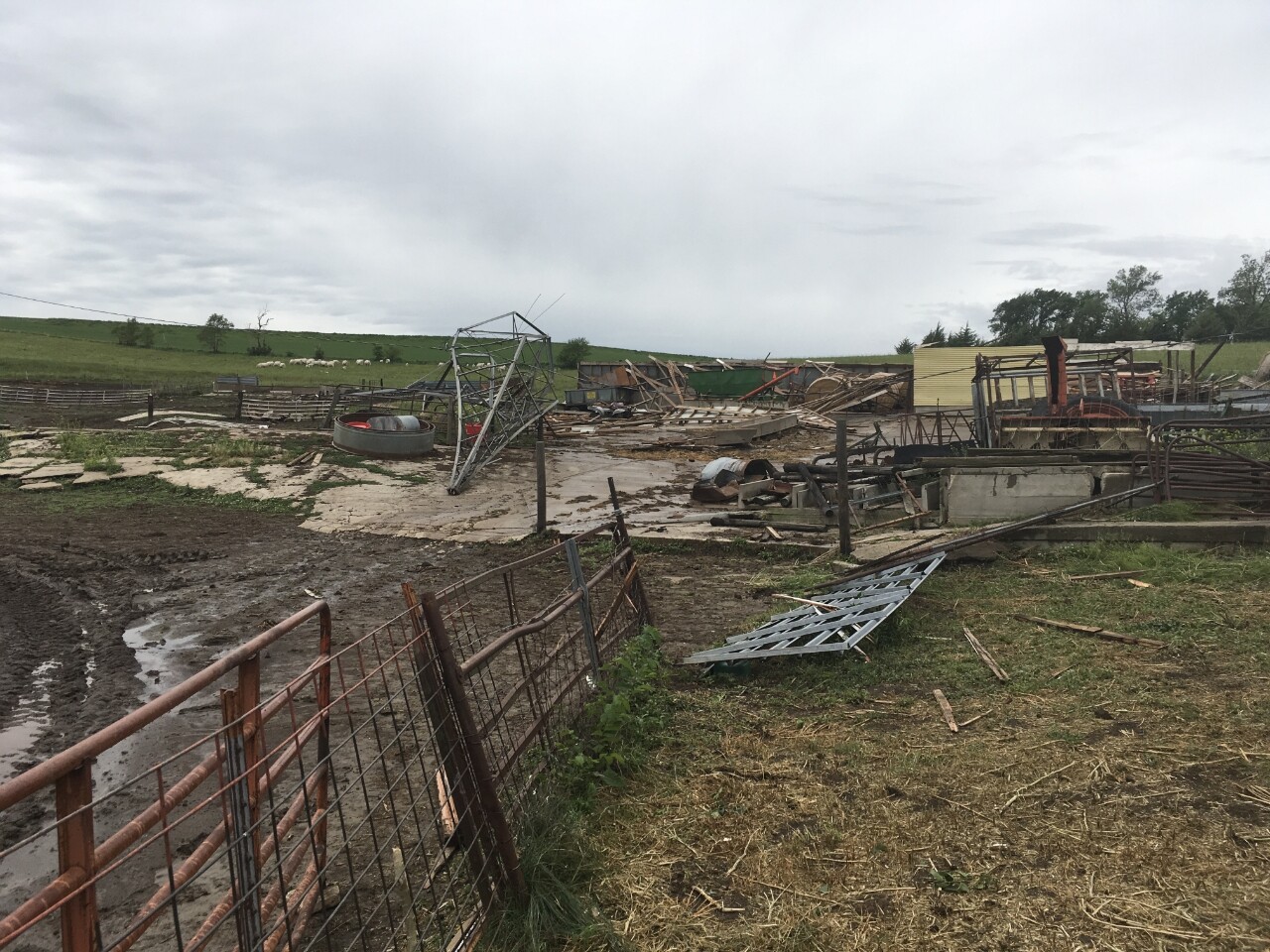
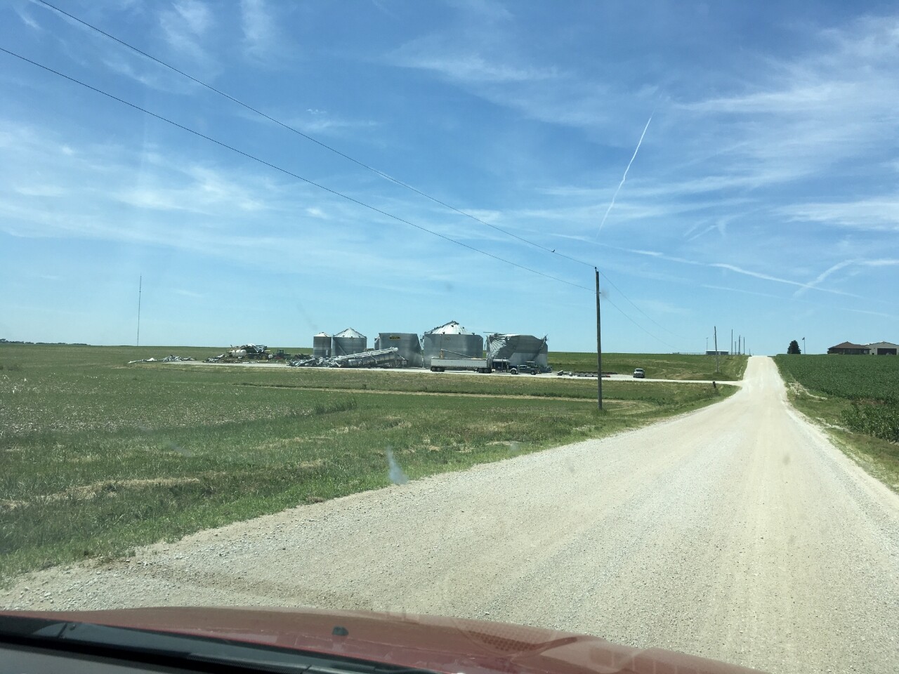
The most extensive damage due to extreme wind was in Sarpy County. West of Springfield, winds upwards of 115 mph tossed two grain bins over 1/2 mile away from where they once stood. More extensive damage was done in Springfield itself from winds upwards of 100 mph, which continued down into Plattsmouth.

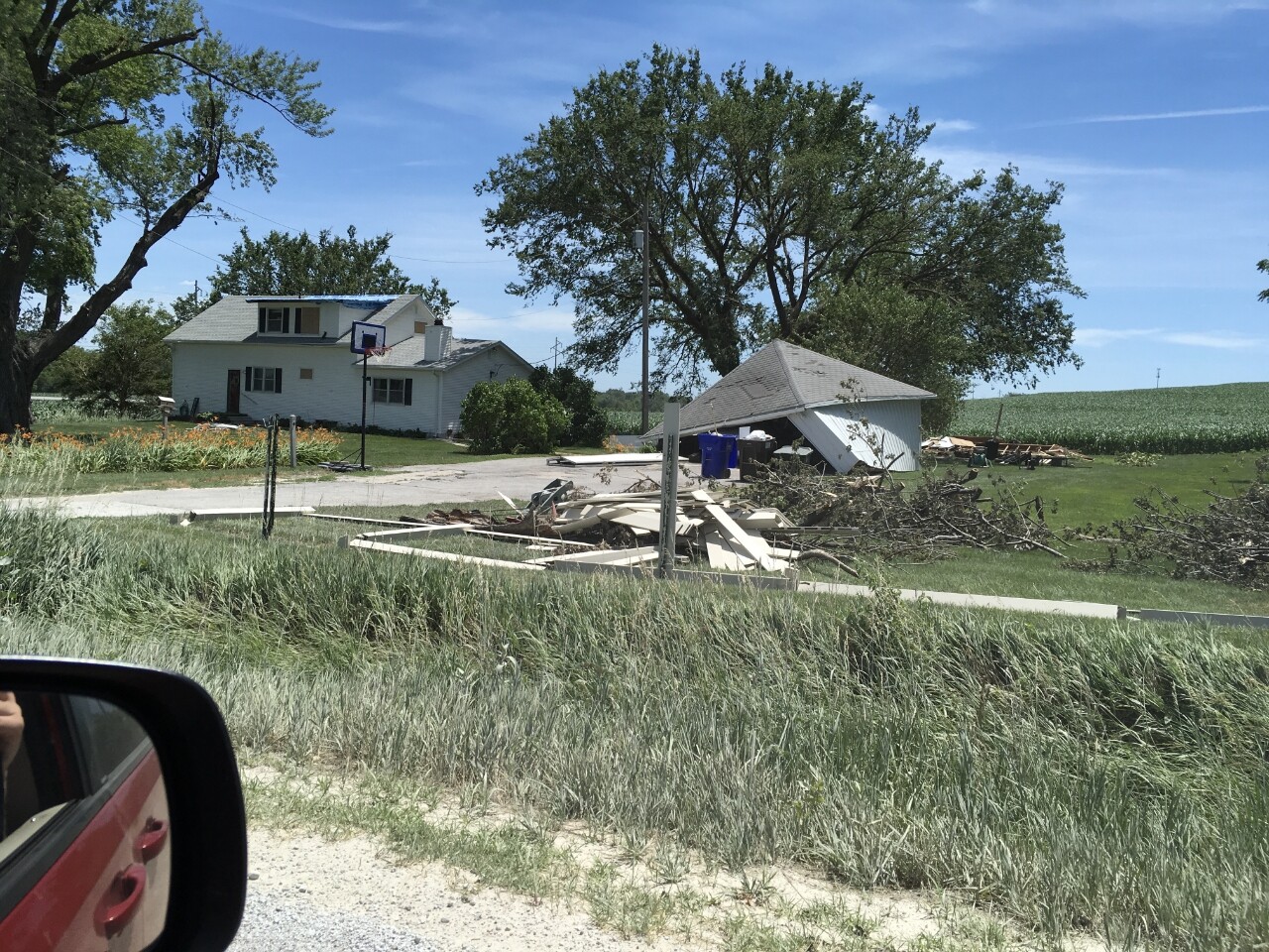
By far the most significant damage came from Bellevue, where two tornadoes touched down. The stronger of the two was an EF-2 which formed over the Twin Springs neighborhood, moving into the Hyda Hills neighborhood. Significant damage was done to many homes, with some losing their roofs and having significant wall damage. The tornado continued southeast, crossing the Missouri River before dissipating southwest of Glenwood in Iowa.

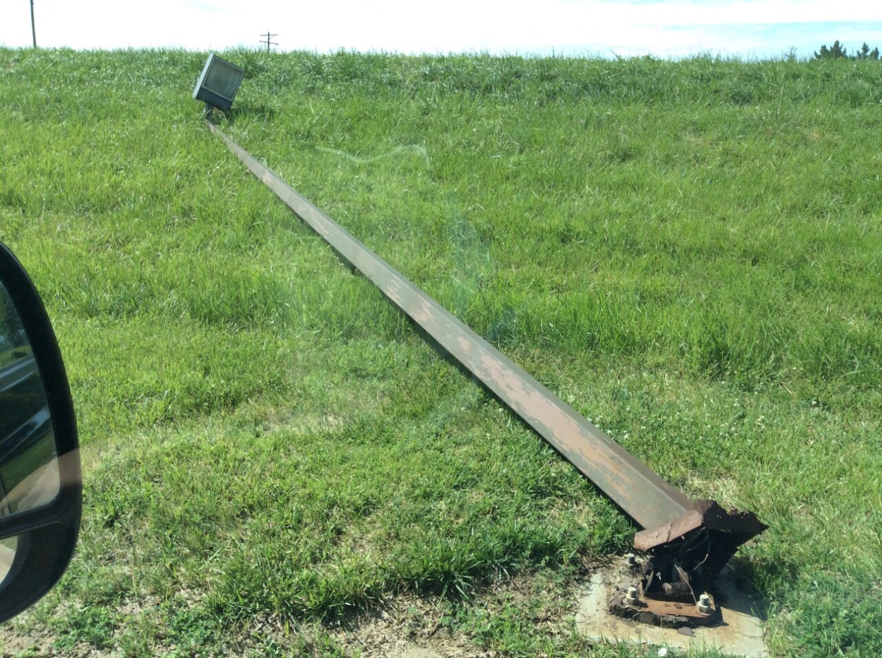
A second tornado touched down and moved over Offutt Air Force Base. On the base, several trees and lamp posts were snapped. Minor structural damage was done to the base itself.
In the Omaha metro, many people lost power. At the height, OPPD reported 76,000 customers without power. For some, it took several days for power to be restored.
8-9PM: STORMS IN LINCOLN AND BEATRICE
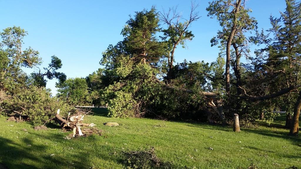
As the storms began to move away from the Omaha metro, a second cluster of storms moved over both Lincoln down into Beatrice causing significant damage. In Lincoln, an 87 mph wind gust was reported north of down. Most of Lincoln saw upwards of 80 mph winds which caused significant tree damage in the city. Just east of the UNL campus, a brief EF-0 tornado snapped a few trees.

To the southwest of Lincoln in Saline and Gage Counties, a significant thunderstorm developed and produced damaging winds upwards of 115mph. The most significant damage occurred in Wilber and Beatrice. A home lost its roof, which was thrown over 100 yards. On the west side of Beatrice, several grain bins were shredded.

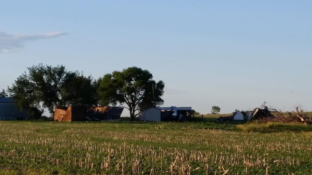
Northeast of Beatrice, the final EF-0 tornado touched down damaging a farmstead and destroying crops.


AFTERMATH
After the storms cleared, destruction was left in its wake. Millions of dollars in damages were incurred from the storms. As of June 16, 2022, the Bellevue tornadoes have been the last time the immediate Omaha metro was impacted.
