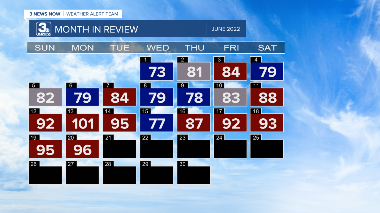
The main story weather-wise for most of June has been the extreme, unrelenting heat. After starting June of on a cool note with highs in the 70s and 80s, but that cool weather did not last. Most of last week into the early part of this week featured highs in the 90s and lows in the 70s. Last Monday, Omaha tied its record high of 101 while Lincoln broke theirs with a high of 102. However, a few changes in the upper-air pattern we have seen are coming. Let's break it down

Over the last week or so, much of the central and eastern United States has been under the dominance of a high pressure system which has meandered across the Great Plains. This pushes the jet stream, where most storm systems ride along, well north into Canada. The combination of the high pressure and jet stream position has brought under the extreme heat dome for June 2022.

The beginning of a pattern change was today, as the high pressure began to move a little to the south and east. The movement had allowed the jet stream to buckle to the south a little, bringing some slight relief to the heat in the form of a cold front. Temperatures tomorrow will drop into the 80s as northerly winds bring cooler air down from Canada.

Is this cool down temporary? Well. Not really. Once the jet stream pushes to the south it hovers over the northern United States for the next several days, even into next week. What this means is that while temperatures will still be warm, highs in the 80s, they will not be overly hot like last week.


