


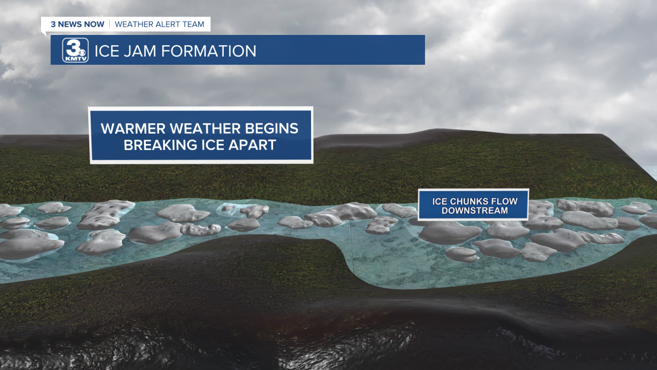
As anyone who lives near the rivers knows, if you have a good snow pack with warmer temperatures in the forecast, you need to watch the rivers carefully. For those who might be new to Nebraska, due to the flat nature of the rivers (Nebraska does mean literally 'flat water') during the winter the water freezes into ice. This ice has to go somewhere, and as temperatures warm it begins to break up and flow downstream. Occasionally, ice can get stuck at river bends or in shallow parts, acting as a dam. This can lead to major localized flooding. Most recently, the historic floods of 2019 were in part caused by ice jams, but 1993 and 1978 were big years as well.


The areas most at risk for ice jams are the North Loup River, the Lower Platte River, and the Elkhorn River.

So with that said, let's look at the factors of an ice jam.
Ice Thickness - Ice thickness is self-explanatory, it refers to how thick the ice pack is on the rivers. The colder the temperature, the thicker the ice grows, but sometimes the snow can act as an insulator slowing the growth. We have a snowpack, but the arctic blast earlier this month certainly allowed the ice to grow quite thick. Therefore, ice thickness is a concern for any possible ice jams.

Snowpack - The two snowstorms earlier this month brought over a foot of snow to parts of eastern and northeastern Nebraska. That snow has to go somewhere, and into the ground/rivers, it will go. If the snow melts too fast, it could overwhelm the rivers causing them to swell, increasing any flood risk from an ice jam. Thankfully, the week of slightly above-average temperatures has been slowly eroding snow melt over the state, allowing it to seep into the ground/rivers at a good pace. As of January 25, snow depths were between 7" at Lincoln and Omaha to 18" in West Point, that is still a lot of snow to melt. With warmer temperatures in the forecast (see below), the risk of an ice jam from the snowpack is heightened.

Streamflow - The streamflow is also self-explanatory, it's the flow of water in waterways. As of January 25, the rivers are completely frozen, thus there is no movement. The risk of an ice jam due to streamflow is low at this time.

Temperatures - If you look at the 7-day forecast, you can see temperatures will slowly warm into next week. By next week, some parts of Nebraska will likely climb into the 40s/50s as we end January. For the next several days, temperatures should be cool enough to not allow any major snowmelt, but as they climb into the 50s by the end of the week into next week this could accelerate the snowmelt. Thus, temperatures are a concern for potential ice jams.

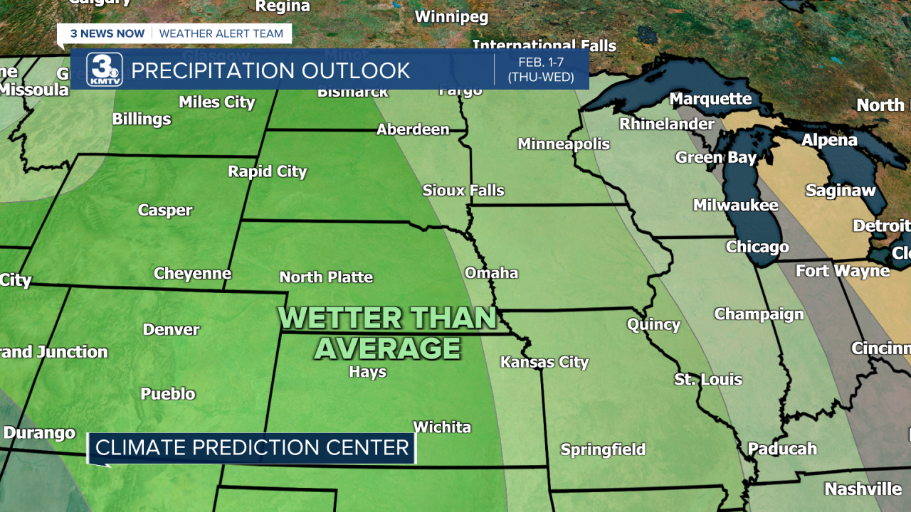
Precipitation - Any additional moisture brought by rain can worsen conditions as it 1.) increases snowmelt and 2.) adds more runoff into the rivers. In March 2019, 3" of rain on top of a deep snowpack led to disaster. Long-range outlooks by the Climate Prediction Center show an increased chance for precipitation into the first week of February, and since it will be warmer it could fall as rain. Therefore, precipitation could be a concern for ice jams.
Although several factors bring about an increased risk of ice jams in the coming weeks, it is not a guarantee anything will occur. Just because ice begins to move does not mean there will be an ice jam, but the risk is there. Those with interests along the rivers should monitor the forecasts and river conditions carefully, particularly into early February.
