


These are the tornadoes from the May 12, 2023, Nebraska Tornado Outbreak. If you are looking for the tornado count from the April 26, 2024 tornado outbreak, you can find them here.
Friday's severe weather across Nebraska brought a variety of weather to the region. From beneficial rain in northeast Nebraska, to hail as large as 4" in southeast Nebraska, and numerous tornadoes over eastern Nebraska.
So far, the National Weather Service in Omaha/Valley has confirmed at least 19 tornadoes from the storms Friday. 18 of which were in the KMTV 3 News Now Viewing Area, all of them occurring in eastern Nebraska.
The official tornado count in our region is as follows:
Total Tornadoes: 18
EF-U: 4
EF-0: 5
EF-1: 6
EF-2: 3
Across the state of Nebraska, 25 tornadoes have been confirmed from central Nebraska eastward. This is the highest tornado count since December 15, 2021, and currently the state's 3rd largest tornado outbreak in terms of number of tornadoes. The top spots were the May 22, 2004, Hallam Tornado Outbreak and the aforementioned December 15 event respectively.
DODGE AND BURT COUNTIES

By far the region of greatest damage came from a long-tracked rotation that produced multiple tornadoes from near the Platte River in southern Dodge County to the Lyons area of Burt County. This rotation produced 5 tornadoes, 3 of those being EF-2.
1. SOUTHERN DODGE COUNTY EF-2
WINDS: 112 mph
LENGTH: 5.5 miles (5 miles E of North Bend to 6 miles NW of Ames)
WIDTH: 1/2 mile
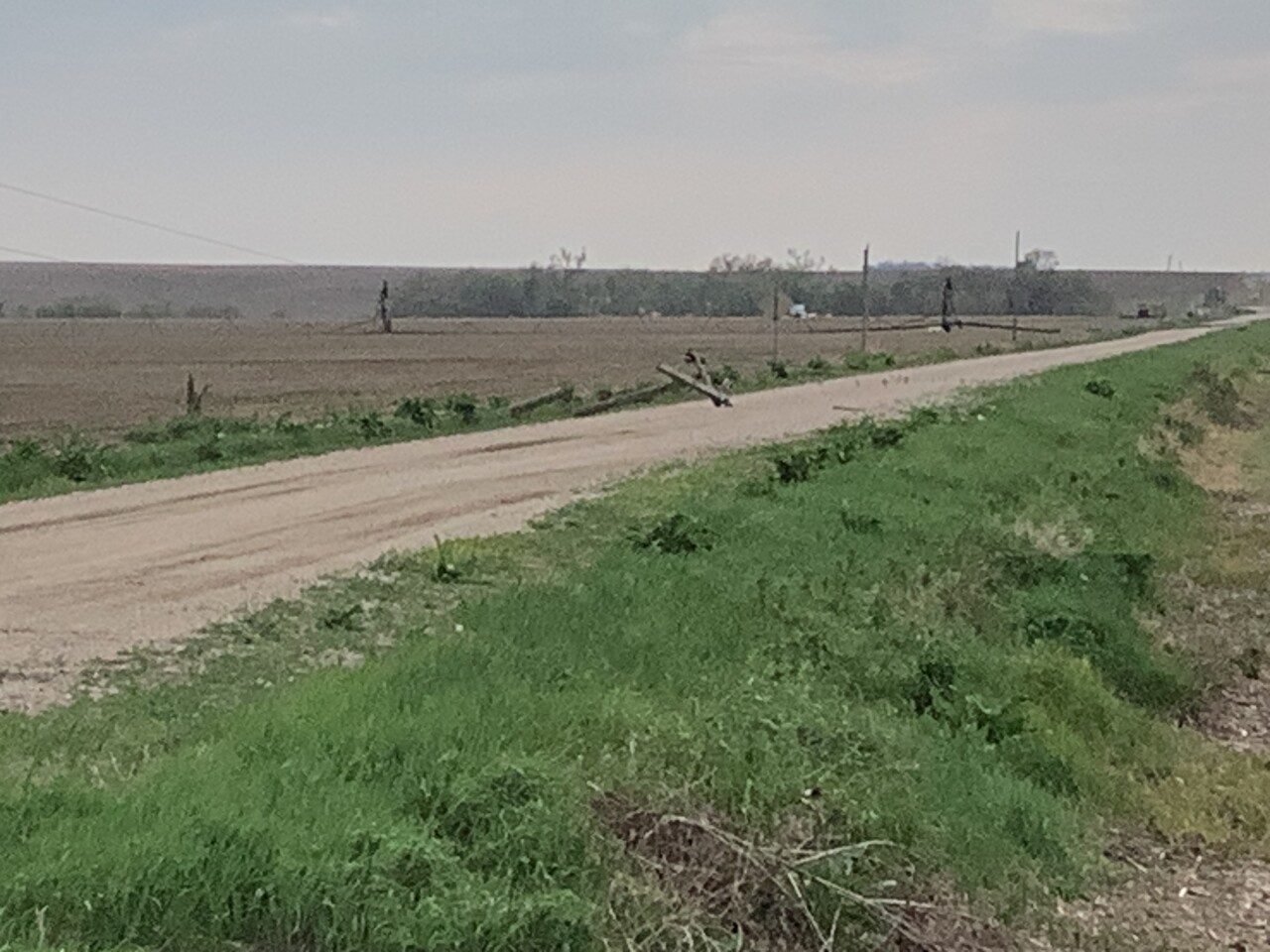
Started near the Platte River and crossed Highway 30 between North Bend and Ames. Multiple center irrigation pivots were flipped. More substantial damage was done to snapped power poles, and outbuildings, and structural damage was done to a home. It dissipated in central Dodge County just north of County Road P.

2. SCRIBNER STATE AIRPORT EF-0
WINDS: 85 mph
LENGTH: 2.5 miles (5 miles SW of Hooper to 4 miles W of Hooper)
WIDTH: 300 yards
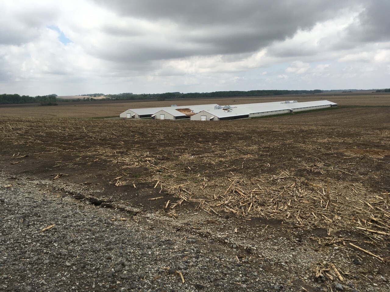
Around 15 minutes after the first tornado lifted, a second tornado touched down just south of Scribner State Airport. It damaged the roof of a hog barn, irrigation pivots overturned, and an outbuilding was destroyed.
3. UEHLING EF-2
WINDS: 125 mph
LENGTH: 10.5 miles (3 miles W of Hooper to 2 miles NW of Uehling)
WIDTH: Around 1 mile
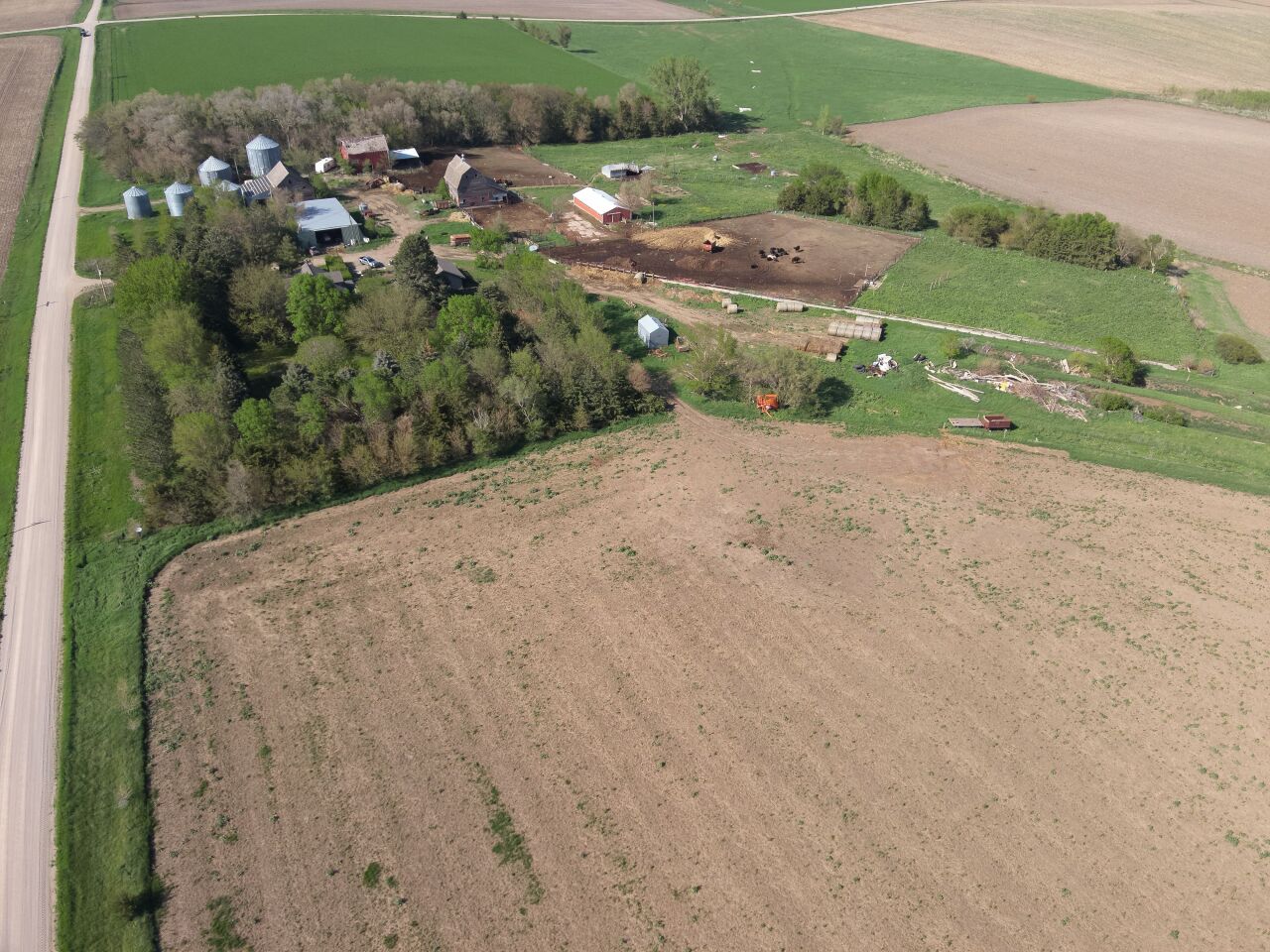
Just two minutes after the second tornado lifted, the strongest tornado of the entire day touched down just south of Highway 275, immediately producing significant damage. Near the Elkhorn River, a porch was ripped off of a home and significant tree damage was reported. As it continued northeast, hog barns were destroyed, as were well-built outbuildings. Home damage consisted of lost roofs, ripped-off porches, and garage doors destroyed. Between County Road F and County Road B, the tornado approached a mile wide as it struck a large cattle feed barn. The tornado lifted just north of County Road F in southwest Burt County.

4. UEHLING SATELLITE EF-1
WINDS: 110 mph
LENGTH: 1.2 miles (1 mile NW of Uehling to 2 miles NW of Uehling)
WIDTH: 100 yards
Sometimes when tornadic circulations are so intense, they can produce a second smaller tornado which circulates the larger tornado. This is known as a satellite tornado, and that is what occurred as the previous tornado crossed into Burt County. Not only was this tornado a satellite tornado, but it was also an anti-cyclonic tornado. Anti-cyclonic tornadoes rotate in the opposite direction (clockwise rather than counter-clockwise) and are very rare in the northern hemisphere! Only 1% of tornadoes in the northern hemisphere are anti-cyclonic. This tornado damaged some irrigation systems and power poles.
5. OAKLAND/LYONS EF-2
WINDS: 120 mph
LENGTH: 11 miles (5 miles SW of Oakland to 5 miles W of Lyons)
WIDTH: Over 1/2 mile
The final tornado touched down only minutes after the Uehling tornado lifted. This tornado moved north over western Burt County, missing the towns of Oakland and Lyons by a few miles. Outbuildings and trees were destroyed at various farmsteads. North of County Road L, nearly a half-mile wide span of power poles were snapped. As the tornado hit more farmsteads, two people were injured in the storm, the only injuries of the entire tornado event in Nebraska. No one lost their lives. The tornado lifted west of Lyons, ending the string of tornadoes that stretched back over 30 miles to North Bend.

6. SOUTHWEST OF TEKAMAH EF-U
WINDS: Unknown
LENGTH: 0.5 miles (5 miles SW of Tekamah)
WIDTH: 50 yards
A storm chaser reported a rope tornado in southwest Burt County, which is supported by radar data. There was no visible damage.
7. EAST OF TEKAMAH EF-U
WINDS: Unknown
LENGTH: 0.5 miles (4 miles E of Tekamah)
WIDTH: 50 yards
A storm chaser recorded video of a brief tornado that stayed over open farmland in Burt County, lasting around 15 to 30 seconds. There was no visible damage.
NORTHEAST NEBRASKA

In northeast Nebraska, multiple supercells produced numerous tornadoes over a large area. In our section of northeast NE, 8 tornadoes touched down, another was out of our area in Boone County. 1 tornado impacted Platte and Wayne Counties, 2 separate tornadoes occurred in Madison County, and 4 tornadoes happened in Stanton County.
8. PLATTE COUNTY EF-U
WINDS: Unknown
LENGTH: 0.1 miles (7 miles S of Lindsay)
WIDTH: 10 yards
A storm chaser recorded a video of a brief tornado over open fields south of Lindsay, northwest of Columbus. No visible damage was reported.
9. MADISON COUNTY EF-U
WINDS: Unknown
LENGTH: 0.1 miles (5 miles NE of Newman Grove)
WIDTH: 50 yards
A storm chaser recorded a video of a brief tornado over open fields in southern Madison County. No visible damage was reported.
10. NORTHWEST OF NORFOLK EF-1
WINDS: 100mph
LENGTH: 3 miles (5 miles WSW of Hadar to 5 miles W of Hadar)
WIDTH: 50 yards
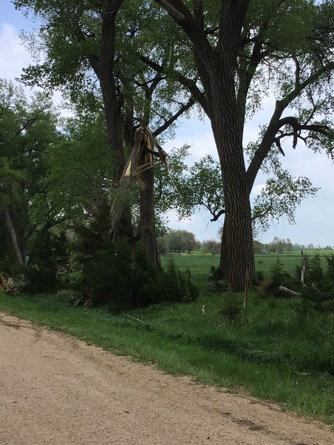
Mostly tree damage, particularly to a grove of cottonwood trees where many were snapped.
11. SOUTH OF WAYNE EF-0
WINDS: 85mph
LENGTH: 0.3 miles (5 miles S of Wayne)
WIDTH: 20 yards
The tornado began in an open field, it then crossed the east side of a farm where it caused damage to sheds and trees. The debris from this farm was thrown 150 yards away. The tornado lifted a short time later in an open field.
12. NORTH OF WAYNE EF-0
WINDS: 80 mph
LENGTH: 0.75 miles (6 miles N of Wayne)
WIDTH: 20 yards
A focused area of tree damage in northern Wayne County was likely caused by a brief tornado.
13. SOUTH OF STANTON EF-1
WINDS: 107 mph
LENGTH: 9 miles (4 miles NW of Leigh to 4 miles SW of Stanton)
WIDTH: 1/10 of a mile
Primary damage was done to trees, where multiple tree trunks were snapped. Minor roof, siding and window damage done to a home along Highway 32. Near the end of the track, a hog barn roof was torn off and a trailer flipped.

14. SOUTHEAST STANTON COUNTY EF-1
WINDS: 105 mph
LENGTH: 5 miles (4 miles NNE of Leigh to 5 miles N of Clarkson)
WIDTH: 150 yards
A hog barn was destroyed with debris tossed half a mile away. Tree damage occurred as well as flipped irrigation pivots.

15. NORTH OF STANTON EF-1
WINDS: 88 mph
LENGTH: 2 miles (3 miles N of Stanton to 5 miles N of Stanton)
WIDTH: 200 yards
The most intense damage was near Highway 275 where several trees were uprooted, roof damage was done to a home and a shed was destroyed.
16. SOUTH OF PILGER EF-1
WINDS: 105 mph
LENGTH: 4 miles (6 miles SW of Pilger to 2 miles SW of Pilger)
WIDTH: 200 yards
On the western edge of an elongated area of damaging winds, a weak tornado was noted south of Pilger. Damage was largely confined to trees, one particular patch of trees was significantly damaged. Structural damage consisted of a few outbuildings. In Pilger itself, damaging winds over 70mph caused minor damage in town.

SOUTHEAST NEBRASKA

Over Pawnee, Richardson, and Nemaha Counties one supercell produced a brief tornado near Pawnee City. This storm did produce large hail up to and exceeding 4" in diameter at times near Table Rock. Near the Nebraska/Kansas border, south of Falls City, another supercell produced an EF-0.
17. PAWNEE CITY EF-1
WINDS: 90 mph
LENGTH: 3 miles (1 mile NE of Pawnee City to 2 miles SW of Table Rock)
WIDTH: 80 yards
A tornado touched down on the northeast edge of Pawnee City, near some baseball fields. Damage to fences, an open shelter, and bleachers occurred. Northeast of the baseball fields, a grain bin was damaged. Although visual reports confirm the tornado continued for a short time after, there was little damage done as it remained over open fields.
18. SOUTH OF FALLS CITY EF-0
WINDS: 83 mph
LENGTH: 2.5 miles (4 miles SE of Falls City)
WIDTH: 50 yards
This tornado began just a few hundred yards south of the Nebraska/Kansas state line, meaning it began in Kansas. The tornado caused power line, roof, and shed damage in multiple spots. There were also swirl marks in a cornfield.

These are preliminary and subject to change, so when it does this article will be updated.
