
If you are a snow lover, these past two winters have not been exciting. Omaha experienced back-to-back near-record dry winters in terms of snowfall. Winter 2021-2022 was the 3rd least snowy winter since records were kept in the 1880s. 2023 was the 6th least snowy year on record as well. So far, 2023-2024 has been on the slower side with winter despite seeing snowfall both Thanksgiving Weekend and Christmas.
However, as we head into next week, we expect things to get much more active. In a quick summary, we are watching the potential for a big storm on Monday and Tuesday, another chance for snow on Sunday, and the arrival of some cold air by the end of the week. Is this just an isolated week, or a sign of a more active winter to come? What is driving this weather pattern? And what can you expect to see in your backyard? The answers to all of these questions lie below!
WHAT IS CHANGING WITH THE WEATHER PATTERN?
The majority of weather in the United States is broadly driven by the jet stream, that belt of fast-moving air at the upper levels of the atmosphere that separates the colder Canadian air to the north from the warmer sub-tropical air to the south. The jet stream is not a static belt, but one that constantly fluctuates in waves as it moves over North America.
Over the past few months, the jet stream has been largely zonal, meaning it moves from west to east across the country. Zonal weather patterns are notorious for bringing mostly quiet weather to the country, as there are no significant clashes of air masses to get low-pressure systems going.

Occasionally you get a breakdown in this pattern, like what happened on Christmas with our snow. Heading into next week, the zonal weather pattern will break down into what we call a meridional weather pattern. Meridional weather patterns are when the jet stream takes on a more north/south orientation, where deep troughs and ridges move across the country. This is conducive for large storm systems to sweep across the country, and that change begins this weekend.

FRIDAY SNOW

The first storm system is moving through Friday, but the majority of the impacts will be south of the KMTV viewing area over Kansas and Missouri. Still, through the rest of the day, some light snow will fall south of I-80 with any accumulation less than 1". Some flurries/light snow is possible in Omaha during the afternoon, but any accumulations will be minimal to cause any travel impacts.
MONDAY-TUESDAY SNOW
The main storm of interest is the potential for a big winter system to trek across the country by the end of the weekend into early next week. As of Friday afternoon, our storm system is still off the coast of British Columbia, Canada. The storm still hasn't made "landfall" yet, meaning our weather stations have been unable to observe, but it will this afternoon meaning we will have a better handle on where this system will track.

Over the weekend it will dive southeastward through the western United States, and emerge off the Rocky Mountains in New Mexico. Then it will track across Oklahoma into southern Missouri. Historically, this storm track has brought us some of our big snowstorms in the past. This is known as a "Colorado Low" (in this case, a "New Mexico Low"), if you want more information on how this plays into our weather click here.

With plentiful moisture to work with and a favorable track, snow accumulations up to several inches are quite possible across Nebraska and Iowa. However, where exactly this heavy snow falls will depend on where exactly the storm tracks and temperatures. For updates on snowfall accumulations and the impacts, you can go to our weather page for the latest.
THURSDAY SNOW

After our big system early in the week, there are hints at a second chance at some snow on Thursday. This second system looks less impressive as it comes from the north, meaning it won't have access to the reservoir of moisture to the south that our early week system has. However, snowfall accumulations are still possible if the forecast holds. Things will change between now and then, so let's get through our early-week system before worrying about what happens a week out.
COLD AIR COMES IN

What is more certain about the Thursday system is it will carry with it a blast of arctic air behind it. While it is still uncertain exactly how cold it will get, it will get colder than we have been so far. Some early signs of highs in the teens and lows below zero are not out of the question. Certainly not unusual, but in 2023 Omaha did not have a low go below zero which has not happened since 1941.

WILL THIS ACTIVE WEATHER PATTERN CONTINUE?
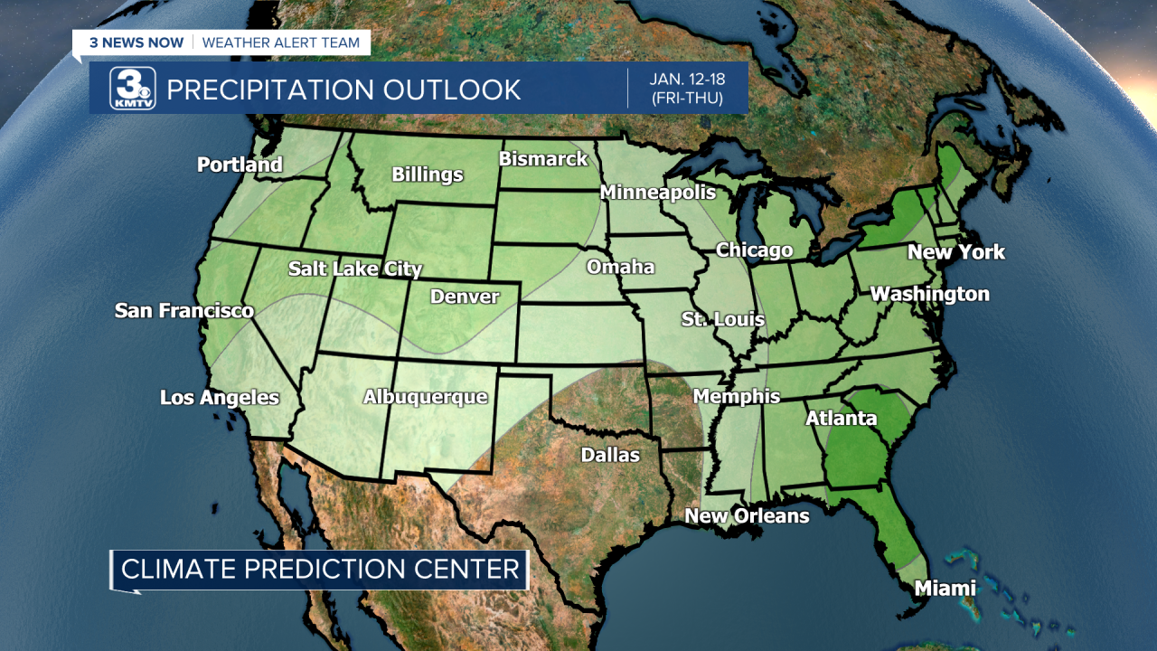
While we cannot give specifics on what could happen past next week, we can look at the broader trends. According to the Climate Prediction Center, the 8-14 day outlook (January 12-18) shows an above-average chance for some precipitation in that period. This could mean that the weather pattern remains somewhat active into the middle part of the month.
Looking even longer range, the 3-month outlook (January-March) shows equal to above-average precipitation during that stretch. So while we will have quiet intervals through the rest of winter, this winter is certainly looking to be more active than the past two winters...but that isn't saying much.

For more specific details on the snow chances coming up and what comes in the longer term, keep updated with the KMTV Weather Alert Team as we will give you the latest. (Link to the weather page, updated multiple times daily). You can also download the 3NewsNow App (free on iPhone and Android) to keep updated on the go.
