


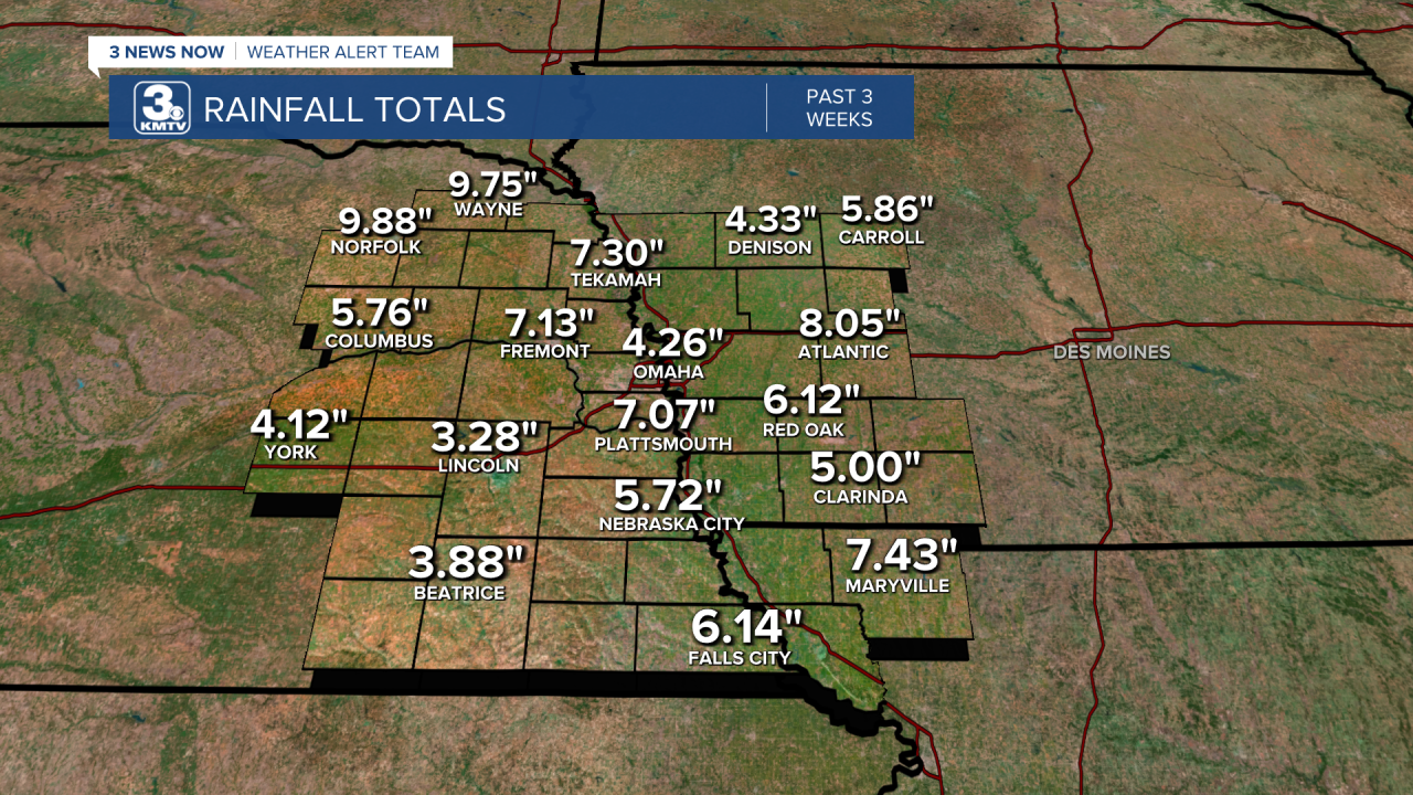
For the past several weeks, Nebraska and Iowa have been in an active weather pattern with several days of showers and storms rolling across the region. Thankfully, the severe weather has been kept to the low side, and it's been bringing beneficial rain to our neighborhoods. Since June 23, most of us have picked up 4-8" of rainfall, which is about as much as we see in 2 months!
What effect has this rain had on the drought? A lot, and in the good direction!
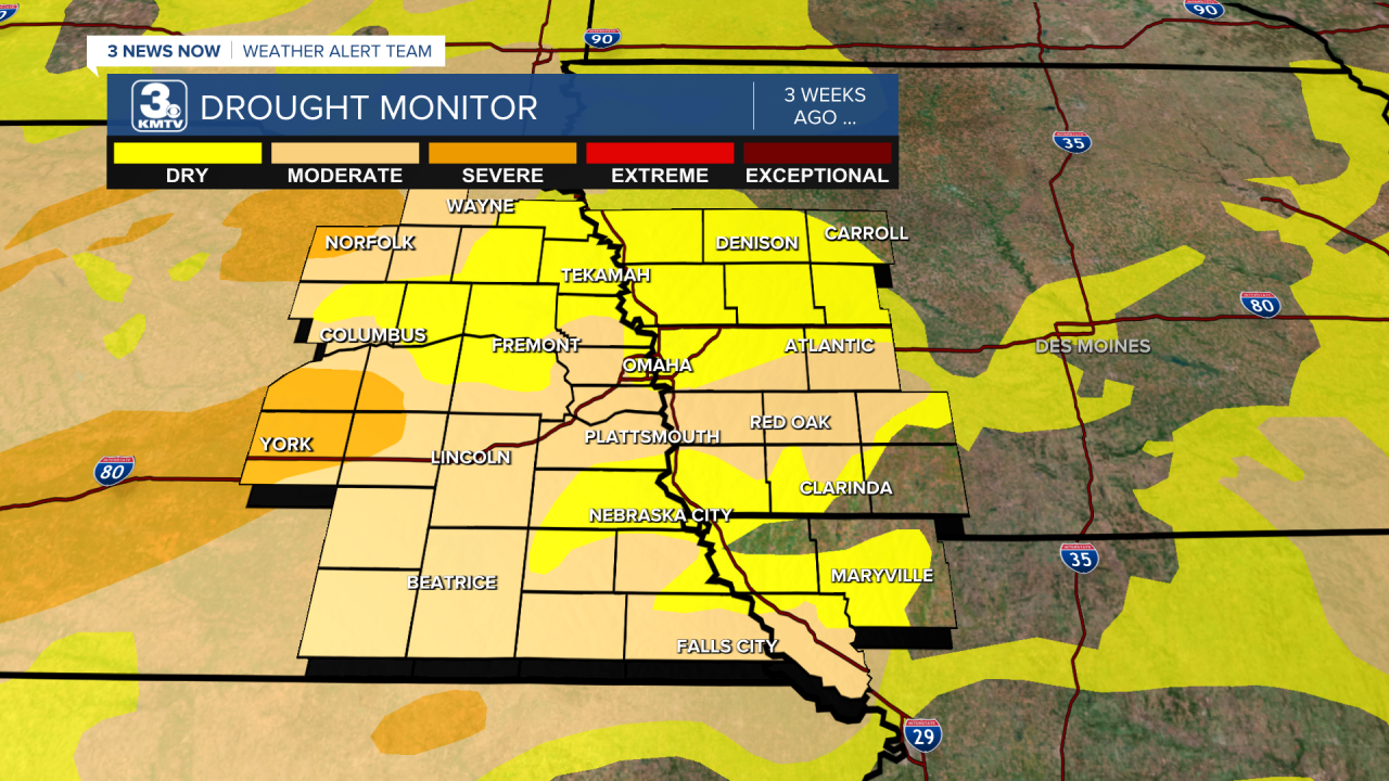
For our baseline, this was the drought map from June 24, right as the active pattern began. The yellow shading is "abnormally dry", which is not a drought category, but either a developing or recovering drought. Almost all of us were in that category. A step above that is "moderate drought" in the tan shade, which included much of eastern Nebraska into western Iowa. The darker shade is the "severe drought," which was in the York & Norfolk vicinity.
Now, fast forward to this week, and you can see the improvement! Large swaths of northeast & southeast Nebraska, western Iowa, and northwest Missouri are cleared from all categories! This includes Douglas County, which has been removed from the "moderate drought" category and lowered to "abnormally dry", which is not a drought category.
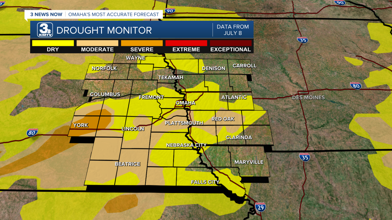
Despite the improvement, we still have a bit to go. Parts of southeast Nebraska into southwest Iowa are still in a moderate drought, and the severe drought still exists over York. Still, with the continuing active weather pattern, we will likely continue to see improvements in the coming weeks! Keep the rain dances going!
