
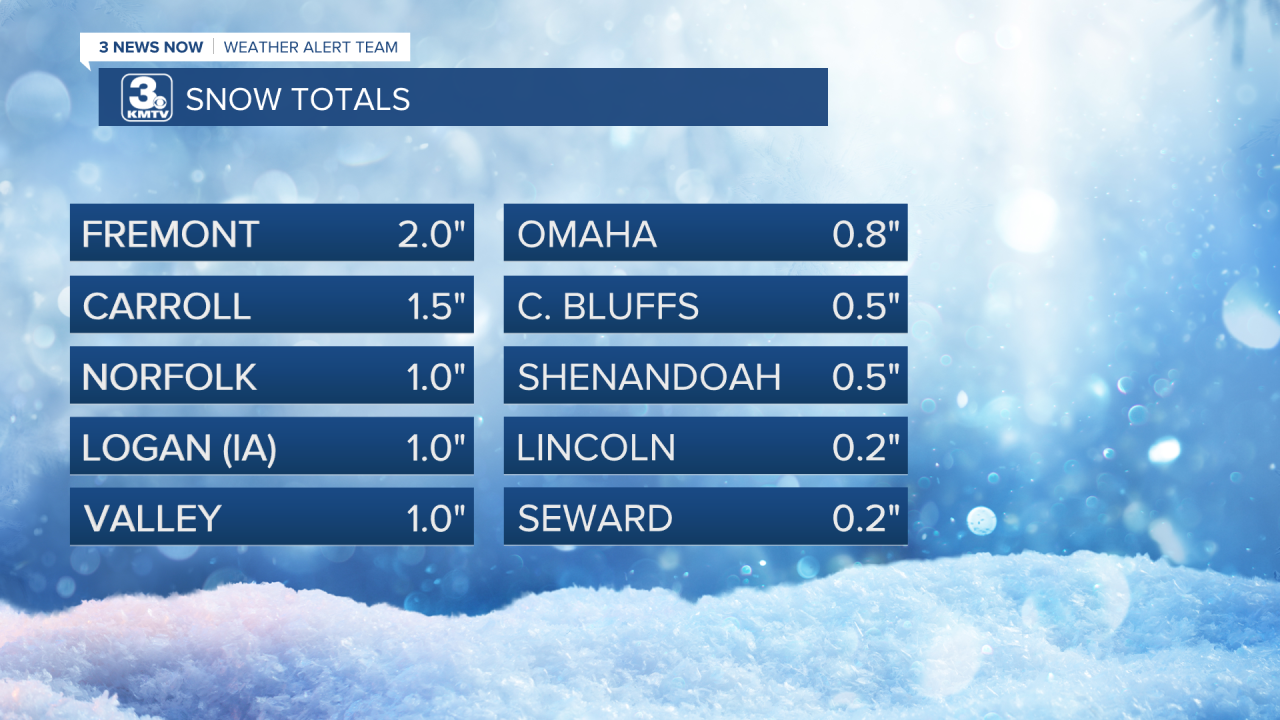
We woke up this morning to a welcome sight (for some), snow! A band of snow moved through overnight, dropping less than 2" of snow for most of eastern Nebraska, western Iowa, and northwest Missouri. Officially, Eppley Airfield picked up 0.8" of snow, the highest total was in Fremont with 2" on the ground.
It was a sign that we are indeed still in February, but it certainly does not feel like it. On Valentine's Day Omaha hit 60 degrees for the first time this year. The rest of the month has been very warm with highs not dropping below the 40s for the first half of the month. This has had an impact on our rain/snow for the month, with the only measurable precipitation being 0.02" of rain last week, and the 0.8" of snow this morning.

So how warm has it been this month? If February ended today, it would go down as the 3rd warmest February on record in Omaha, which dates back to 1871.

Now that we have gotten a reminder that it is indeed winter, is that a sign of a coming pattern change? The short answer is not really. The longer answer is also not really. Our current forecast calls for a return to the 40s by Saturday, the 50s by Sunday, and next week we could make another run at 60 by midweek.

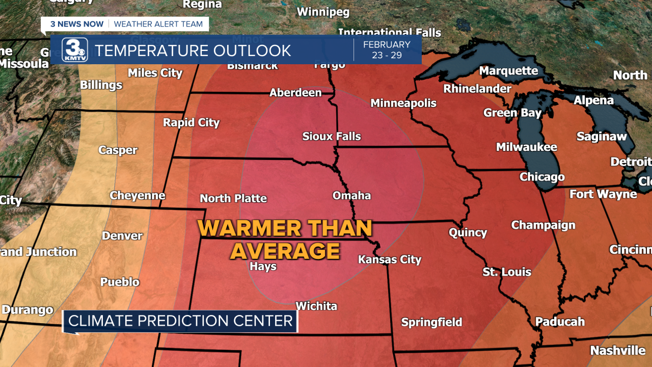
In the longer term, cold weather lovers look to be disappointed. According to the latest Climate Prediction Center outlook which covers the last week of February, warmer-than-average temperatures look likely across much of the Midwest. The deeper the red does not mean the warmer it will be, but the likelihood of above average temperatures. Therefore, We can expect highs in the 40s and 50s (maybe a rouge 30s) to probably continue to the end of the month.
There are some signals of some cooler weather into March, but the indications are too early to say when or how cold things get. Safe to say that Old Man Winter will not be arriving anytime soon, even with the snow this morning.
