


Over the last few days, the region has received multiple rounds of rainfall. Friday morning, Saturday, and Monday morning brought the lions share of the rainfall. Despite the prolonged nature of the rain, only a few spots really picked up on significant rainfall. It was another event where a few communities got their fair share, while others were left in the dust.
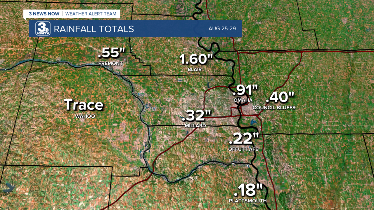
Look at the Omaha metro for example, some locations particularly north and east of the metro saw much needed rainfall. Blair picked up 1.60" while Wahoo only saw a trace. Sarpy County also picked up one more rainfall, although official readings from Millard and Offutt AFB were on the low end. This map of rainfall over the last 48 hours sums up the spots who saw the heavier rains.

Zooming out to show the entire viewing area, it becomes clear the winners was southwestern Iowa. Red Oak picked up over 2" of rain, along with strong storms which produced a 55mph wind gust at the airport. Other locations in eastern Nebraska were hit or miss, with rainfall amounts less than a quarter inch commonplace.
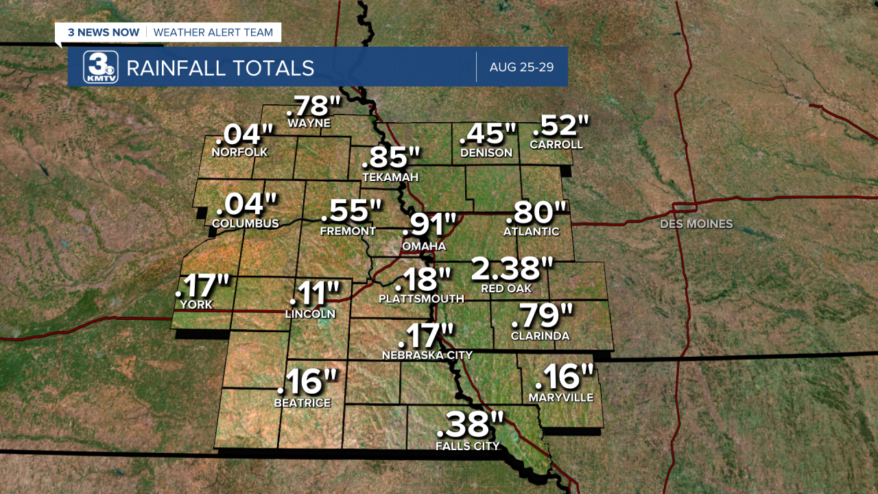
Time will tell to see if this rain affected the drought, the drought monitor came out before the rainfall began. The next drought monitor comes out on Thursday, where improvement will likely be seen over Iowa, but conditions remain severe across Nebraska.

