


It's May in Nebraska and Iowa, which means we are in the peak of severe weather season. Although the season has been somewhat quiet compared to other years, the events we have had left significant impacts, as those in Malvern, Iowa can attest to. The active weather pattern we have seen over the last week will continue at least for a few more days, bringing strong to severe storm chances to parts of Nebraska and Iowa each day through the weekend.
Today, let's dive a bit deeper into the reasons for this severe weather, and it's potential caveats over our area.
AN ACTIVE PATTERN
Since the start of May, the weather over much of the country has been similar from day-to-day. In our region, this meant warmer weather with nearly daily chances for showers and thunderstorms. A very summer-like pattern has persisted due to what happens at the upper-levels of the atmosphere in the jet stream.
The jet stream is a current of fast moving air high in the atmosphere which drives a lot of our broader weather patterns. It acts like a wavy pattern, occasionally rising and dipping over the United States. A rise in the jet stream is often called a "ridge", while the dips in the jet stream are called "troughs". Broadly speaking, a ridge correlates with periods of warm air and high pressure as it allows warmer air from the south to rise into the United States. Likewise, a trough is associated with cooler weather and low pressure as it brings down air from Canada.
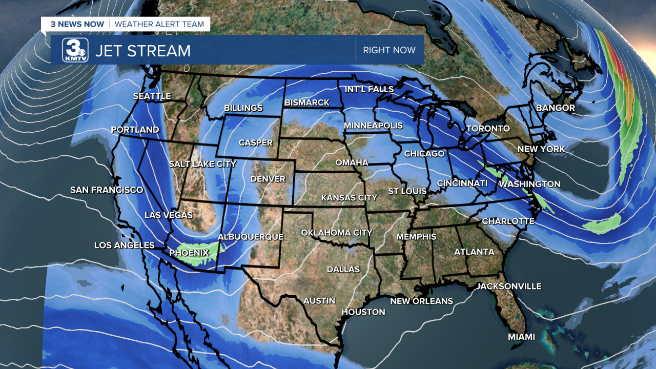
Over the last week, a ridge has dominated much of the central part of the country, the main reason for the stretch of 70s/80s Omaha has seen. Out west, over the Rocky Mountains, a trough has sat keeping the cooler weather away from us. This sort of pattern also brings wet weather to the northern part of the country, as small areas of low-pressure ride the ridge, bringing thunderstorm chances. This pattern has been the reason for our summer-like feel.
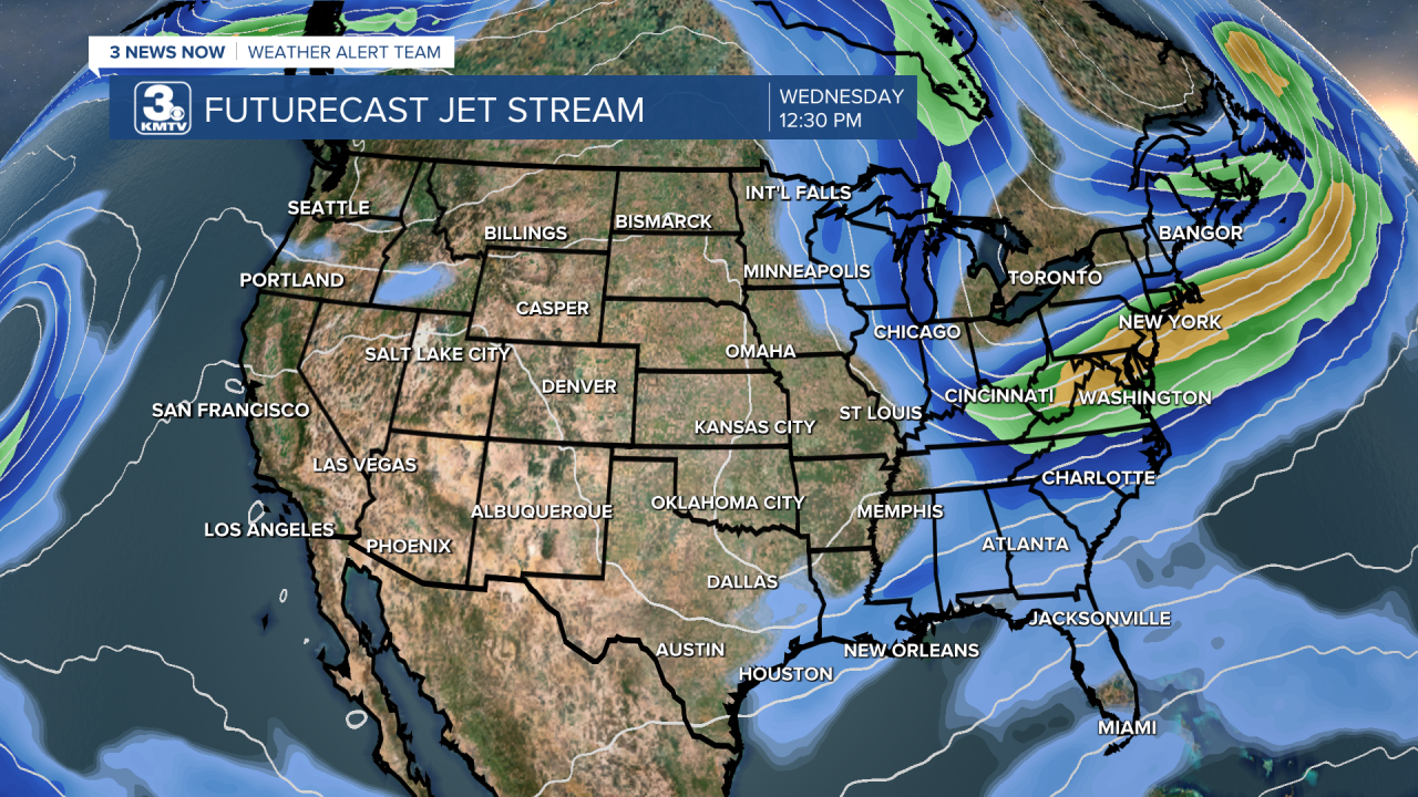
However, this will change over the next couple of days as the trough in the west finally begins to push eastward. This will bring the larger area of low-pressure eastward into the central part of the country, bringing the region an increased chance of Severe weather.
WEDNESDAY
For this afternoon, the severe weather remains confined to our west. The Storm Prediction Center in Norman OK has issued a slight risk (2/5) for much of western Nebraska, with an enhanced risk (3/5) for parts of southwest Nebraska into northeast Colorado. In those areas, very large hail and a few tornadoes are possible.

In northeast Nebraska, a level 1/5 severe risk has been issued for the potential of a few storms overnight. Places like Norfolk and Wayne might get clipped by some hail, but a majority of these storms should remain closer to Sioux City IA or Sioux Falls SD. Further south into Omaha, expect a dry night as much of the remain sticks to the north.
THURSDAY
On Thursday, the main low-pressure system begins its journey off the Rocky Mountains into eastern Colorado. Ahead of it, warm air laden with moisture will exist for widespread showers and thunderstorms, some of which could be severe. The Storm Prediction Center has placed most of Nebraska and far west Iowa in a slight risk (2/5) for this potential. Into Omaha, a level 1/5 risk has been issued.

Although Omaha and surrounding areas could see scattered storms through the afternoon, these will mostly stay non-severe although a few instances of large hail is possible. The main severe weather develops over western Nebraska into Kansas and works its way east towards our area. However, as they get closer the sun will set, meaning the storms lose a lot of their energy the further east they move. So expect them to weaken as they approach Omaha, but as they weaken we could still see some isolated severe storms over eastern Nebraska.
FRIDAY
Friday is when things get interesting over eastern Nebraska into Iowa. The main low-pressure system pushes over Nebraska. Ahead of it still exists warm air, temperatures in Omaha reach into the 80s. Historically, this kind of set-up is known for producing severe weather in our region. As such, the Storm Prediction Center has parts of Nebraska and Iowa in that level 2/5 severe risk.

There are still some lingering questions. The low-pressure system will be weakening as it moves further east, meaning the wind fields favorable for severe weather will be waning in intensity. This could help keep the severe weather threat more isolated. Another big question is how much energy exists for storms to feed off of, if we see cloud cover/rain early in the day Friday, that could keep our energy lower. These factors are still in question. If we see them become more favorable for severe weather, then our chances for strong storms also increase; if they become more unfavorable, then we could see our severe weather chances decline. Time will tell as more details unfold.
NEXT WEEK: A PATTERN CHANGE?
This low-pressure system that pulls into the region will represent the final gasps of this active weather pattern for early May. Although some shower/storm chances linger into Mothers Day Weekend, the severe weather threat pulls away.
Into next week, the aforementioned ridge slides to the west, bringing warmer weather to the Rocky Mountains. Although the eastern half of the country does not see a huge trough, expect a return to near-average temperatures next week. Unfortunately, this also means a drier weather pattern takes hold into the middle part of the month. As the Climate Prediction Center shows, drier than normal conditions can be expected through the next week or two. This does not mean it will not rain this entire time, but it means a drier pattern is in store.

