
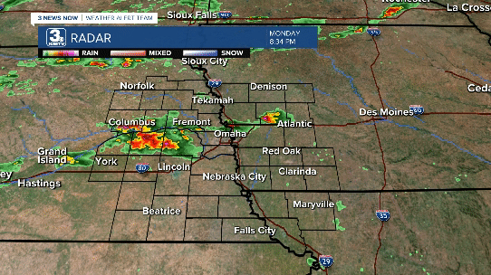
This past week, Nebraska and Iowa experienced several waves of severe weather that produced tornadoes, wind damage, hail, and flooding. Below is a recap of what we experienced during the waves of severe weather from Monday evening to Tuesday afternoon.
TORNADO COUNT:
Tornadoes: 14
EF-UNK: 1
EF-0: 9
EF-1: 2
EF-2: 0
EF-3: 1
EF-4: 1
MONDAY EVENING TORNADO
Scattered severe thunderstorms developed Monday evening over eastern Nebraska and western Iowa. Most of these storms produced hail and gusty winds, but a brief “landspout” tornado occurred in Shelby County, Iowa.

A “landspout” tornado is not formed like a traditional tornado with a rotating storm. Landspouts act similar to fair-weather waterspouts. Small areas of spin can be stretched into a weak tornado. This is what happened in Shelby County near Tennant.

TUESDAY MORNING STORMS
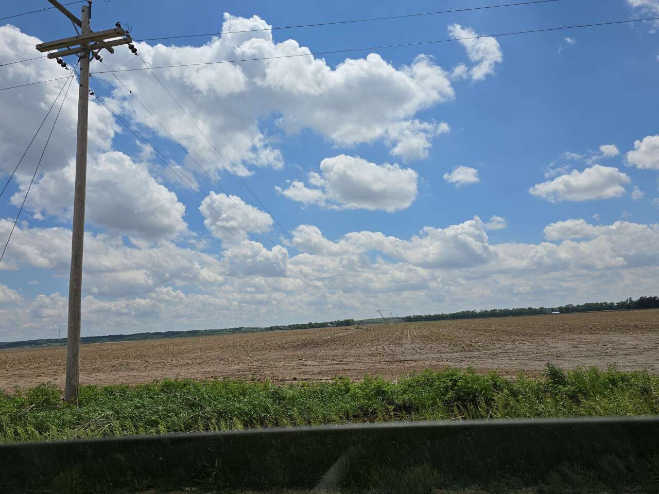
Between 5 and 8 am, severe storms produced tornadoes, damaging winds, and flooding over eastern Nebraska and western Iowa. The storms produced 7 tornadoes over eastern Nebraska and southwest Iowa. Alongside the wind/tornado damage, the storms dropped 2-4” of rain over the Omaha metro, which led to significant flooding.
NE POLK COUNTY, NE
Rating: EF-0
County: Polk
Max. Wind Speed: 80 mph
Path Length: 4.41 miles
Tornado Width: 75 yards
Time: 4:57 – 4:58 am
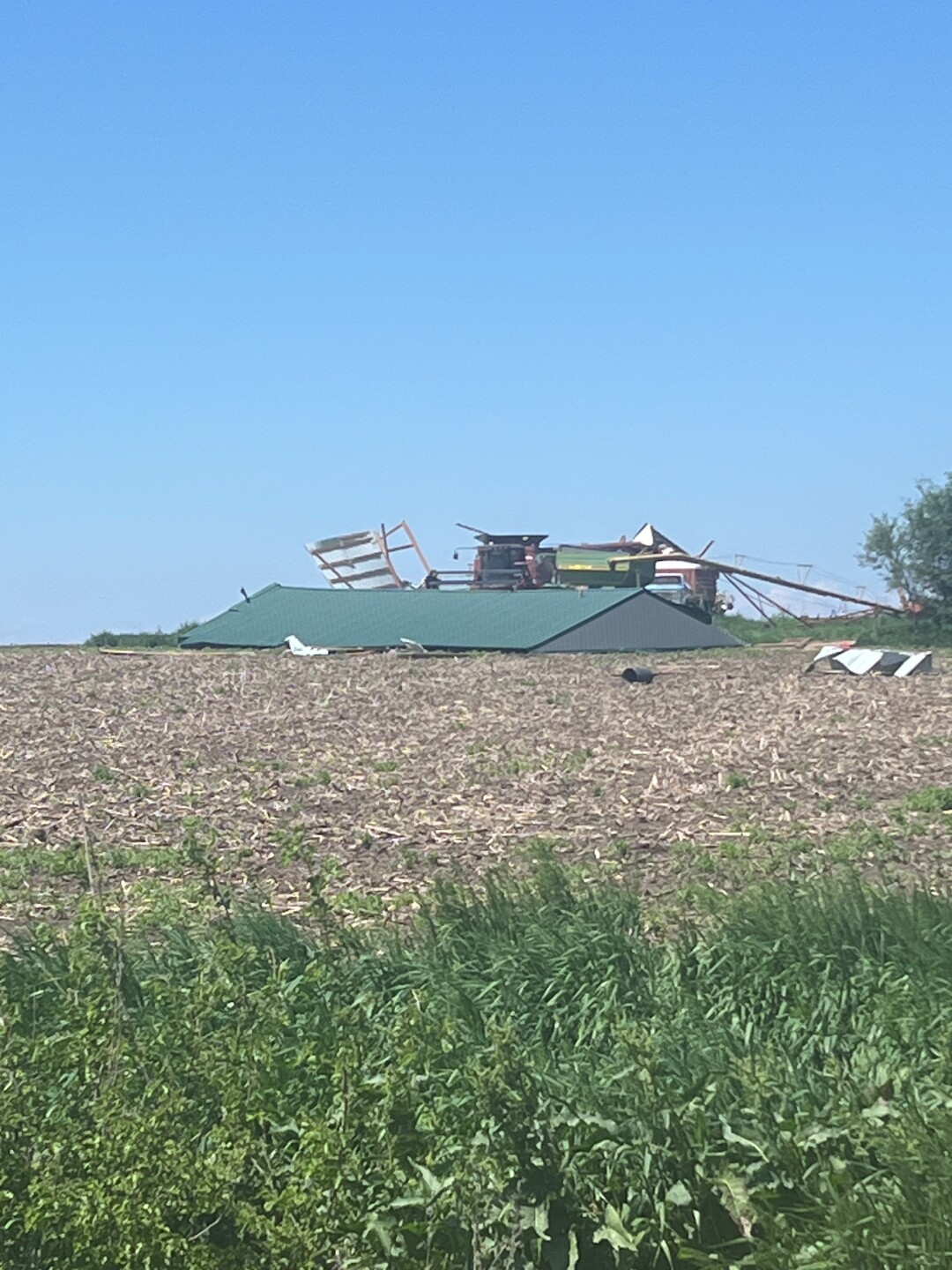
Overview: The tornado began west of County Road S between County Roads 38 and 39 in northeast Polk County. The tornado took a path to the northeast, flipping center irrigation pivots, snapping power poles, and damaging trees at one homestead. The tornado lifted before reaching the Butler County line.

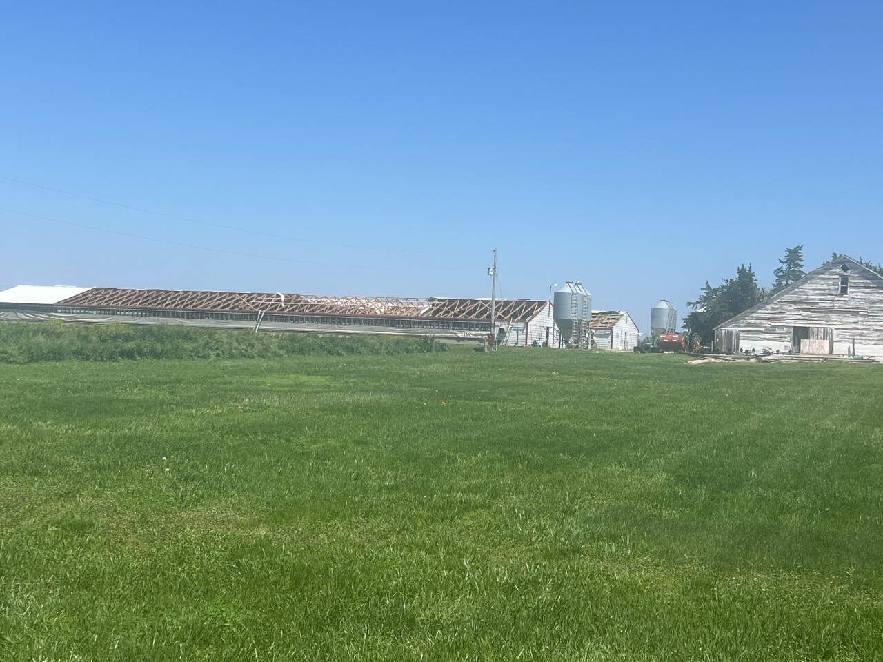
PLATTE/COLFAX/DODGE, NE HIGH WIND
Wind Speed: 80-100 mph
Overview: An area of high winds above 80 mph swept from Columbus into western Dodge County. Across this area, irrigation pivots were flipped, power poles were snapped, and damage was done to some homes and outbuildings. In Columbus, a soccer net on the north side of town was blown 100 yards due to the wind.

RICHLAND, NE
Rating: EF-0
County: Colfax
Max. Wind Speed: 82 mph
Path Length: 0.51 miles
Tornado Width: 50 yards
Time: 5:14 am
Overview: Began on a farmstead 200 yards west of Road 6 south of Road H where a roof was blown off an outbuilding. As it crossed Road 6, a power pole was pushed to a 45-degree angle. An empty grain bin was also knocked over before the tornado lifted shortly after crossing Road H.

BRAINARD, NE #1
Rating: EF-0
County: Butler
Max. Wind Speed: 84 mph
Path Length: 0.62 miles
Tornado Width: 50 yards
Time: 5:20 am
Overview: A tornado crossed County Road Q between Road 28 and 29 southwest of Brainard. An irrigation pivot was flipped and trees were snapped near Q road.
BRAINARD, NE #2
Rating: EF-0
County: Butler
Max. Wind Speed: 80 mph
Path Length: 2.04 miles
Tornado Width: 50 yards
Time: 5:26 – 5:28 am
Overview: A tornado followed Road 28 between County Road T and V southeast of Brainard. Most of the damage was done to trees. One farm building had pieces of wood paneling peeled off.


VALLEY VIEW GOLF COURSE, NE
Rating: EF-0
County: Saunders
Max. Wind Speed: 84 mph
Path Length: 0.39 miles
Tornado Width: 50 yards
Time: 5:45 am
Overview: A tornado moved over the Valley View Golf Course south of Fremont. Several trees were snapped on the golf course, and in the neighborhood just to its east. The tornado lifted before crossing Highway 77.

COBURG, IA
Rating: EF-0
County: Montgomery
Max. Wind Speed: 75 mph
Path Length: 0.69 miles
Tornado Width: 40 yards
Time: 7:10 – 7:11 am
Overview: A tornado began north of Coburg west of Evergreen Ave and south of 250th Street. It crossed Evergreen Ave and lifted before reaching the East Nishabotna River. Damage to fields and a fence occurred near a home, but no damage was done to the home.

HEPBURN, IA
Rating: EF-1
County: Page
Max. Wind Speed: 100 mph
Path Length: 3.27 miles
Tornado Width: 80 yards
Time: 7:32 – 7:36 am
Overview: A tornado began at the 170th Street and N Avenue intersection and moved northeast. It lifted near P Avenue between 160th and 150th Streets. Trees and outbuildings were damaged, one barn significantly.


TUESDAY AFTERNOON STORMS
After the morning round of storms passed on by, more severe weather developed as early as 11 am across eastern Nebraska. Initially, these storms produced hail, including 2” hail in Fremont. As they crossed toward the Omaha metro, these storms became tornado warned. Although no tornadoes occurred in the Omaha metro, they intensified further into southwest Iowa where several intense to violent tornadoes occurred.
YUTAN, NE
Rating: EF-0
County: Saunders
Max. Wind Speed: 80 mph
Path Length: 0.22 miles
Tornado Width: 50 yards
Time: 12:52 pm
Overview: A tornado hit the north side of Yutan. It began near Upper Cedar Creek north of Vine Street and moved north-northeast before crossing Hillside Ave. Damage was confined mostly to trees, although a fence was damaged too.


RED OAK, IA
Rating: EF-1
County: Montgomery
Max. Wind Speed: 107 mph
Path Length: 2.95 miles
Tornado Width: 70 yards
Time: 2:35 – 2:40 pm
Overview: A tornado began near Evergreen Avenue and 220th Street southwest of Red Oak. The tornado moved over open fields before crossing the East Nishabotna River, where major tree damage occurred along the riverbed. The tornado entered the west side of Red Oak where a building at the city water facility was hit, where all doors were blown out alongside a wall. The tornado continued to produce tree damage in western Red Oak before lifting near the intersection of W 2nd Street and W Reed Street.


EXIRA, IA
Rating: EF-0
County: Audubon
Max. Wind Speed: 80 mph
Path Length: 7.33 miles
Tornado Width: 100 yards
Time: 3:09 – 3:18 pm
Overview: A tornado started near Jay Avenue just north of I-80 in southern Audubon County. This tornado moved to the east of Brayton and Exira before lifting north of the intersection of Littlefield Drive and Pheasant Avenue. Minor damage was done to trees.

VILLISCA/CARBON, IA
Rating: EF-3
Counties: Page, Montgomery, Adams
Max. Wind Speed: 140-150 mph
Path Length: 32.01 miles
Tornado Width: 1300 yards (3/4 miles)
Time: 2:43 – 3:19 pm
Overview: This long-tracked and intense tornado began near 130th Street and J Avenue in northern Page County, southeast of Coburg. It hit an outbuilding shortly into its track, strewing metal into nearby fields. Damage was done to trees and outbuildings in Page County, although one farm building along M Avenue was destroyed. It intensified as it crossed into Montgomery County at O Street, where several homes were damaged. The tornado intensified further as it moved west of Villisca. As it crossed 250th Street, a communications tower was toppled. The most significant damage was to a home near 240th Street and T Avenue, where the roof was removed and several exterior walls collapsed. The tornado crossed Highway 71 just south of the Highway 34 intersection, where an attached garage to a home was destroyed. The tornado hit a campground at Hacklebarney Woods, where damage was done to RVs and trees. As the tornado crossed into Adams County, it reached a peak strength of an EF-3. On 200th Street, a house had its roof and some walls destroyed. One home near 175th Street and Cherry Avenue only had a few interior walls left standing, as did a home on 150th Street and Dogwood Avenue. The tornado lifted north of the community of Carl not too far from the Cass County line.


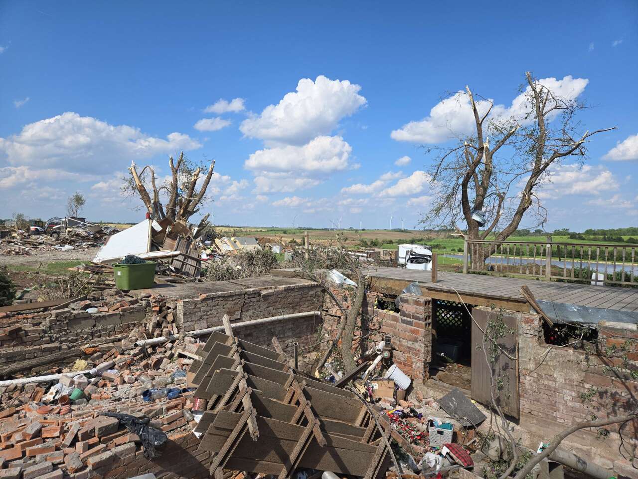
CORNING/GREENFIELD, IA
Rating: EF-4
Counties: Adams, Adair
Max. Wind Speed: 175-185 mph
Path Length: 43.98 miles
Tornado Width: 1000 yards
Time: 2:57 – 3:43 pm
Overview: This violent tornado began in far northeast Page County near the intersection of 110th Street and Vine Avenue. It tore a roof off a farm building on Willow Avenue before exiting Page County. The tornado clipped far northwest Taylor County, doing no damage. It then continued into Adams County as the Carbon EF-3 was ongoing to the north. It slowly strengthened as it passed southeast of Nodaway, mostly damaging trees. It crossed US-34 west of Corning, producing significant tree damage. It started to cross into more populated centers in northern Adams County, where home damage started to occur. At 150th Street and Notchwood Avenue, the tornado slid a home off its foundation and removed many of its walls, this was the greatest damage in Adams County. The tornado also hit an industrial wind farm, where several wind turbines were snapped with some blades being thrown hundreds of yards away. Tragically, the tornado also took the life of a woman in Adams County when she was thrown from her vehicle. The tornado then crossed into Adair County where it reached peak intensity. One home was destroyed near 320th Street and Fontanelle Road. Another destroyed home had large trees on the property turned into bare stumps on Jordan Avenue south of 280th Street. It then entered Greenfield, the county seat of Adair County, where it did its worst damage on the southeast side of town. Numerous homes were reduced to rubble, vehicles were mangled, and trees were left to stumps. 4 people were killed in Greenfield with 35 others injured. The tornado lifted shortly after exiting Greenfield.


PRESCOTT, IA
Rating: EF-1
County: Adams
Max. Wind Speed: 95 mph
Path Length: 12.84 miles
Tornado Width: 100 yards
Time: 3:19 – 3:33 pm
Overview: East of the EF-4, a weak tornado occurred in eastern Adams County south of Prescott. The tornado began near 240th Street and Notchwood Avenue. It produced minor damage as it crossed US-34 near Orange Avenue. The tornado lifted near 190th Street and Willow Avenue, just southwest of Cromwell and the Union County line.

