
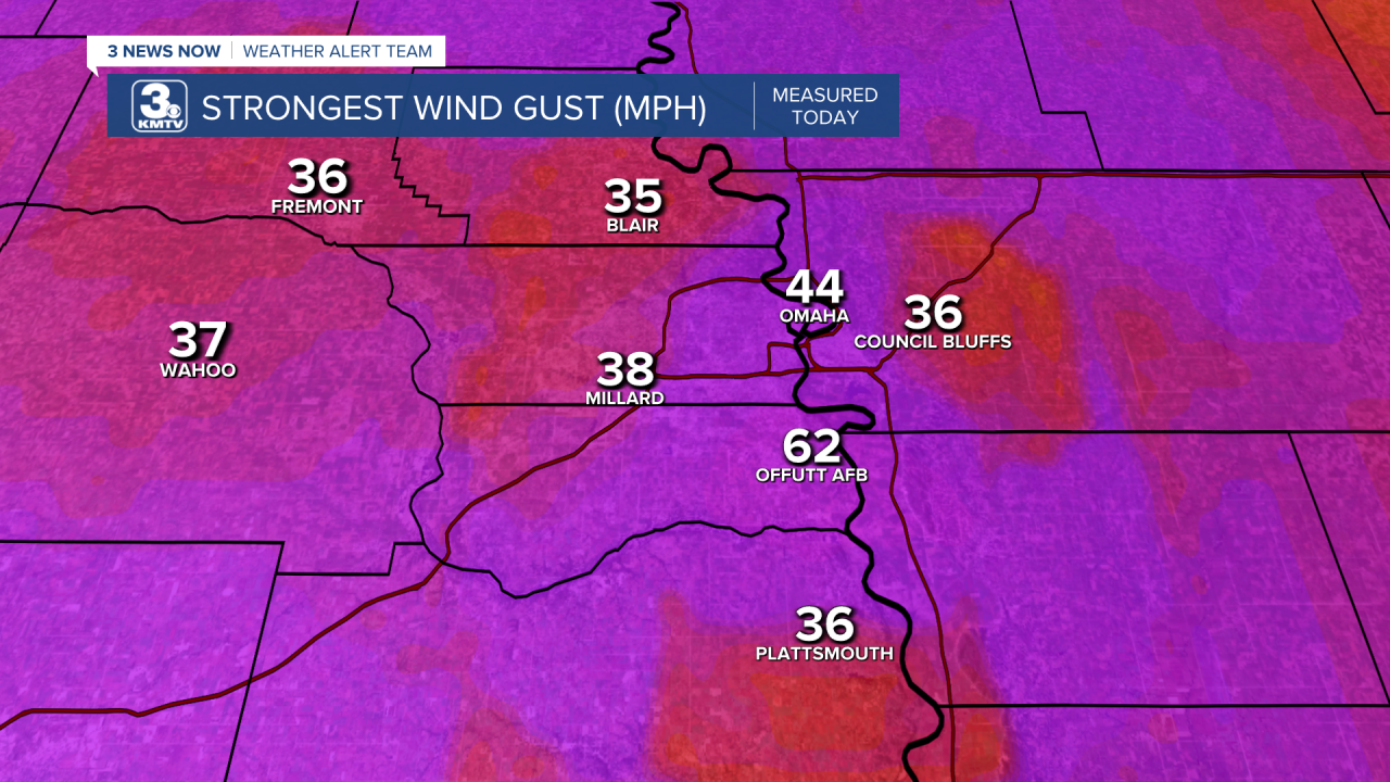
Eastern Nebraska and southwest Iowa have been hit with multiple rounds of severe weather from Tuesday night through Thursday morning. These produced large hail, high winds, and even a few tornadoes. However, in the Omaha metro to western Iowa, the rain ended but high winds kicked up. At Offutt AFB in Bellevue, a 62mph wind gust was recorded when the rain ended. Other reports of 30-40mph winds were seen across the metro into western Iowa. What happened? Why did it get windy after the rain ended? The answer comes from a somewhat uncommon weather phenomenon known as a 'wake low'. But what is a wake low? How does it form? What happens in a wake low?
You are probably familar with high and low-pressure systems, it the primary weather-drivers in the country. If we are under an area of high pressure, expect calm conditions with sunshine and little wind. If we are under a low pressure, the weather get's a little more bumpy.
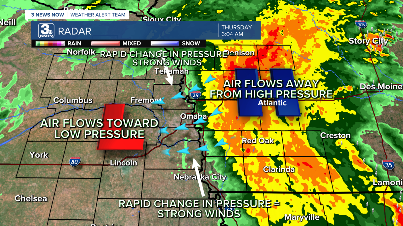
The relationship between winds and pressure is crucial to wake lows. The atmosphere is constantly looking to balance itself pressure-wise, so in areas of high pressure and low pressure the winds attempt to move around to find balance. In cases of high pressure, air moves downward then outward to try to lower the pressure. The opposite is the case for low pressure, as air rushes inward to fill the vacuum of lower pressure inside. It is these changes in pressure which not only give us wind, but also keeps our weather constantly changing.

Now take those same mechanics, but shrink them down to storms. Thunderstorms have both areas of low and high pressure in them, as air rushes inward and upward to form updrafts, and downward to form downdrafts (where the rain falls). In downdrafts, areas of high pressure form. Many thunderstorm complexes, like the one that developed in Omaha Thursday morning, carry their own area of high pressure.
Occasionally, low pressure can develop behind areas of thunderstorms. This is your wake low, as it develops in the wake of the thunderstorm. As mentioned above, air will try to rush away from the high pressure towards areas of low pressure to attempt to balance each other out. If the difference in pressure is great enough, this can cause significant wind gusts. Most of the time, they stay above the surface, but sometimes they come crashing down. This was the case Thursday morning for eastern Nebraska and western Iowa.
How do we know this? Well two things can tell us a wake low occurred. The first, of course, is the actual wind gusts. Behind the front, 30-45mph winds were common in the minutes following the end of the rain. Omaha Eppley recorded a wind gust of 40mph. The strongest wind gust occurred in Bellevue at Offutt AFB, where a 62mph wind gust was recorded in the minutes following the storm.


The biggest indicator of what happened is a change in pressure. Below are pressure readings taken from Offutt AFB, Eppley, Nebraska City, Plattsmouth, Council Bluffs, Red Oak, and Atlantic. Notice how the pressure briefly rises before sharply crashing? That is the arrival of the wake low! They are quick, and within the hour pressure levels returned to normal.


Wake lows are sometimes hard to forecast as they can form seemingly at random, but with better equipment like weather stations recording this data it makes finding them easier.
