

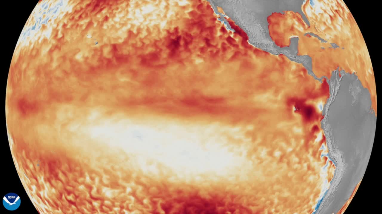


A "super El Niño" is generating buzz across news sites and social media feeds, with some dismissing it and others warning of a significant winter ahead. Experts say the reality may fall somewhere in between — but this year's event could be historic.
Taylor Nicolaisen, a meteorologist at the National Weather Service, said the scale of this El Niño is unlike anything previously recorded.
"This could possibly be the warmest El Niño ever measured," Nicolaisen said.
A typical El Niño winter brings wetter conditions to the southern United States and warmer conditions across the north. But the effects of a "super El Niño" are less predictable.
"It doesn't necessarily suggest that the impacts are going to be higher. I would say it's more of a likelihood that we're going to see the impacts," Nicolaisen said.
The Climate Prediction Center's latest winter outlook, released on Aug. 20, favors a warmer and wetter winter for the Omaha area.
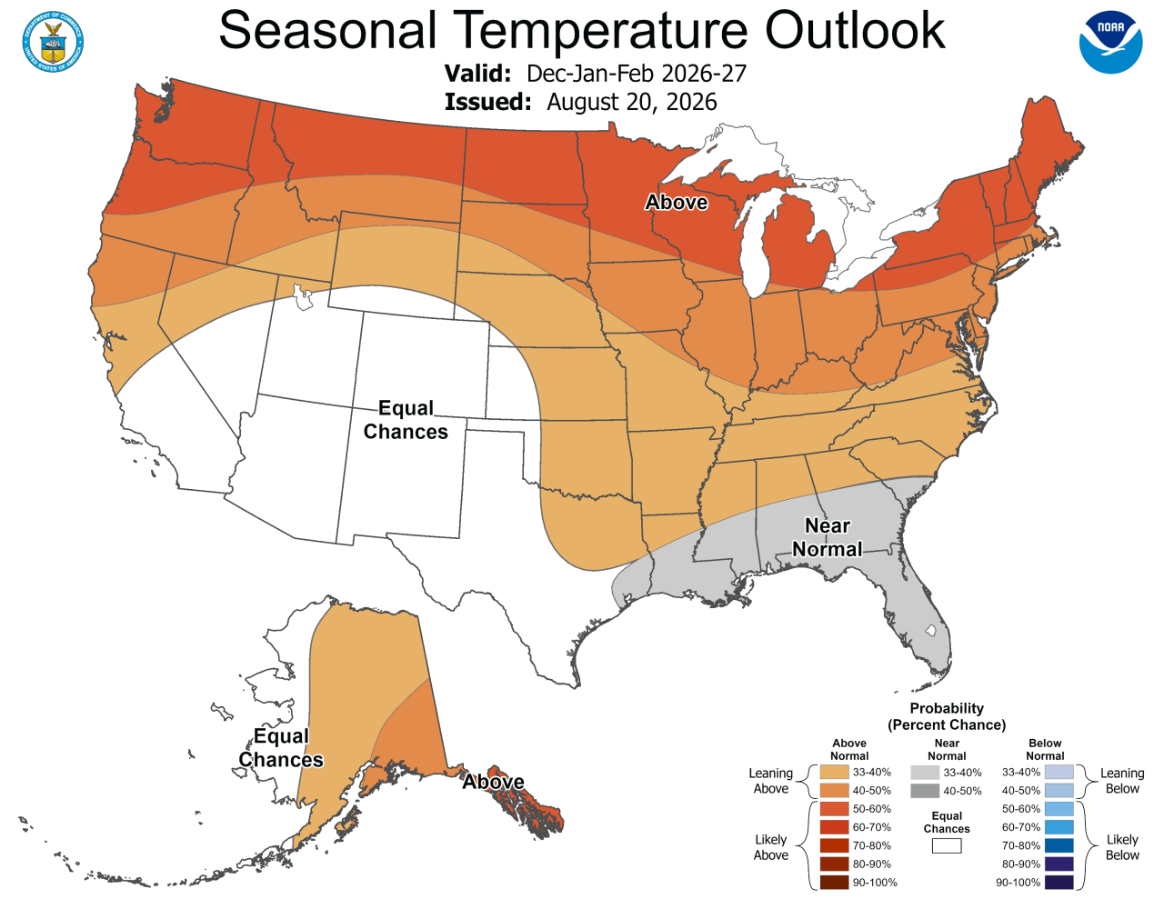
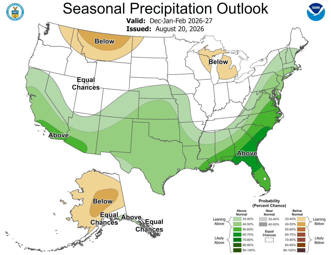
History offers some clues about what this El Niño could mean for Omaha. Here's a look at past El Niño winters, from December through February.
KEY: + = Above Average | - = Below Average
2015-2016
SNOW: 25.5" (+)
PRECIP: 6.98" (++ 2nd wettest)
TEMP: 30.9° (++)
NOTE: Groundhog Day Blizzard
1997-1998
SNOW: Incomplete data
PRECIP: 2.97" (+)
TEMP: 30.5° (++)
NOTE: October 25-26, 1997 Snowstorm
1991-1992
SNOW: 1.5" (- - Driest!)
PRECIP: 4.38" (++)
TEMP: 33.7° (++ Warmest!)
NOTE: Halloween 1991 Snowstorm
1982-1983
SNOW: 25.4" (+)
PRECIP: 3.85" (+)
TEMP: 28.8° (+)
1972-1973
SNOW: 26.3" (+)
PRECIP: 3.93" (+)
TEMP: 24.1° (-)
1965-1966
SNOW: 5.8" (-)
PRECIP: 2.62" (+)
TEMP: 28° (+)
So, history would tell us that with a strong El Niño, Omaha could expect a warm and wet winter. Snowfall data varies, likely due to close temperatures. For snow lovers, an increase in wet snow events may be welcome news. But a warmer, wetter pattern also raises the risk of "battle zone" weather events, and one particularly dangerous hazard.
"You know, if we tend to be a little bit warmer and a little bit wet. That might mean more ice storms," Nicolaisen said.
While El Niño conditions will generally trend wetter over time, day-to-day weather will still vary. Staying current with your local forecast remains the best way to prepare.
This story was reported on-air by a journalist and has been converted to this platform with the assistance of AI. Our editorial team verifies all reporting on all platforms for fairness and accuracy.
