



3 THINGS TO KNOW;
- Off and on rain throughout the week
- Temps remain warmer than average
- Plan for rain on Halloween
FORECAST
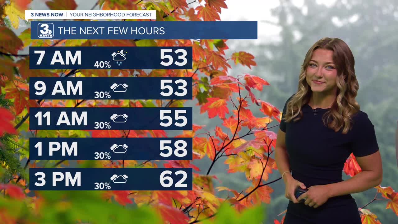
It's a bit of a wetter morning for most to kick off our Tuesday, these spotty showers will only stick around until about lunchtime! We can expect some partly cloudy skies and chillier temps only around the 60s for our Tuesday afternoon.
More rain moves in Wednesday, but there will be plenty of dry-time midday while it gets warm and windy. Highs will be in the mid 70s with some southerly winds at 25-30MPH. A few more thunderstorms are possible Wednesday evening with a cold front, most of these look to hang out near Iowa.
Thursday will be the dry day out of the week, followed by more rain on Friday and into the weekend. For now, assume there will be scattered rain showers on Saturday for Halloween evening. Temps will be in the 50s/60s for trick-or-treating!
Daylight Saving Time ENDS Saturday night. Set your clocks back ONE hour. Sun set times will be before 5:30 PM until late January.
We should get a break from the rain on Sunday, but there is another storm system expected to move in early next week (Monday - Wednesday) that could bring more rain and cooler weather, in the 50s, for the first days of November. There may be a few night in the 30s later next week if cold enough air can arrive.
TUESDAY
Mostly Cloudy
Spotty Morning Rain
High: 63
Wind: S 5-15
TUESDAY NIGHT
Mostly Cloudy
Iso. AM Drizzle
Low: 56
Wind: SE 5-10
WEDNESDAY
Windy
Iso. PM Storms
High: 76
Wind: S 15-35
Share your weather pictures with KMTV:
- Email to News@3newsnow.com
- 3 News Now Facebook page
- Use the hashtag #3NewsNow on Instagram or X.
 Facebook
 YouTube
 Instagram
 X
