
While all of Nebraska and Iowa was baking in the heat, a few locations also had some severe weather Tuesday night into early Wednesday morning. 3 tornadoes were produced by those storms, along with areas of significant winds and very large hail.
Many locations across Nebraska and Iowa that afternoon got up into the mid-90s with high amounts of humidity. The amount of storm energy available was more than enough for thunderstorms to explode as the night set in. A stationary front located from York to just south of Omaha to Atlantic provided the trigger for waves of thunderstorms to ride along the boundary. This meant that cities along the boundary were hit by storm after storm, while those north and south of this boundary saw hardly nothing at all.

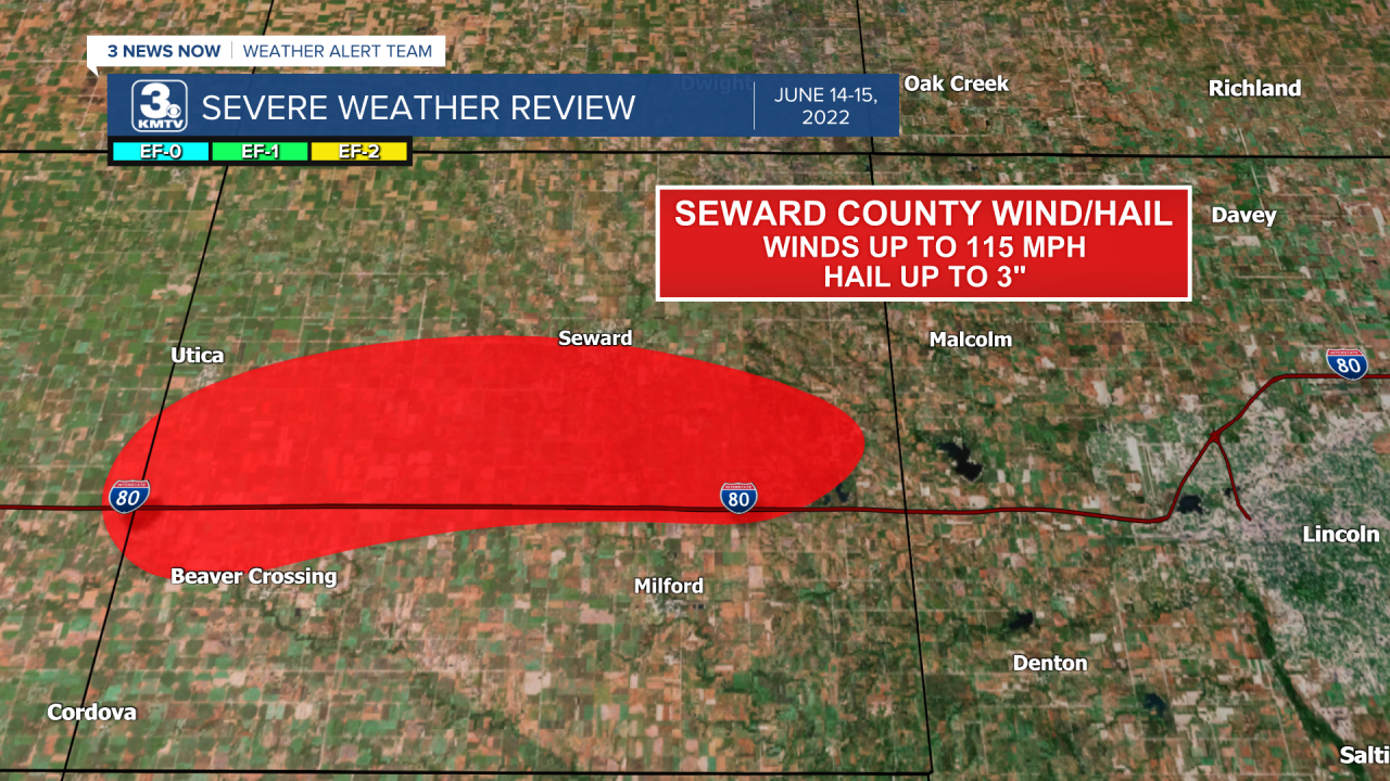
The main cluster of storms developed near York and generally moved along and just north of I-80 into Seward County. The storm greatly intensified in Seward County, where the winds increased to over 100 mph in certain spots causing significant damage. To make matters worse, the wind drove hail as large as 3" into homes, businesses, and crops. In some spots of York and Seward County, the crop damage was so significant it almost looked like nothing was planted.


Despite a report of a tornado along I-80 near the Seward/Lancaster County line, it was determined to be straight-line wind damage. The storm produced more large hail into northern Lancaster County narrowly missing Lincoln. As the storm crossed into Cass County the hail size began to decrease, but the damaging wind and tornado potential rose. From Greenwood through Murdock and south of Louisville winds upwards of 100mph caused significant damage, including flipping a camper and injuring the residents inside.

Among the wind damage, an EF-1 tornado also caused damage north of Murdock. A few homes and trees suffered damage from the small tornado as it continued east for a few miles before dissipating.

The storm continued into western Iowa where it continued to produce damaging winds in excess of 80mph along the line. In Glenwood, power was knocked out and trees snapped in town. More concentrated damage occurred in southern Pottawatomie County south of Treynor, where winds in excess of 100 mph blew through the small towns of Carson and Macedonia.

Within the winds was another small tornado with some concentrated wind damage. This tornado significantly damaged a winery southeast of Treynor. For more information on the winery damage you can check out this story on our website or this story about its effects on weddings taking place in the venue.
The storm began to slowly weaken as it crossed into Atlantic and eventually into central Iowa.
Meanwhile, back to the west more storms were developing along the stationary front and moving into areas already hit hard by severe weather. As the next storm moved into York, it produced the strongest tornado of the night near the community of Lushton in southwestern York County. This tornado was rated an EF-2 with winds upwards of 115 mph.


To top it all off, the repeated rounds of thunderstorms brought heavy rain to many areas. In the Omaha metro, street flooding occurred in several areas as 1-2" of rain fell overnight. In places closer to York, radar estimates upwards of 4" of rain had fallen through the night.
Damages from the severe weather totaled in the tens of thousands of dollars across eastern Nebraska into western Iowa. After the front passed, all of us saw a reprieve from the heat with highs only in the 70s.
