


Edward Murrow is known as one of the big legends in journalism. Working for CBS in the 1930s, he covered monumental political events such as the Austrian Anschluss, the Munich Conference, and the Battle of Britain. He also became a pioneer in television broadcasting with his show on CBS, See it Now, bringing the news to people in a visual medium. He was a major part of the downfall of Senator Joseph McCarthy in 1954 for his dubious tactics in rooting out communism in the United States.
In April 1952, the esteemed journalist was brought to the Omaha-Council Bluffs area to cover breaking news. It was removed from the high political events he was used to covering, but the drama was no less intense. Murrow was in Omaha to cover the enormous effort of the town to save it from the rising waters of the Missouri River. In April 1952, the Missouri River would reach its highest crest in recorded history at Omaha. It was a monumental effort that involved thousands of Omaha and Council Bluffs residents of all stripes working around the clock, and the results were significant. In this installment of This Week in Weather History, it's the tale of a community coming together to avoid disaster.
THE EVENTS LEADING UP TO APRIL 1952
The early 1950s were not a great time for flooding, as there was significant flooding in the lower Midwest three years in a row. Between May and July 1950, a series of heavy rain events brought major flooding to the rivers and creeks of southeast Nebraska. The floods of 1950 were the largest in Nebraska since the Republican River Flooding of 1935. It claimed 23 lives.

In 1951, the focus on the flooding turned farther south into Kansas and Missouri. Periodic flooding occurred across eastern Kansas through late May into June, but they peaked in early July. Floodwaters in the Kansas River flowed into the Missouri at Kansas City, causing major flooding. The Kansas City Stockyards were flooded out, as was the airport which had to be moved to the current site of Kansas City International Airport today. The floods of 1951 claimed 17 people and displaced half a million others.

The fall of 1951 was wet for the upper Midwest, and that wet weather continued into a severe winter in 1951-1952. In South Dakota and Montana, it was one of the snowiest winters up to that point, as well as one of the coldest. In Pierre SD, 82" of snow fell between October and April, the snowiest winter in recorded history of the capital city of South Dakota. By March 1952, over 20" of snow was still on the ground across much of South Dakota. Not only was there a lot of snow, but it was wet when melted down. Likewise, the cold conditions allowed for the river ice to remain solid over the Dakotas into Montana.

In late March, the cold and snowy pattern completely reversed. Temperatures rose into the 40s in South Dakota by the end of the month, quickly beginning to erode the snowpack. As the snow melted, the river ice began to break up. Much like the antecedent conditions that led to the floods of March 2019 in Nebraska/Iowa, the conditions in late March 1952 were ripe for major flooding across much of the Midwest.
It began in early April up north. In Harve, Montana, 1500 residents were evacuated. Major flooding impacted Pierre, South Dakota, and Sioux Falls, Iowa. This water was roaring down the Missouri River, and it would only be a matter of time before it reached Omaha/Council Bluffs.
APRIL 1952 FLOODING
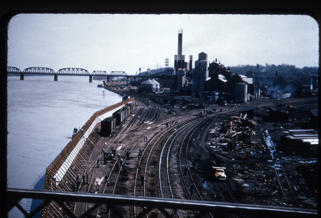
Alarm bells began to ring for eastern Nebraska and western Iowa around April 7, when forecasts from the Weather Bureau started calling for record high crests along the Missouri River in Omaha. The previous records were 22.4' from a flood in 1943 and 24.6' from 1881. Since the flood of 1943, which caused extensive damage at the airport, a series of dikes and flood walls were established in Omaha that could hold a crest of 26.6'. Still, forecasters were urging caution as the waters rushed down the Missouri through the Dakotas.
By April 8, a few levees broke north of Blair flooding some farmland. Water also flowed under the new Decatur Bridge for the first time, as the bridge was built over a dry section of the river. On April 10, Sioux City dealt with significant flooding in the stockyards. The flooding also covered 1/5 of the South Dakota capital of Pierre at the same time.

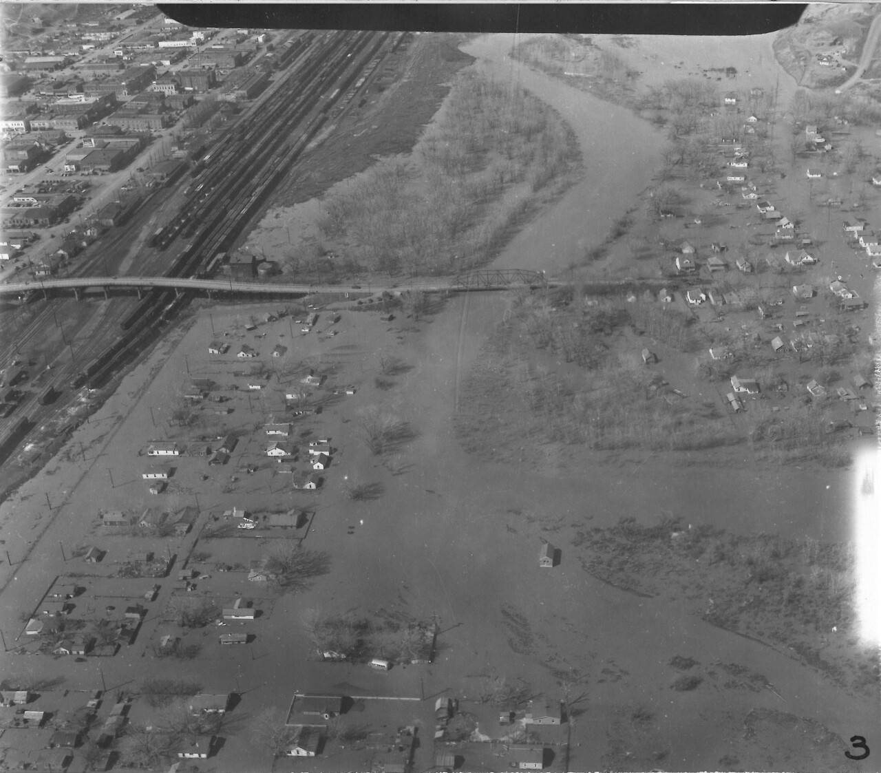
Events started to speed up the weekend of April 12-13 (Easter weekend) as the river continued to rise. Two National Guard companies were called up, volunteers were called for, and residents of East Omaha and Council Bluffs were urged to evacuate. In Council Bluffs, those west of 30th Street were urged to evacuate, and businesses were closed to provide volunteers for the flood relief efforts. At the height, 35 thousand people from East Omaha, Carter Lake, and Council Bluffs evacuated for higher ground.
With the crest expected to peak on Wednesday, April 16th, things turned into full gear to stop the Missouri. Up north, the River continued to swell. Towns such as Onawa were threatened with flooding. As was Missouri Valley in Iowa, Decatur and Tekamah were also threatened with floodwaters.
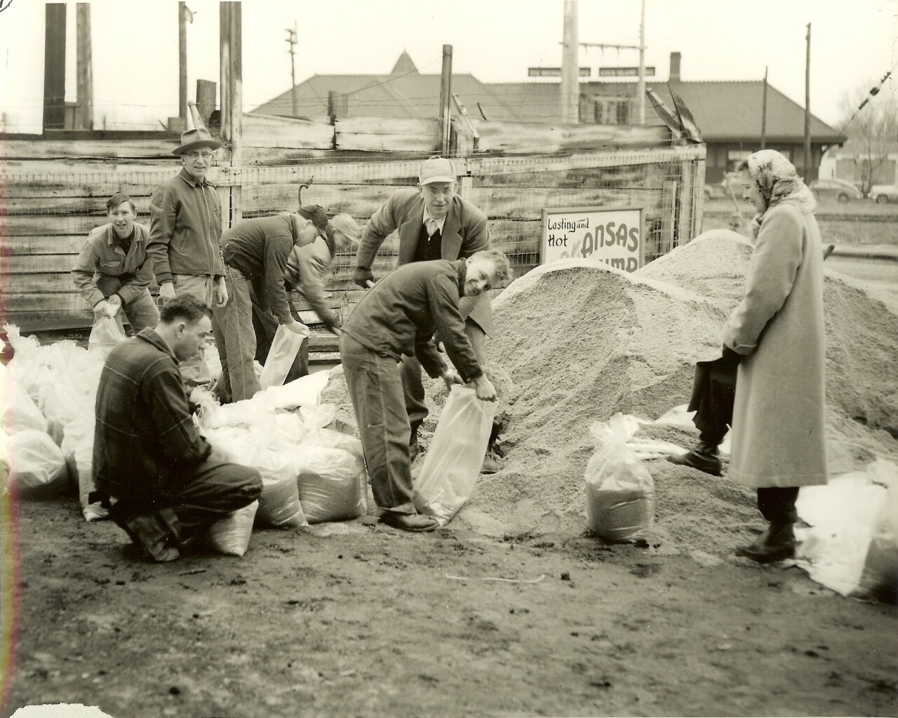
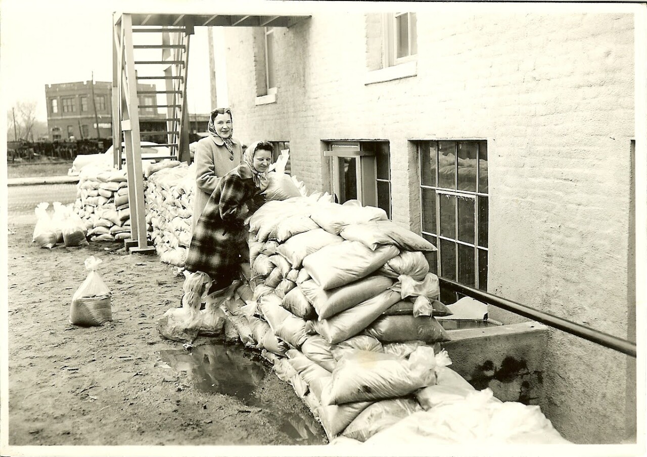
An enormous effort to stop the flooding commenced in the two cities of Omaha and Council Bluffs. Thousands of volunteers from all stripes of life pitched in to lay
sandbags, build dikes, supply food and water, help evacuees, and whatever else anyone needed. It was incredible and nationally recognized. On Wednesday, President Harry S. Truman alongside Edward Murrow visited the flooded areas. The President declared the region a disaster area, which allowed for federal funding.
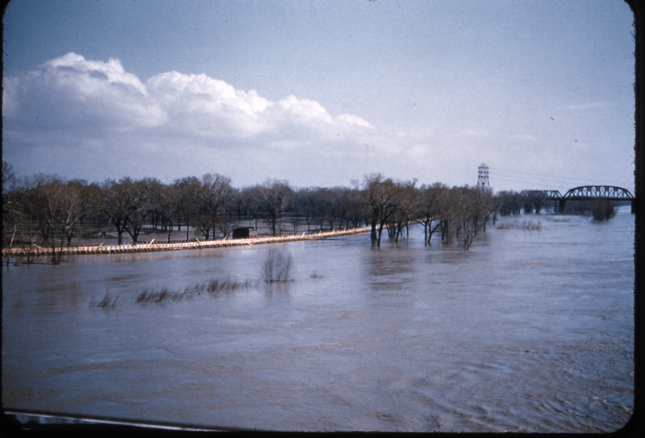
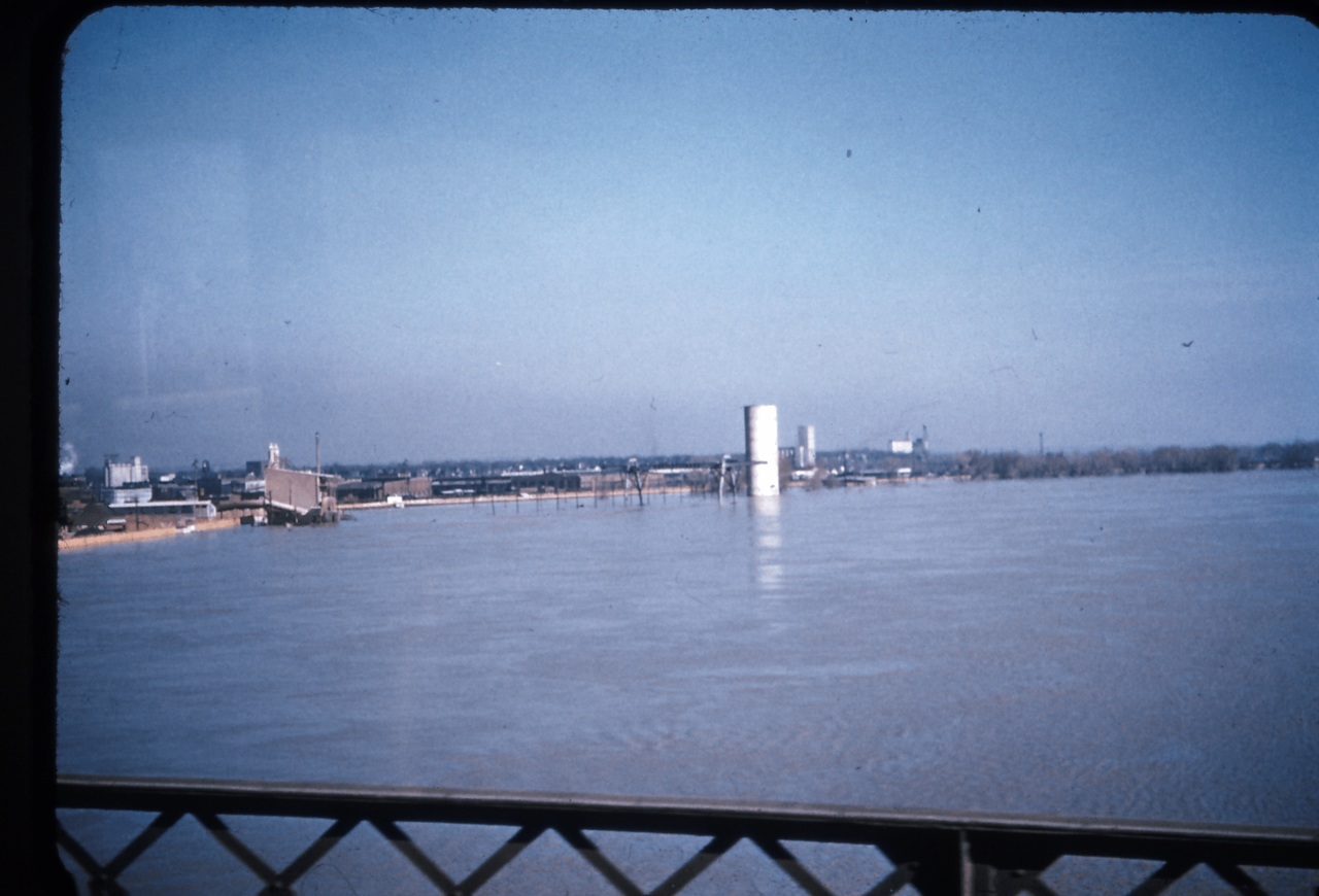
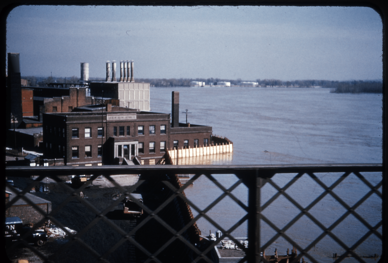
The river rose to 30 feet, less than a foot from the top of the flood walls. The water was roaring past, putting extreme pressure on the levees and dikes. Occasionally, there was a leak, which would be quickly patched up with dirt or sand. By Friday, April 18, the Missouri River hit its crest in Omaha at 40.20'. To this day, it is the highest crest along the Missouri River measured in Omaha.

Against all odds, the floodwalls held in both Omaha and Council Bluffs. The water rose to less than 6" from the top of the wall. Both cities were spared disaster. The one unfortunate incident occurred at 13th and Grace streets where a sewer line broke, spewing water and covering a two-block radius with water.

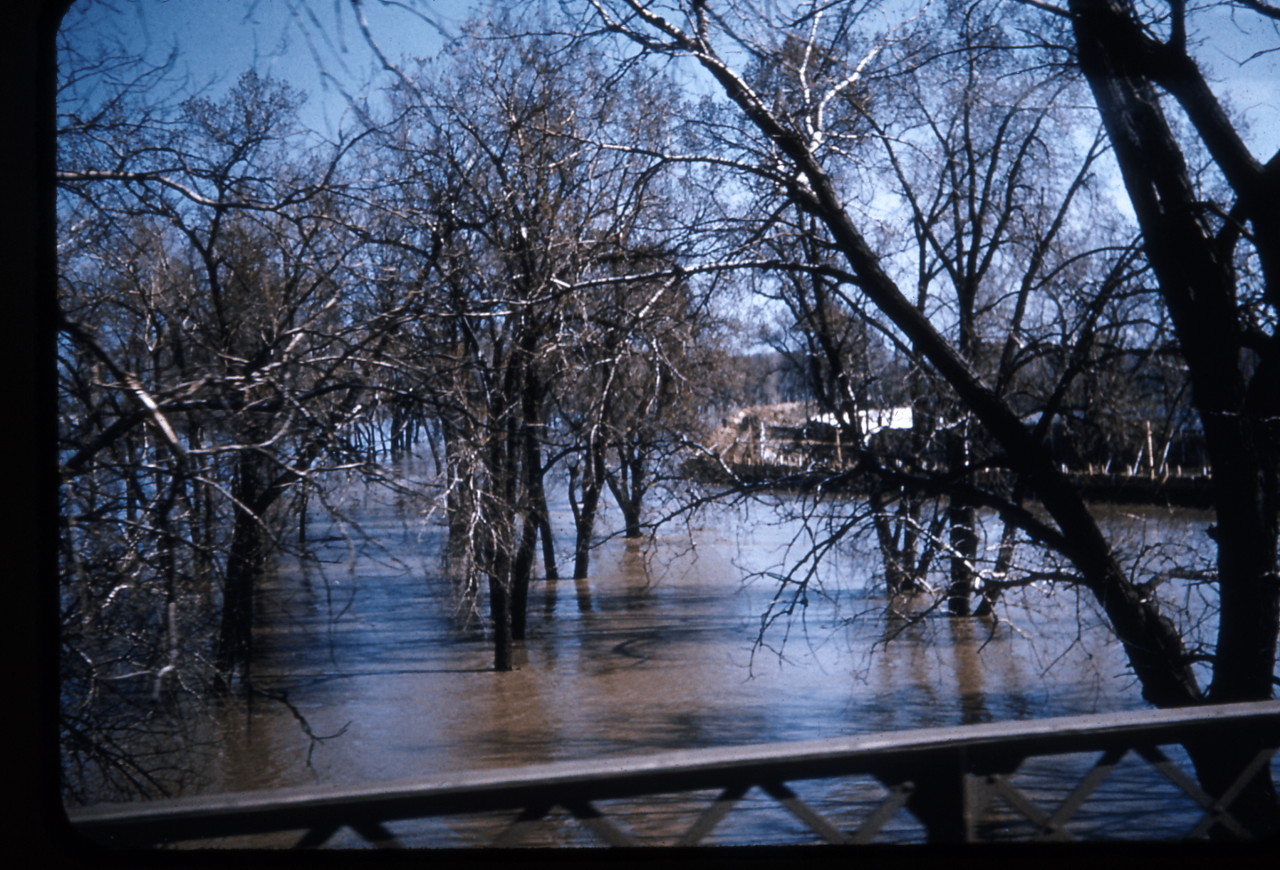
Into the weekend of April 19-20, the Missouri River started to fall at Omaha, the worst of the crisis was over. However, the river continued to wreak havoc on communities farther downstream. Towns such as Bartlett and Hamburg were flooded out as levees failed, in Hamburg 60% of the community was inundated with water. The flooding continued downstream into Missouri, where Kansas City was threatened with flooding for the second year in a row.
While bad, the floods of April 1952 could have been much worse had Omaha and Council Bluffs been flooded out. Estimates at the time would've placed flood damages in those cities at around 60 million dollars (just over 700 million in today's money). The lessons learned in the floods of 1952 would help in later flooding in Nebraska and Iowa in 1993, 2011, and 2019. Still, it's one of the biggest floods of the Missouri River in the 20th century.
