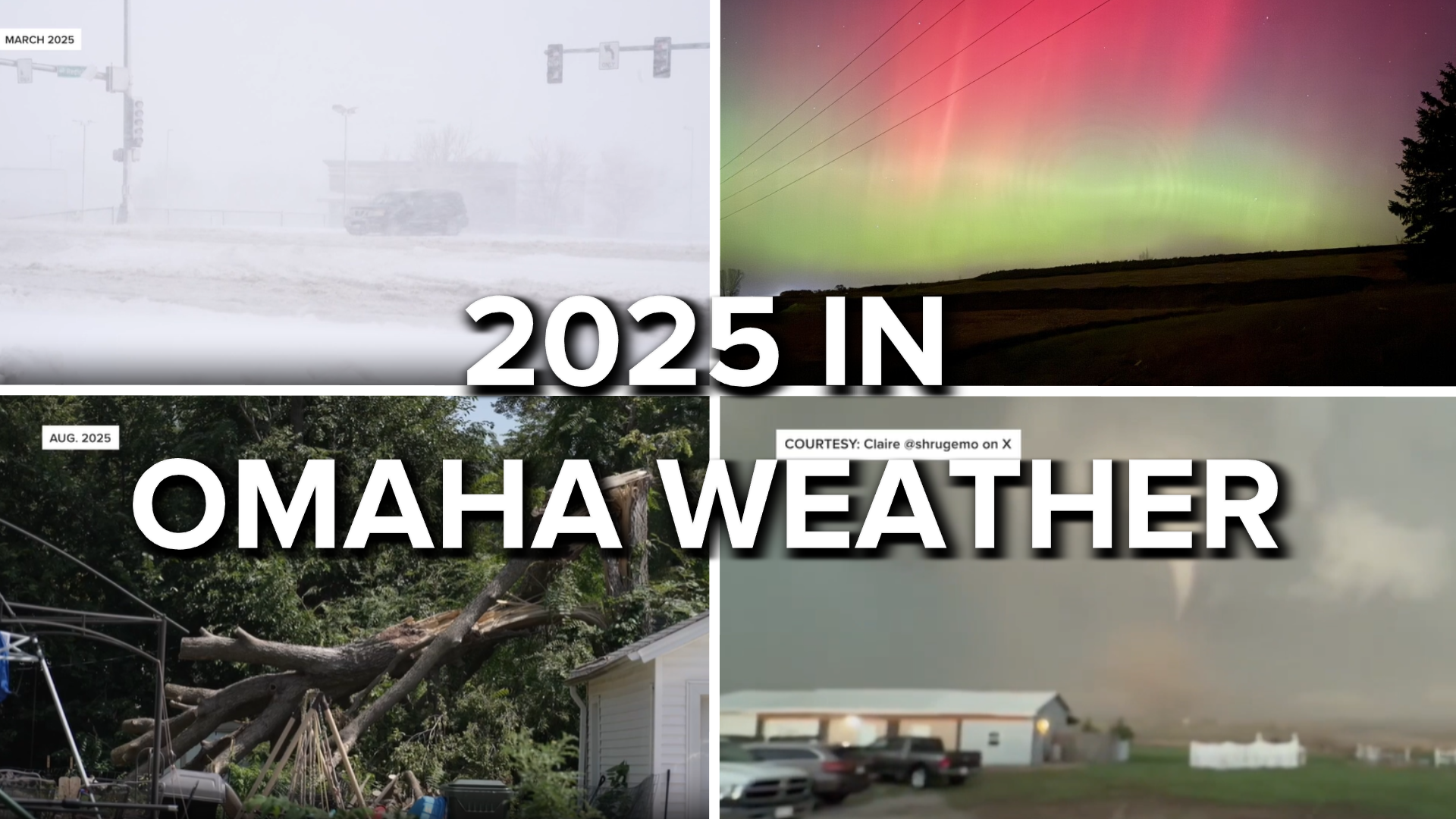


2025 is over, and it ended yet another wild weather year for Nebraska and Iowa (though isn't every year a wild one in our area). Although it may not have been as active as 2024, 2025 still brought its share of memorable weather.
Here are a few highlights (and low lights) of the year for weather in our neck of the woods. For more details on any weather event this year, click or tap on the links to read the associated weather blog post.
THE WINTER THAT WASN'T...AGAIN
Starting with winter...or lack thereof...again. For the 4th winter in a row, Omaha recorded low snowfall for the season. At Eppley Airfield, we received 17.4" of snow, about 8-10" below the seasonal average.
For the snow lovers, it was an exceptionally bad season as Omaha saw almost no snow until mid-February, one of the latest in the season. It was compounded by events elsewhere: a few days into the new year, a major snowstorm brought 18" to Falls City, and up to a foot over Kansas City & St. Louis. Then it got worse, between Jan 20-22, a blizzard hit the Gulf coast! New Orleans recieved 10" of snow, and Pensacola FL got 8"! This meant that by mid-February, Florida had 8 times as much snow as Omaha did!
Things turned around by mid-February, when Omaha received 3 rounds of snow within a week. Round 1 brought 3.7" of snow, round 2 brought 1.5" (though Blair received 8"), and round 3 with another 4" for the city.
MARCH: BLIZZARD, SEVERE WEATHER, BLIZZARD
Then came March, and winter really showed us what it can be capable of.
On March 3-4, the first of two blizzards hammered the Heartland. Winds gusted as high as 65 mph as 3-6" of snow fell across the area. Power outages occurred, and schools were closed for a couple of days.
Ten days later, the talk of the town was on our first severe weather event of the year. A line of storms associated with a powerful low-pressure system raced through Nebraska & Iowa, prompting the Storm Prediction Center to issue a rare level 4/5 risk for severe weather over western Iowa. Winds topped out at 78 mph at Tekamah. Behind the storms, 65-80 mph winds buffeted southeast Nebraska. To our southeast, Missouri & Arkansas were hit by the largest tornado outbreak in March history.
Not even a week later, and another, this time much more impactful, blizzard slammed Nebraska and Iowa. We began the event on the morning of March 19th with thunderstorms & even some hail! Then the cold air arrived, and heavy snow with 60-70 mph winds began. As ice accumulated on power poles, outages became widespread across Nebraska. Numerous roads were closed, and power was out for days in some spots. Much of eastern Nebraska was declared a disaster area due to tree & power pole damage in the wake of the blizzard.
Thanks to these big events, March was a windy month for Omaha, one of the windiest on record!
APRIL 17: THE FIRST TORNADO OUTBREAK
Our severe & tornado season this year was notably lower than 2024; yet, we still were dealt blows by severe storms early on.
It was not a lot of storms, only 2, on April 17. The first developed over Columbus and rolled down the Platte River. It dropped 2+" hail & 80 mph winds in Fremont and Washington County, ripping homes to shreds and costing millions in damage. As it scraped the Omaha metro, it dropped an EF-3 tornado near Bennington. Homes were destroyed near the Douglas/Washington County line by the tornado. As the storm crossed into Iowa, it produced 4" hail in Underwood, causing damage.
The second storm developed near York and moved north of Lincoln, dropping 4.5" hail over northern Lancaster County. The storm became tornadic over Cass County, dropping 3 weak tornadoes. As it crossed into Iowa, it produced an EF-0 that crossed US-275 near Tabor, and a massive mile-wide EF-1 that narrowly missed Essex in Page County.
APRIL 24: HAIL & FLOODING IN THE OMAHA METRO
A week after the April 17 storms, another severe storm developed over the Omaha metro and caused problems on April 24. This storm initially dropped up to 3" hail over central Omaha. As it slowly crossed the river, it became tornado-warned, and a rotating wall cloud passed right over downtown into Council Bluffs. No tornado dropped from the storm, thankfully.
The slow-moving storm also dumped 2-4" of rain over the Omaha metro over a short time, leading to significant flooding on Saddle Creek & Creighton's campus.
Beginning in late June, Omaha entered into a wet pattern that lasted through August. We had repeated rounds of thunderstorms (sometimes with severe weather included) that brought over a foot of rain in that same timeframe.
This helped to bust the drought that had been over our area for more or less 3 years, with Douglas County being completely removed from drought conditions by mid-July.
Unfortunately, with a dry fall, drought is knocking on the door again.
AUGUST 9: THE EARLY MORNING WINDSTORM
Omaha's severe weather season ended on an unusual note at 6 am on Saturday, August 9. Many woke up to phone alerts as a windstorm packing winds up to 100 mph raced through eastern Nebraska.
It began east of Hastings and brought major damage from Seward, north of Lincoln, to Valley, and to Blair. Hundreds of trees, power poles, and buildings were damaged. Winds were measured as high as 110 mph near Blair, where a building collapsed. Sadly, the windstorm took 1 life in Douglas County when a tree fell onto a car, and others were injured near Malcolm when a trailer tipped over. Damage was in the tens of millions across eastern Nebraska.
The next night, another round of severe storms passed through southwest Iowa, impacting Fremont County & Shenandoah hard. Extensive tree damage was reported in Riverton, Farragut, and Shenandoah. Tragically, a person was killed in Shenandoah when an object fell on their tent.
THE VERY DELAYED FALL
September & October are typically the first months where we experience fall weather, but 2025 was not the year for that. Summerlike heat continued into September & October.
In September, the Huskers played in scorching games in Lincoln, with some of the hottest weather on record for late-season games as temperatures hit the 90s at various games.
The heat lasted through October. Typically, Omaha experiences its first frost around the first week of the month. Last year, our first frost was not until almost Halloween!
NOVEMBER 11: THE AURORA BOREALIS RETURNS
Being in a middle latitude, the northern lights don't often make an appearance this far south, maybe once a year. We had brilliant displays in 2023 and 2024, and we were treated to another in 2025.
On the night of November 11, the Northern Lights danced above our heads for several hours after sunset! It was one of the strongest displays we have seen in our area in a while, and it put on an amazing show.
NOVEMBER 29: THE FIRST SNOW OF THE SEASON
The last thing anyone wants during the busiest travel weekend of the year is a winter storm, but that's what we got in Nebraska & Iowa with the first winter storm of the season occurring the weekend after Thanksgiving.
Omaha received just over 4" of snow, with Carroll, Iowa, picking up 9.5"! The snow delayed flights, slowed travel, and made children happy as the holiday weekend meant more fun in the snow!
DECEMBER: FRIGID START, MILD END
December 2025 can be divided almost evenly in half in terms of the weather we experienced for the month.
For the first 15 days, it was cold. Not as cold as 1983 or 1989, not by a long shot, but cold enough to know that winter had arrived in the Heartland. High temperatures were in the 30s, and we had two nights with lows dipping to 0.
After the 15th, it was a different story as temperatures soared to well above average. We had numerous days with highs in the 40s and 50s. In fact, it was so warm we were in contention for record highs around Christmas (thanks to the fog...those dreams were squashed). Thanks to this warmer weather, we ended up above average on temperatures for the month!
Now, we look ahead to 2026, and with the 3 News Now Weather Alert Team, you can be prepared for whatever Mother Nature has to throw at us.
