



3 Things to Know
- Fall-like for rest of workweek
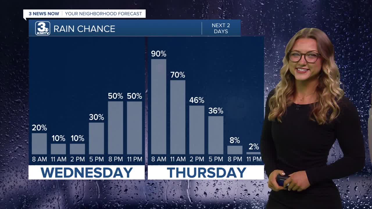
- Rain possible tonight through Thursday
- Chance at first frost of season Friday night
Forecast:
Grab your jacket once again for you Wednesday morning! We'll wake up with most temps in the low 50s, a couple only in the upper 40s!
Wednesday starts mostly dry, cloudy and cool with temps holding in the 50s for most of the day. Heading into the late afternoon hours, rain will begin moving in from the southwest and will be spotty/scattered at times by Wednesday evening, becoming widespread after midnight.
The rain likely continues into Thursday morning before slowly clearing up Thursday afternoon. Thursday evening appears dry for now. It will start to get windy as the rain clears out with northwest winds gusting to 35+ MPH.
Sunshine looks to return on Friday and we'll see a lot of it over the coming weekend. It stays windy and cool on Friday with highs in the 50s and gusts up to 40 MPH
The first frost of the season appears likely Friday night as temps across the whole Omaha region dip in the mid/upper 30s. A freeze does not appear likely at this time.
The dry time continues into the weekend with temps in the 60s on Saturday, and it may still be a little breezy out. We get more sunshine and slightly warmer weather, in the lower 70s Sunday!
WEDNESDAY
Cloudy
Mostly Dry
High: 60
Wind: N 5-15
WEDNESDAY NIGHT
Mostly Cloudy
Showers Move In
Low: 53
Wind: NE 5-15
THURSDAY
Cloudy
Rainy & Windy
High: 57
Wind: NW 15-35
Share your weather pictures with KMTV:
- Email to News@3newsnow.com
- 3 News Now Facebook page
- Use the hashtag #3NewsNow on Instagram or X.
 Facebook
  YouTube
 Instagram
 X
X