



3 Things to Know
- Several rounds of rain through Saturday
- Watching for flooding potential this weekend
- Highs staying cool, in the 60s
Forecast
We've already had a taste of some light rain on Thursday, which will continue into this evening. Heading into the overnight hours, the rain will become heavier and there may be a few rumbles of thunder through Friday morning.
Friday likely starts out very wet for Omaha, but the trends are for the morning rain to clear up around noon, and for there to be quite a bit of afternoon to early evening dry-time before the Friday night round moves in. That is promising for high school football around Omaha! It does get a little breezy with highs in the mid 60s and breezy southeast winds up to 25 MPH.
More pockets of heavy rain will move in late Friday night, continuing for much of the day on Saturday. This rain will be a bit more scattered and spotty. Eventually the rain begins to taper off late Saturday night, but we'll leave a small chance for some lingering light on on Sunday.
Weekend temps will be in the upper 60s to low 70s and the wind may be a bit breezy at times on Saturday. By Sunday, things will be starting to dry out and there will be a little sunshine with highs in the mid 70s
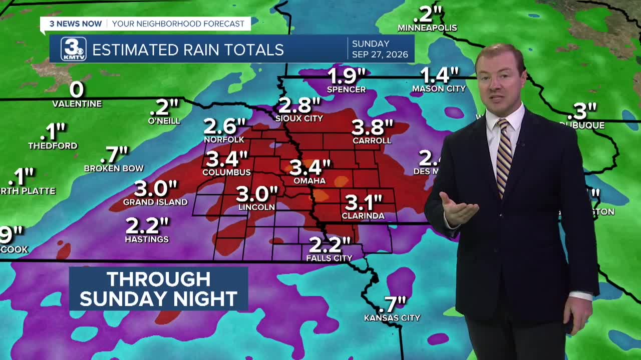
Due to the amount of rain we've had this month, and the amount of rain we could see through Sunday morning, river and farm field flooding will become more of a concern later this weekend.
Looking ahead into next week, Monday looks partly sunny and near average in the upper 70s. However, it appears another system will move in and bring more rain for Tuesday and Wednesday, and there could be more than 1.0" of rain from that system, too.
THURSDAY NIGHT
Mostly Cloudy
Rainy
Low: 61
Wind: SE 7-15
FRIDAY
Cloudy and Wet
Scattered Showers
High: 66
Wind: SE 15-25
SATURDAY
Cloudy and Wet
Scattered Showers
High: 71
Wind: SE 10-15
Share your weather pictures with KMTV:
- Email to News@3newsnow.com
- 3 News Now Facebook page
- Use the hashtag #3NewsNow on Instagram or X.
 Facebook
  YouTube
 Instagram
 X
X