



3 Things to Know
- More rain Saturday night
- Trending drier on Sunday & Monday
- There's more rain TUE - THUR next week
Forecast
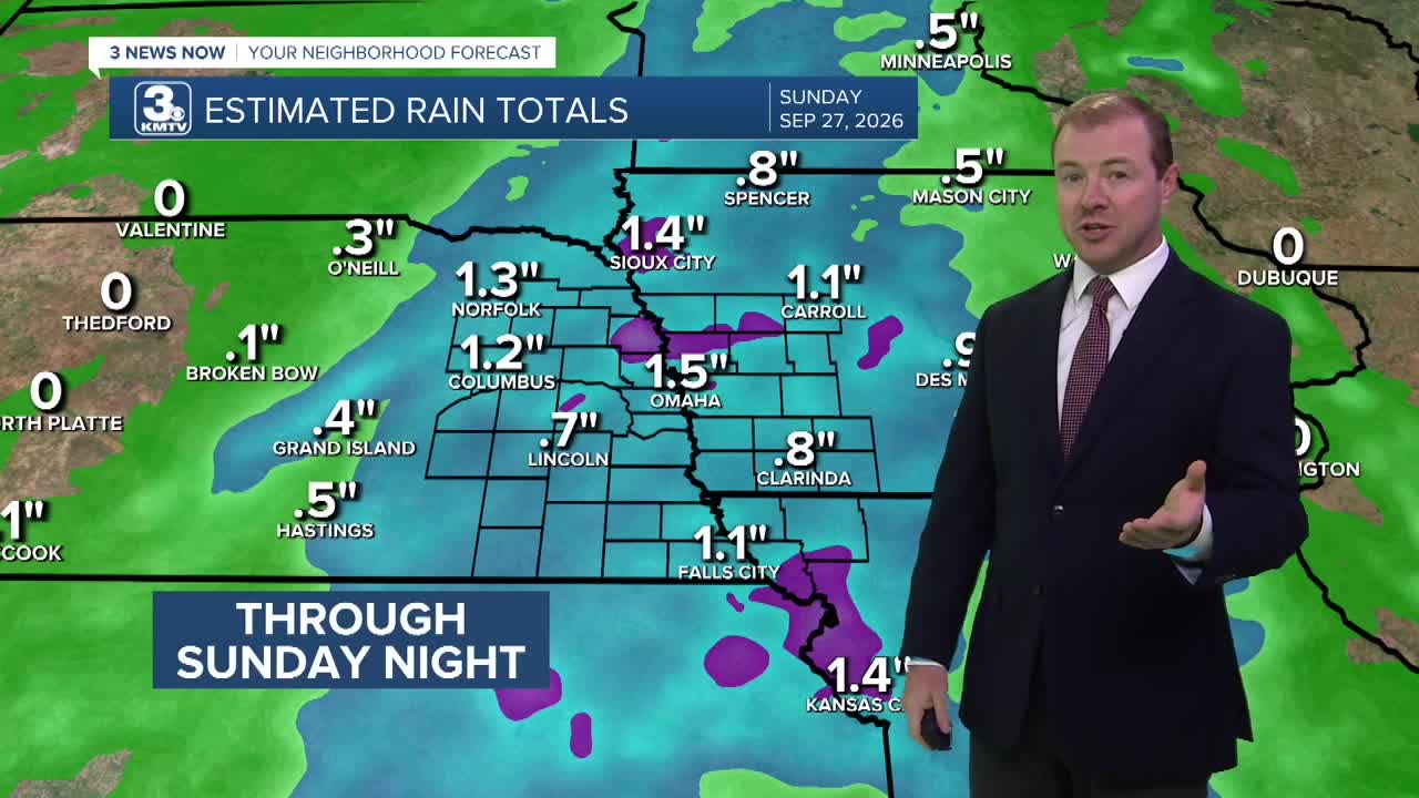
There will be several hours of dry time from late morning until mid-afternoon. Then more rain will move in after 4 p.m., continuing through Saturday night. But the rain will be more spotty at times than widespread, which should keep the overall rain totals a bit lower and reduce the risk for flooding to only isolated cases through Sunday morning.
Weekend temps will be closer to 70 degrees and the wind may be a bit breezy at times on Saturday. By Sunday, things will be starting to dry out and there will be a little sunshine.
Looking ahead into next week, Monday looks partly sunny and near average in the upper 70s.
By Tuesday, another storm system will move through with a widespread chance of rain. This could be aided by moisture streaming up from the remnants of Hurricane Polo in the Pacific, only adding to the rain by Wednesday and Thursday. By the end of the week, we could see another 1-3" of rain, leading to another concern for flooding.
So far, September rain totals at Eppley are around 6.25" as of Friday morning. We may be ending the month around top 5 wettest for September on record. The record is 13", set in 1965.
FRIDAY NIGHT
Cloudy
Rain & Storms
Low: 61
Wind: SE 7-15
SATURDAY
Cloudy
Morning & Evening Rain
High: 71
Wind: SE 10-20
SUNDAY
Partly Cloudy
Mostly Dry
High: 72
Wind: SE 5-15
Share your weather pictures with KMTV:
- Email to News@3newsnow.com
- 3 News Now Facebook page
- Use the hashtag #3NewsNow on Instagram or X.
 Facebook
 YouTube
 Instagram
 X
