



3 Things to Know
- Warmer and humid Friday, small rain chance
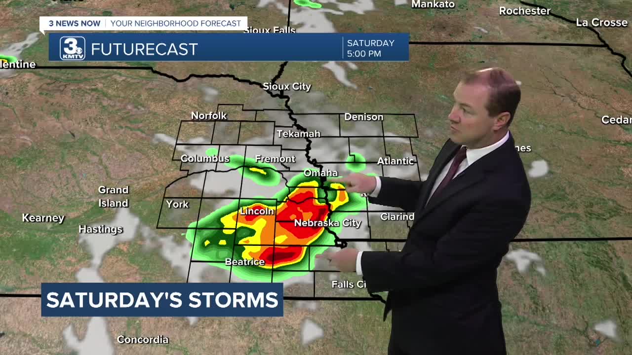
- Strong storms possible Saturday
- Heat index near 100 Sunday & Monday
Forecast
it should be a pretty comfortable Thursday evening with some noticeable August humidity. Overnight, temps could remain fairly warm, in the upper 60s. We may see some more areas of fog develop overnight and into to Friday morning as well.. We could wake up Friday morning to some more patchy fog.
Things will be warmer Friday and heading into the weekend. Look for highs on Friday and Saturday in the mid to upper 80s, feeling more like the low 90s outside.
We are now tracking the potential for thunderstorms for both Friday and Saturday
Friday Storms
Thundershowers will be possible across much of western Iowa by late morning and through the afternoon. By the evening, this rain should clear up. There rest of Nebraska should likely remain dry, including Omaha.
Saturday Storms
There is now also the chance at thunderstorms across much of eastern Nebraska starting early Saturday afternoon and continuing into southeast Nebraska through early evening. This does include Omaha. Severe weather may be possible on Saturday afternoon, with damaging winds and pockets of large hail as the main concern.
It gets even warmer by Sunday and Monday with highs in the low 90s and the humidity will make it feel more like 100 outside. There may be a few more spotty storms round, too.
Cooler air will start to move back into the region around the middle of next week with temps closer to the mid 80s by Wednesday. There are already some modest chances at rain from Wednesday to next Friday as well.
THURSDAY NIGHT
Mostly Clear
Dense Fog
Low: 68
Wind: SE 3-6
FRIDAY
Partly Sunny
Isolated PM Storms
High: 88
Wind: SW 5-10
SATURDAY
Partly Sunny
Strong PM Storms
High: 86
Wind: E 5-10
Share your weather pictures with KMTV:
- Email to News@3newsnow.com
- 3 News Now Facebook page
- Use the hashtag #3NewsNow on Instagram or X (formerly Twitter)
