



3 THINGS TO KNOW:
- Tuesday night cold front leads to breezy, chilly Wednesday
- Highs in the 40s Thursday, Friday
- Hard freeze expected Thursday and Friday night
FORECAST:
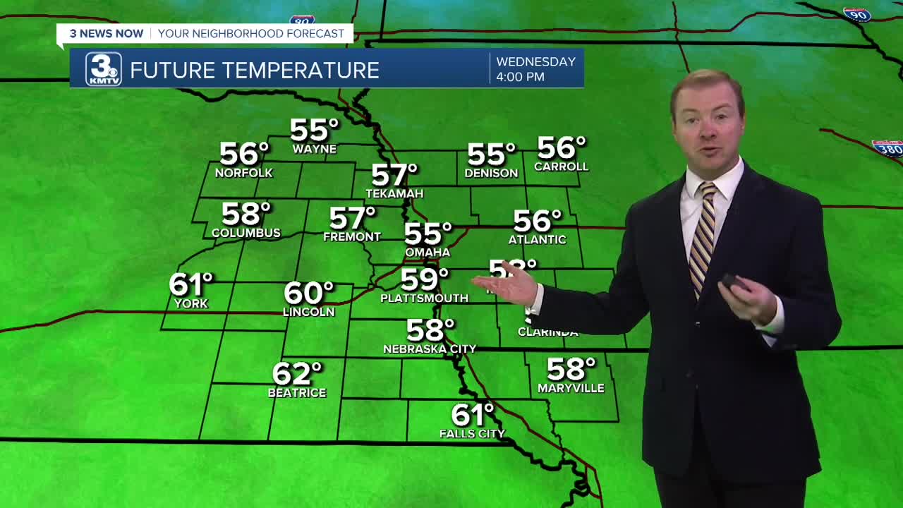
We've enjoyed some milder weather recently, but things are changing beginning tonight. A cold front will sweep through the region overnight, leading to breezy northwest winds on Wednesday at 15-30 MPH. We'll see morning sunshine, followed by afternoon and evening clouds. The day now looks dry, but cooler with highs in the mid 50s on Veteran's Day.
Temps will be near freezing for a few areas to begin Thursday, and it will stay cold! Highs will be in the upper 40s on Thursday with calmer winds, and the mid 40s on Friday.
A hard freeze is likely Thursday night and Friday night across the region as air temps are expected to dip in the mid to upper 20s, which is cold enough to kill off most annuals, and freeze water pipes if not winterized.
The weekend starts sunny and chilly, but normal now for mid-November. Highs on Saturday will be near 50. There is now a chance for a few spotty rain showers on Sunday.
Next week will be a milder and wetter pattern for the region. Monday looks dry, but the rest of the week could be wet after Tuesday or Wednesday. For now, it all looks to just be rain with temps in the 50s.
TUESDAY NIGHT
Partly Cloudy
Mild
Low: 45
Wind: N 5-15
WEDNESDAY
Partly Cloudy
Spotty Rain
High: 59
Wind: N 15-25
THURSDAY
Mostly Sunny
Colder
High: 47
Wind: N 5-15
Share your weather pictures with KMTV:
- Email to News@3newsnow.com
- 3 News Now Facebook page
- Use the hashtag #3NewsNow on Instagram or X.
 Facebook
 YouTube
 Instagram
 X
