


OMAHA, Neb. — Hurricane Isaias became a Category 3 storm early Friday and forecasters say it is expected to be a Category 2 hurricane when it reaches the Gulf Coast.
Isaias will mark the first time in more than two years a hurricane is poised to make a direct strike on the United States.
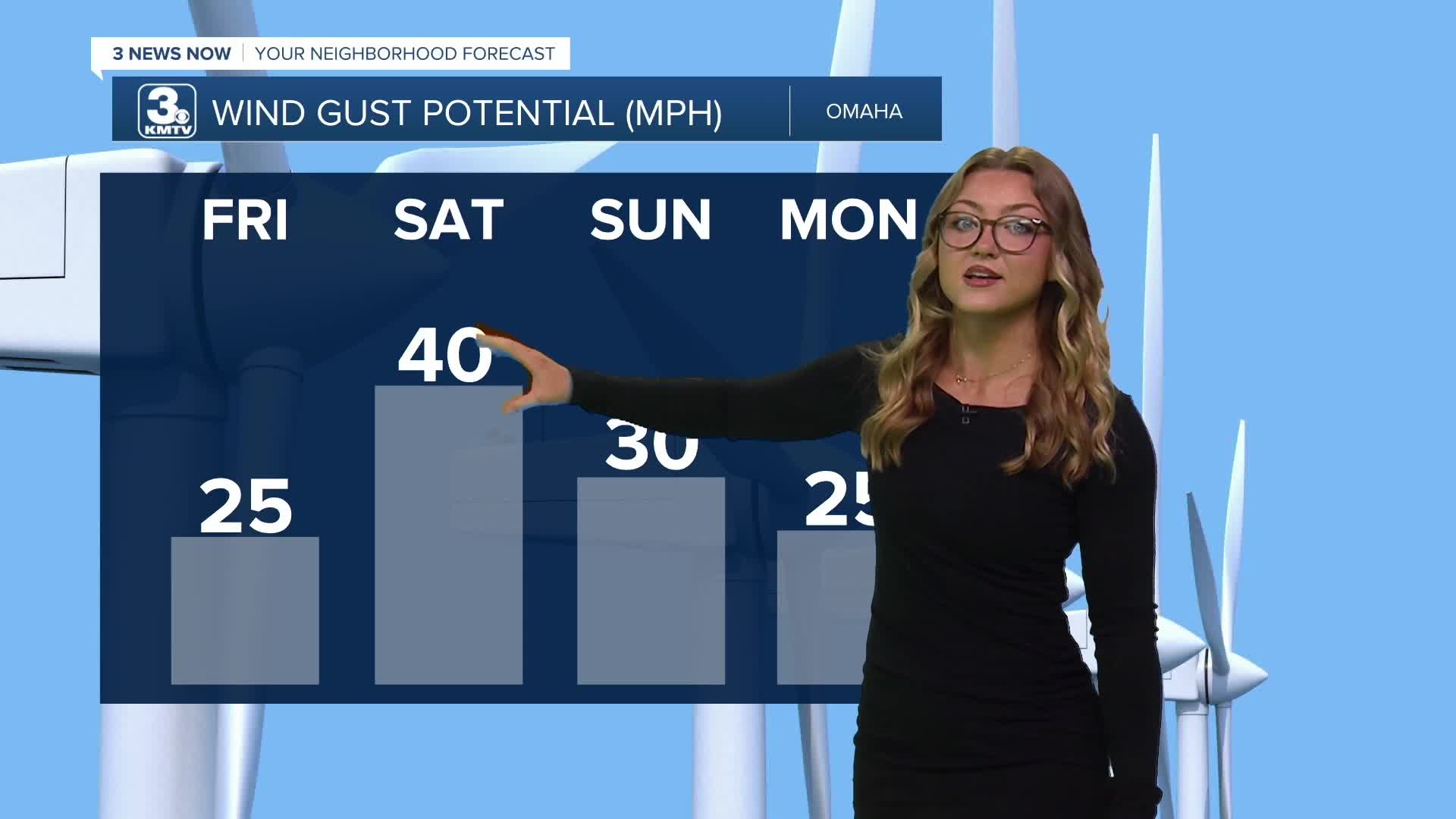
KMTV meteorologist Paige Halter says while Omaha may feel tropical this weekend due to warmer than usual weather, the region should not see much if any effects from Isaias.
"It looks like the system starts to head north before pushing farther towards the east," she said Friday morning. "While we won't see any effect from the hurricane, it does feel a little tropical here. We've got some record threatening highs and dew points in the 60s over the weekend!"
She said to expect breezy conditions to pick up, and for temps to warm to record-threatening as we head into Friday afternoon.
"Even with all of that rain we had last week, the combination of gusty 30+ MPH winds on Saturday and very dry air means we will have elevated wildfire conditions. Please avoid burning any brush piles or the use of fire pits this weekend," she said.
Watch: Hurricane Isaias nears Gulf Coast
Back to Isaias, as of early Friday, the storm had maximum sustained winds of 120 mph. The storm was about 170 miles south-southeast of the mouth of the Mississippi River and moving north-northeast at 15 mph.
Hurricane-force winds extended up to 30 miles from the storm's center, while tropical-storm-force winds stretched as far as 185 miles.
Forecasters warned that a storm surge of 5 to 7 feet is possible near the Alabama-Florida border along the Gulf Coast.
Complicated forecast
An El Niño pattern has largely suppressed hurricane development this season, as strong upper-level winds have produced unfavorable wind shear across much of the tropical Atlantic.
Isaias was able to develop during a narrow window of favorable conditions, taking advantage of warm ocean temperatures, high humidity and relatively low wind shear.
However, as the storm approaches the coast late Friday, the same wind shear that has limited tropical development this season could begin to weaken it. The National Hurricane Center said the timing of that wind shear will play a major role in determining whether Isaias loses strength before landfall.
Forecasters are urging residents along the Gulf Coast, particularly in Mississippi, Alabama and the western Florida Panhandle, to prepare for a hurricane of at least Category 2 strength. They said it is possible the wind shear will not affect Isaias until after landfall. According to the National Hurricane Center, the difference could come down to just a few hours.
Hurricane warnings in effect
The National Hurricane Center has issued a hurricane warning for the coast from Ocean Springs, Mississippi, to the Bay-Gulf County line in Florida. Several inland Alabama counties are also under hurricane warnings because of the threat of damaging winds and heavy rain.
Tropical storm warnings extend inland as far north as Montgomery, Alabama, while Birmingham is under a tropical storm watch.
Although Isaias is expected to weaken to a tropical depression by late Saturday, its remnants could bring heavy rainfall to parts of the Ohio and Tennessee valleys. Flood watches are in effect for areas as far north as Nashville, Tennessee, and Memphis, Tennessee.
Alabama Gov. Kay Ivey encouraged tourists in the Mobile Bay area to evacuate and urged residents across the state to prepare.
“We're worried about strong winds, heavy rain and possible spin-off tornadoes in certain parts of the state,” Ivey said. “As we approach the weekend and any travel plans, make sure you have reliable information as conditions develop. We often hear in emergency management, ‘Hope for the best, prepare for the worst.’ That is the approach we need with this particular storm system.”
Alabama-Georgia game to be played despite hurricane
One of the biggest college football games of the season is still scheduled for Saturday night, when No. 6 Alabama hosts No. 2 Georgia. It remains unclear whether President Donald Trump plans to attend.
Trump said Thursday that he had been unaware of the hurricane but would not want his visit to distract emergency officials. After learning about the storm from a reporter, he said he was reconsidering the trip.
“If there's an emergency, if there's a hurricane, I don't want to do anything to take the focus of all of the great people that work on those things,” Trump said. “They have some tremendously great people. I don't want to take the focus off, so we'll have to see.”
ESPN's “College GameDay” announced it will move its broadcast indoors to Coleman Coliseum, Alabama's basketball arena.
While rain and strong winds could affect Tuscaloosa on Saturday morning, conditions are expected to improve by the evening.
Rain and wind may have a greater impact farther north, where Vanderbilt is set to host No. 9 Ole Miss and Kentucky is scheduled to face No. 10 LSU on Saturday.
This is a developing story, so check back with 3NewsNow.com for updates. Email the 3 News Now Newsroom if you have info, photos or videos to share.
 Facebook
  YouTube
 Instagram
 X
XThis story was initially reported by a journalist and has been converted to this platform with the assistance of AI. Our editorial team verifies all reporting on all platforms for fairness and accuracy.
