



3 THINGS TO KNOW:
- Calmer wind, more sun on Thursday
- Windy and warm Friday
- Rain, cooler weather Saturday
FORECAST:
The wind will begin to settle down as a cold front moves through the region this evening. Under clear skies, temps will dip in the mid 30s by Thursday morning.
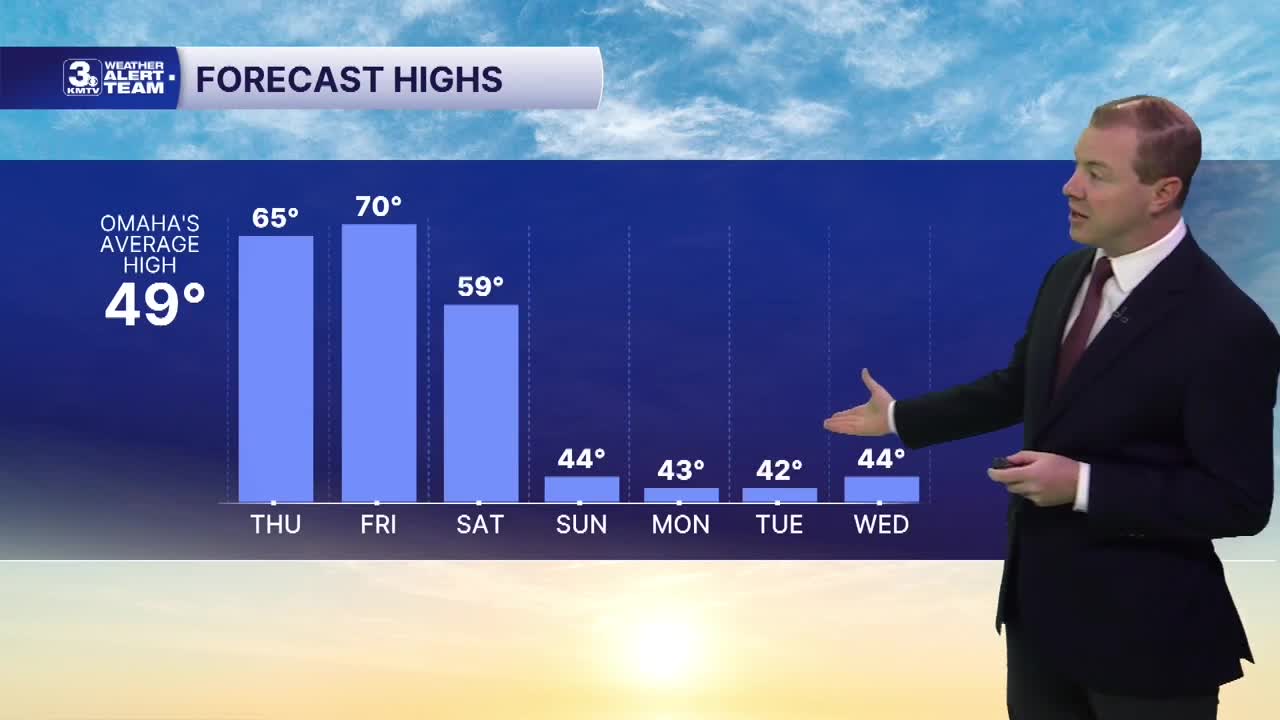
Thursday looks like it may be the nicest day out of the week! Sunshine, lighter wind, mild temps. Highs will reach the mid 60s.
The wind picks back up again Friday, out from the south at 25-35 MPH. Some gusts could reach 45 MPH It will be a warm day near 70 degrees. The record is 75 set in 1933.
While dry on Friday night, rain is looking more possible over the weekend, mainly on Saturday with temps in the 50s. So far, models have some spotty showers majority of Saturday morning, with more widespread rainfall during the afternoon and early evening hours, coming to and end Saturday night, In total, we could see around 0.25 to 0.75" of rain.
By Sunday, we're back to sunny and colder weather in the 40s. Nightly temps will dip in the 20s by Sunday night.
We are watching for the potential of a rain and snow mix around the middle of Thanksgiving week, mainly Tuesday. But the latest trends are that it will stay mostly out in western Nebraska. For now, it's looking cold with partly sunny skies and temps in the lower 40s for Thanksgiving.
WEDNESDAY NIGHT
Mostly Clear
Chilly
Low: 37
Wind: S 15-25
THURSDAY
Sunny
Mild and Calmer
High: 65
Wind: W 5-15
Share your weather pictures with KMTV:
- Email to News@3newsnow.com
- 3 News Now Facebook page
- Use the hashtag #3NewsNow on Instagram or X.
 Facebook
 YouTube
 Instagram
 X
