



3 THINGS TO KNOW:
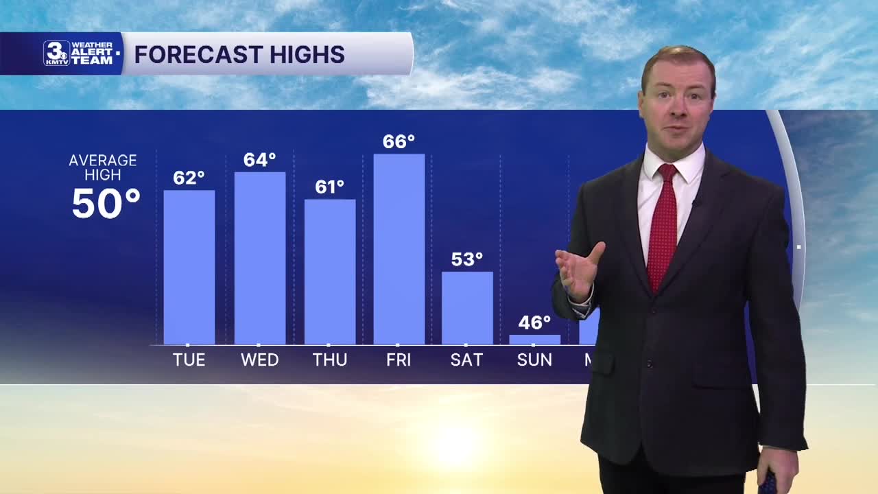
- Warmer than average, in the 50s/60s
- Breezy this week
- Rain, cooler weather around the weekend
FORECAST:
Clouds will be on the increase tonight and into Tuesday, with conditions remaining breezy and milder overnight. We'll hold temps in the mid 40s for Tuesday morning, warming back in the upper 50s to low 60s by Tuesday afternoon. That's about 10 degrees above average now! It may be a little breezy with south wind gusts up to 30 MPH.
A weak cold front will scoot through the region Wednesday afternoon, only kicking up a few isolated rain showers, under a 20% chance.
Temps will remain around 60 on Wednesday and Thursday, followed by a jump in the mid 60s on Friday. An early weekend cold front will drop temps in the 40s for Saturday and Sunday, and the start of next week. Nights will be in the 20s again.
We are watching for some rain to move back into the region Friday evening through Saturday morning. There are more chances for rain and possibly some rain/snow mix over the first half of Thanksgiving week.
MONDAY NIGHT
Mostly Cloudy
Breezy
Low: 44
Wind: S 15-25
TUESDAY
Partly Cloudy
Warmer & Breezy
High: 62
Wind: S 15-30
WEDNESDAY
Partly Cloudy
Iso'd Evening Rain
High: 64
Wind: S 15-30
Share your weather pictures with KMTV:
- Email to News@3newsnow.com
- 3 News Now Facebook page
- Use the hashtag #3NewsNow on Instagram or X.
 Facebook
 YouTube
 Instagram
 X
