



3 Things to Know
- Flood watch until Thursday night
- Heavy rain tonight, Wednesday night
- DRY and fall-like this weekend!
Forecast
A flood watch is in effect for the Omaha region until Thursday evening. Several inches of rain are possible and may lead to flash flooding. DO NOT attempt to drive through a flooded road!
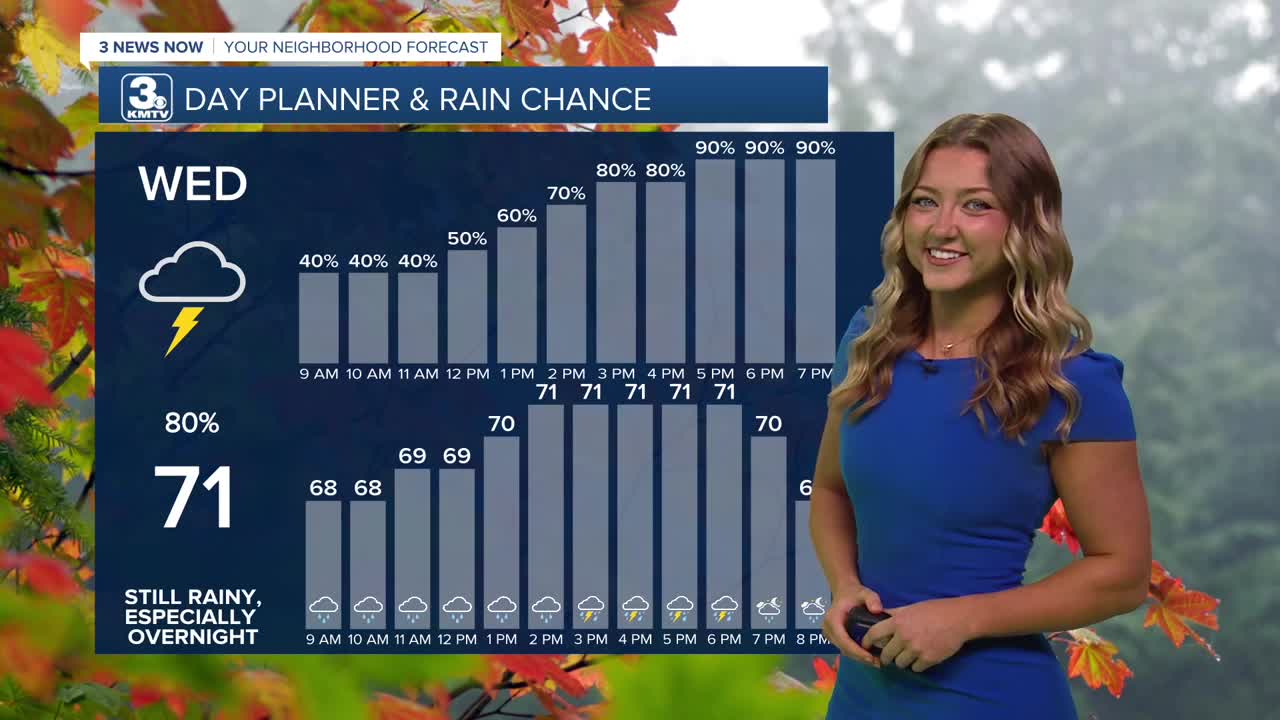
There may be a lull in the rain around Omaha on Wednesday morning, but the later we get into the morning, we can expect more rain to begin moving in from the south. These showers remain widespread and heavy for the rest of Wednesday afternoon through Wednesday night. There is a very small severe risk near Beatrice depending on how much dry time we see during Wednesday morning. Rain totals from Wednesday afternoon through Thursday morning could again reach 2-3" across southeast Nebraska and southwest Iowa, including Omaha. Areas north of Omaha have a better chance to see less than 1" of rain.
These showers will continue to push farther towards the East into the early afternoon hours Thursday, leaving the rest of the afternoon dry, breezy and partly cloudy.
In total, most will see around 1-3" of rain, with the heaviest south of Omaha. Some areas from southeast Nebraska to southwest Iowa could see more than 5.00" of rain.
So far, September rain totals at Eppley are just short of 7" as of Tuesday morning, which is now in the top 10 wettest Septembers on record. With the additional rain on the way through Wednesday, night, we may end up in the top 5. The record is 13.75", set in 1965.
Friday (and the weekend) starts a much-needed pattern of drier weather for the Omaha region. We should see several days of sunshine and our temps look to remain fall-like, in the 60s through the weekend and early next week. There may even be 1 or 2 nights in the upper 40s next week, too! Frost does not appear likely next week. Omaha's average first frost is around October 6th.
So far, we keep with even more dry time into next week, though temperatures look to climb just a tad. We can expect highs to range from upper 60s and lower 70s.
WEDNESDAY
Cloudy
Rain & Storms
High: 71
Wind: SE 8-15
WEDNESDAY NIGHT
Heavy Rain & Storms
Flooding Possible
Low: 61
Wind: SE 8-15
THURSDAY
Cloudy
AM Rain
High: 64
Wind: N 10-20
Share your weather pictures with KMTV:
- Email to News@3newsnow.com
- 3 News Now Facebook page
- Use the hashtag #3NewsNow on Instagram or X.
 Facebook
  YouTube
 Instagram
 X
X